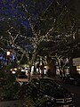
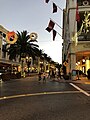
Category:Santana Row
Jump to navigation
Jump to search
| Object location | | View all coordinates using: OpenStreetMap |
|---|
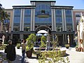
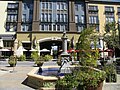
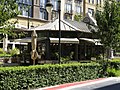
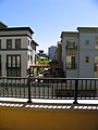
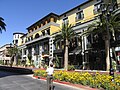
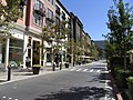
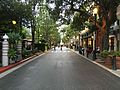
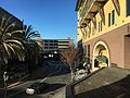
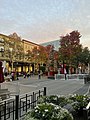
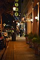
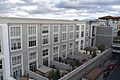
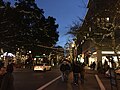
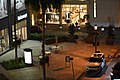
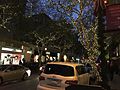
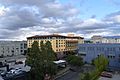
Upscale center located in San Jose, California, United States  | |||||
| Upload media | |||||
| Instance of | |||||
|---|---|---|---|---|---|
| Named after |
| ||||
| Location | California, Pacific States Region | ||||
| Inception |
| ||||
| official website | |||||
 | |||||
English: Media pertaining to Santana Row a shopping and residential district in West San José, California, USA.
Subcategories
This category has the following 3 subcategories, out of 3 total.
Media in category "Santana Row"
The following 200 files are in this category, out of 213 total.
(previous page) (next page)-
 20050321 31 Santana Row, San Jose, CA-2 (9728870322).jpg 2,560 × 1,920; 605 KB
-
 2011-09 San Jose 028, Santana Row (6161018233).jpg 4,912 × 3,264; 9.62 MB
-
 300 Santana Row, San Jose, in winter (cropped).JPG 3,542 × 2,510; 2.64 MB
-
 300 Santana Row, San Jose, in winter.JPG 4,608 × 3,072; 3.5 MB
-
 DeForest building San Jose.jpg 1,313 × 2,075; 974 KB
-
 Hatton St Apt.jpg 4,032 × 3,024; 2.6 MB
-
 Hatton St. Aparments.jpg 4,032 × 3,024; 2.71 MB
-
 Hatton St. Apartments.jpg 4,032 × 3,024; 2.7 MB
-
 Hatton St.jpg 4,032 × 3,024; 2.74 MB
-
 Hatton Street Aptmts (cropped).jpg 2,512 × 1,884; 1.45 MB
-
 Hatton Street Aptmts.jpg 4,032 × 3,024; 2.24 MB
-
 Hatton Street.jpg 4,032 × 3,024; 2.12 MB
-
 Hotel Valencia, Santana Row (4961844298).jpg 3,072 × 2,048; 4.58 MB
-
 Intersection of Olin Ave & Winchester Blvd in Santana Row 2.jpg 4,032 × 3,024; 2.64 MB
-
 Intersection of Olin Ave & Winchester Blvd in Santana Row.jpg 4,032 × 3,024; 3.09 MB
-
 Leafs on wall in Santana Row.jpg 4,372 × 2,906; 3.55 MB
-
 Olin Ave.jpg 3,024 × 4,032; 3.22 MB
-
 Olsen Dr. Apartments.jpg 3,024 × 4,032; 2.73 MB
-
 Olsen Dr.jpg 4,032 × 3,024; 2.72 MB
-
 Public space, Santana Row (30241529168).jpg 975 × 731; 123 KB
-
 Santana Row (1).jpg 3,264 × 2,448; 4.51 MB
-
 Santana Row (13946065707).jpg 3,240 × 4,320; 5.28 MB
-
 Santana Row (15371236324).jpg 3,264 × 2,448; 3.93 MB
-
 Santana Row (15992803222).jpg 3,264 × 2,448; 3.48 MB
-
 Santana Row (2).jpg 3,264 × 2,448; 3.95 MB
-
 Santana Row (534639744).jpg 1,600 × 1,200; 1.24 MB
-
 Santana Row (534640266).jpg 1,600 × 1,200; 1.36 MB
-
 Santana Row (534641844).jpg 1,600 × 1,200; 1.17 MB
-
 Santana Row (534642024).jpg 1,600 × 1,200; 1.19 MB
-
 Santana Row (534642534).jpg 1,200 × 1,600; 1.11 MB
-
 Santana Row (534642844).jpg 1,600 × 1,200; 1.34 MB
-
 Santana Row (534643378).jpg 1,600 × 1,200; 1.31 MB
-
 Santana Row (534643758).jpg 1,600 × 1,200; 1.35 MB
-
 Santana Row (534645770).jpg 1,200 × 1,600; 996 KB
-
 Santana Row (534646010).jpg 1,600 × 1,200; 1.44 MB
-
 Santana Row (534646634).jpg 1,200 × 1,600; 1.1 MB
-
 Santana Row (534648286).jpg 1,600 × 1,200; 1.08 MB
-
 Santana Row (534648838).jpg 1,600 × 1,200; 1.11 MB
-
 Santana Row (534649198).jpg 1,600 × 1,200; 1.17 MB
-
 Santana Row (534650098).jpg 1,200 × 1,600; 1.04 MB
-
 Santana Row (534650366).jpg 1,600 × 1,200; 1.13 MB
-
 Santana Row (534650642).jpg 1,600 × 1,200; 1.14 MB
-
 Santana Row (534650822).jpg 1,600 × 1,200; 1.21 MB
-
 Santana Row (534651252).jpg 1,600 × 1,200; 1.16 MB
-
 Santana Row (534652024).jpg 1,600 × 1,200; 1.02 MB
-
 Santana Row (534652436).jpg 1,600 × 1,200; 1.27 MB
-
 Santana Row (534652614).jpg 1,600 × 1,200; 1.07 MB
-
 Santana Row (534652820).jpg 1,200 × 1,600; 997 KB
-
 Santana Row (534652982).jpg 1,600 × 1,200; 1.24 MB
-
 Santana Row (534653374).jpg 1,600 × 1,200; 1.19 MB
-
 Santana Row (534653532).jpg 1,600 × 1,200; 1.18 MB
-
 Santana Row (534653988).jpg 1,600 × 1,200; 1.09 MB
-
 Santana Row (534654142).jpg 1,600 × 1,200; 1.11 MB
-
 Santana Row (534654304).jpg 1,200 × 1,600; 875 KB
-
 Santana Row (534655072).jpg 1,600 × 1,200; 1.24 MB
-
 Santana Row (534655216).jpg 1,200 × 1,600; 1,014 KB
-
 Santana Row (534656336).jpg 1,200 × 1,600; 456 KB
-
 Santana Row (534656460).jpg 1,600 × 1,200; 442 KB
-
 Santana Row (534656636).jpg 1,600 × 1,200; 434 KB
-
 Santana Row (534742251).jpg 1,600 × 1,200; 1.21 MB
-
 Santana Row (534742607).jpg 1,600 × 1,200; 1.33 MB
-
 Santana Row (534744079).jpg 1,600 × 1,200; 1.47 MB
-
 Santana Row (534744467).jpg 1,200 × 1,600; 1.21 MB
-
 Santana Row (534745247).jpg 1,600 × 1,200; 1.32 MB
-
 Santana Row (534745601).jpg 1,600 × 1,200; 1.45 MB
-
 Santana Row (534746147).jpg 1,600 × 1,200; 1.22 MB
-
 Santana Row (534746571).jpg 1,600 × 1,200; 1.44 MB
-
 Santana Row (534747053).jpg 1,600 × 1,200; 1.63 MB
-
 Santana Row (534747335).jpg 1,600 × 1,200; 1.81 MB
-
 Santana Row (534748269).jpg 1,200 × 1,600; 859 KB
-
 Santana Row (534748447).jpg 1,600 × 1,200; 1.1 MB
-
 Santana Row (534749117).jpg 1,200 × 1,600; 1.08 MB
-
 Santana Row (534749247).jpg 1,600 × 1,200; 818 KB
-
 Santana Row (534749605).jpg 1,200 × 1,600; 1.41 MB
-
 Santana Row (534749813).jpg 1,600 × 1,200; 1.47 MB
-
 Santana Row (534750489).jpg 1,600 × 1,200; 1.2 MB
-
 Santana Row (534751123).jpg 1,600 × 1,200; 1.16 MB
-
 Santana Row (534751671).jpg 1,200 × 1,600; 1.16 MB
-
 Santana Row (534752051).jpg 1,600 × 1,200; 1.05 MB
-
 Santana Row (534752733).jpg 1,600 × 1,200; 1.02 MB
-
 Santana Row (534752943).jpg 1,600 × 1,200; 1.01 MB
-
 Santana Row (534754077).jpg 1,600 × 1,200; 1.05 MB
-
 Santana Row (534754507).jpg 1,600 × 1,200; 1.22 MB
-
 Santana Row (534754775).jpg 1,600 × 1,200; 1.22 MB
-
 Santana Row (534755293).jpg 1,600 × 1,200; 1.07 MB
-
 Santana Row (534756237).jpg 1,200 × 1,600; 1.07 MB
-
 Santana Row (534756903).jpg 1,200 × 1,600; 934 KB
-
 Santana Row (534757095).jpg 1,200 × 1,600; 1.03 MB
-
 Santana Row (534757759).jpg 1,600 × 1,200; 990 KB
-
 Santana Row (534757945).jpg 1,600 × 1,200; 1.03 MB
-
 Santana Row (534758129).jpg 1,600 × 1,200; 1.2 MB
-
 Santana Row (534758665).jpg 1,200 × 1,600; 255 KB
-
 Santana Row (534758873).jpg 1,600 × 1,200; 1.08 MB
-
 Santana Row (534759091).jpg 1,200 × 1,600; 387 KB
-
 Santana Row (534759213).jpg 1,600 × 1,200; 448 KB
-
 Santana Row (534759479).jpg 1,600 × 1,200; 1.33 MB
-
 Santana Row (534759745).jpg 1,600 × 1,200; 478 KB
-
 Santana Row 1 2016-05-13.jpg 4,032 × 3,024; 3.35 MB
-
 Santana Row 1 2016-08-30.jpg 4,032 × 3,024; 2.75 MB
-
 Santana Row 1 2017-01-18.jpg 4,032 × 3,024; 2.67 MB
-
 Santana Row 1 2017-02-26.jpg 4,032 × 3,024; 3.18 MB
-
 Santana Row 1 2017-05-14.jpg 6,000 × 4,000; 12.19 MB
-
 Santana Row 1 2017-06-08.jpg 3,024 × 4,032; 2.52 MB
-
 Santana Row 1 2017-06-25.jpg 4,000 × 6,000; 12.05 MB
-
 Santana Row 1 2018-02-23.jpg 6,000 × 4,000; 12.75 MB
-
 Santana Row 1 2018-06-20.jpg 4,032 × 3,024; 5.97 MB
-
 Santana Row 1 2018-07-03.jpg 3,024 × 4,032; 8.84 MB
-
 Santana Row 1 2018-07-06.jpg 4,032 × 3,024; 8.88 MB
-
 Santana Row 1 2018-10-16.jpg 4,032 × 3,024; 7.16 MB
-
 Santana Row 1 2019-01-07.jpg 4,032 × 3,024; 5.68 MB
-
 Santana Row 1 2022-04-29.jpeg 4,032 × 3,024; 6.74 MB
-
 Santana Row 1 2022-12-04.jpeg 3,024 × 4,032; 4.78 MB
-
 Santana Row 1 2023-04-24.jpeg 3,024 × 4,032; 7.64 MB
-
 Santana Row 1 2023-11-14.jpg 3,024 × 4,032; 7.08 MB
-
 Santana Row 1.1.jpg 1,600 × 1,200; 435 KB
-
 Santana Row 10 2017-06-25.jpg 6,000 × 4,000; 13.58 MB
-
 Santana Row 10 2018-02-23.jpg 6,000 × 4,000; 13.11 MB
-
 Santana Row 11 2017-06-25.jpg 6,000 × 4,000; 12.8 MB
-
 Santana Row 11 2018-02-23.jpg 6,000 × 4,000; 12.79 MB
-
 Santana Row 12 2017-06-25.jpg 6,000 × 4,000; 14 MB
-
 Santana Row 12 2018-02-23.jpg 4,000 × 6,000; 13.57 MB
-
 Santana Row 13 2017-06-25.jpg 6,000 × 4,000; 13.26 MB
-
 Santana Row 13 2018-02-23.jpg 6,000 × 4,000; 12.5 MB
-
 Santana Row 14 2017-06-25.jpg 6,000 × 4,000; 14.62 MB
-
 Santana Row 14 2018-02-23.jpg 6,000 × 4,000; 13.29 MB
-
 Santana Row 15 2017-06-25.jpg 4,000 × 6,000; 11.72 MB
-
 Santana Row 15 2018-02-23.jpg 4,000 × 6,000; 12.58 MB
-
 Santana Row 16 2018-02-23.jpg 4,000 × 6,000; 12.8 MB
-
 Santana Row 17 2017-06-25.jpg 6,000 × 4,000; 13.73 MB
-
 Santana Row 17 2018-02-23.jpg 6,000 × 4,000; 13.01 MB
-
 Santana Row 18 2017-06-25.jpg 6,000 × 4,000; 12.53 MB
-
 Santana Row 18 2018-02-23.jpg 6,000 × 4,000; 12.49 MB
-
 Santana Row 19 2018-02-23.jpg 6,000 × 4,000; 13.27 MB
-
 Santana Row 2 2016-08-30.jpg 3,024 × 4,032; 2.55 MB
-
 Santana Row 2 2016-12-30.jpg 3,024 × 4,032; 2.63 MB
-
 Santana Row 2 2017-02-26.jpg 3,024 × 4,032; 2.78 MB
-
 Santana Row 2 2017-05-14.jpg 6,000 × 4,000; 12.66 MB
-
 Santana Row 2 2017-06-08.jpg 4,032 × 3,024; 5.22 MB
-
 Santana Row 2 2017-06-25.jpg 6,000 × 4,000; 12.92 MB
-
 Santana Row 2 2018-02-23.jpg 6,000 × 4,000; 11.65 MB
-
 Santana Row 2 2018-06-20.jpg 4,032 × 3,024; 5.34 MB
-
 Santana Row 2 2018-07-06.jpg 3,024 × 4,032; 8.48 MB
-
 Santana Row 2 2019-01-07.jpg 3,024 × 4,032; 8.12 MB
-
 Santana Row 2 2022-12-04.jpeg 3,024 × 4,032; 8.94 MB
-
 Santana Row 2 2023-04-24.jpeg 4,032 × 3,024; 9.49 MB
-
 Santana Row 2 2023-11-14.jpg 3,024 × 4,032; 6.88 MB
-
 Santana Row 20 2017-06-25.jpg 6,000 × 4,000; 11.58 MB
-
 Santana Row 20 2018-02-23.jpg 6,000 × 4,000; 13.26 MB
-
 Santana Row 21 2017-06-25.jpg 6,000 × 4,000; 12.3 MB
-
 Santana Row 21 2018-02-23.jpg 4,000 × 6,000; 13.13 MB
-
 Santana Row 22 2017-06-25.jpg 6,000 × 4,000; 13.54 MB
-
 Santana Row 22 2018-02-23.jpg 6,000 × 4,000; 12.21 MB
-
 Santana Row 23 2017-06-25.jpg 6,000 × 4,000; 11.81 MB
-
 Santana Row 23 2018-02-23.jpg 6,000 × 4,000; 12.83 MB
-
 Santana Row 24 2017-06-25.jpg 6,000 × 4,000; 14.45 MB
-
 Santana Row 24 2018-02-23.jpg 6,000 × 4,000; 13.34 MB
-
 Santana Row 25 2017-06-25.jpg 6,000 × 4,000; 12.06 MB
-
 Santana Row 25 2018-02-23.jpg 6,000 × 4,000; 13.4 MB
-
 Santana Row 26 2017-06-25.jpg 6,000 × 4,000; 12.26 MB
-
 Santana Row 26 2018-02-23.jpg 6,000 × 4,000; 13.11 MB
-
 Santana Row 27 2017-06-25.jpg 6,000 × 4,000; 12.29 MB
-
 Santana Row 28 2017-06-25.jpg 6,000 × 4,000; 14 MB
-
 Santana Row 29 2017-06-25.jpg 6,000 × 4,000; 13.88 MB
-
 Santana Row 3 2016-12-30.jpg 4,032 × 3,024; 2.42 MB
-
 Santana Row 3 2017-02-26.jpg 3,024 × 4,032; 2.12 MB
-
 Santana Row 3 2017-06-08.jpg 4,032 × 3,024; 2.21 MB
-
 Santana Row 3 2017-06-25.jpg 6,000 × 4,000; 11.72 MB
-
 Santana Row 3 2018-02-23.jpg 4,000 × 6,000; 12.93 MB
-
 Santana Row 3 2018-06-20.jpg 4,032 × 3,024; 5.48 MB
-
 Santana Row 3 2018-07-06.jpg 3,024 × 4,032; 10.89 MB
-
 Santana Row 3 2023-11-14.jpg 4,032 × 3,024; 8.8 MB
-
 Santana Row 30 2017-06-25.jpg 6,000 × 4,000; 13.65 MB
-
 Santana Row 31 2017-06-25.jpg 6,000 × 4,000; 12.83 MB
-
 Santana Row 4 2016-12-30.jpg 4,032 × 3,024; 2.54 MB
-
 Santana Row 4 2017-02-26.jpg 4,032 × 3,024; 2.21 MB
-
 Santana Row 4 2017-04-17.jpg 6,000 × 4,000; 12.22 MB
-
 Santana Row 4 2017-05-14.jpg 6,000 × 4,000; 13.36 MB
-
 Santana Row 4 2017-06-08.jpg 4,032 × 3,024; 3.39 MB
-
 Santana Row 4 2017-06-25.jpg 6,000 × 4,000; 11.74 MB
-
 Santana Row 4 2018-02-23.jpg 6,000 × 4,000; 13.15 MB
-
 Santana Row 5 2016-12-30.jpg 3,024 × 4,032; 2.69 MB
-
 Santana Row 5 2017-02-26.jpg 4,032 × 3,024; 4.66 MB
-
 Santana Row 5 2017-06-08.jpg 3,024 × 4,032; 2.52 MB
-
 Santana Row 5 2017-06-25.jpg 6,000 × 4,000; 12.99 MB
-
 Santana Row 5 2018-02-23.jpg 6,000 × 4,000; 11.88 MB
-
 Santana Row 6 2016-12-30.jpg 4,032 × 3,024; 2.44 MB
-
 Santana Row 6 2017-02-26.jpg 4,032 × 3,024; 4.95 MB
-
 Santana Row 6 2017-06-25.jpg 6,000 × 4,000; 12.06 MB
-
 Santana Row 6 2018-02-23.jpg 6,000 × 4,000; 12.47 MB
-
 Santana Row 7 2016-12-30.jpg 4,032 × 3,024; 2.75 MB
-
 Santana Row 7 2017-05-14.jpg 6,000 × 4,000; 12.8 MB
-
 Santana Row 7 2017-06-25.jpg 6,000 × 4,000; 11.95 MB
-
 Santana Row 7 2018-02-23.jpg 6,000 × 4,000; 13.73 MB
-
 Santana Row 8 2017-05-14.jpg 6,000 × 4,000; 11.8 MB
-
 Santana Row 8 2017-06-25.jpg 6,000 × 4,000; 12.32 MB
-
 Santana Row 8 2018-02-23.jpg 4,000 × 6,000; 13.25 MB
-
 Santana Row 9 2017-05-14.jpg 6,000 × 4,000; 12.04 MB
-
 Santana Row 9 2017-06-25.jpg 6,000 × 4,000; 12.11 MB
-
 Santana Row 9 2018-02-23.jpg 6,000 × 4,000; 13.21 MB
-
 Santana Row from Westfield Valley Fair 1839 19.JPG 2,048 × 1,536; 732 KB
.jpg)
.jpg)
.JPG)


.jpg)


.jpg)


.jpg)
.jpg)
.jpg)
.jpg)
.jpg)
.jpg)
.jpg)
.jpg)
.jpg)
.jpg)
.jpg)
.jpg)
.jpg)
.jpg)
.jpg)
.jpg)
.jpg)
.jpg)
.jpg)
.jpg)
.jpg)
.jpg)
.jpg)
.jpg)
.jpg)
.jpg)
.jpg)
.jpg)
.jpg)
.jpg)
.jpg)
.jpg)
.jpg)
.jpg)
.jpg)
.jpg)
.jpg)
.jpg)
.jpg)
.jpg)
.jpg)
.jpg)
.jpg)
.jpg)
.jpg)
.jpg)
.jpg)
.jpg)
.jpg)
.jpg)
.jpg)
.jpg)
.jpg)
.jpg)
.jpg)
.jpg)
.jpg)
.jpg)
.jpg)
.jpg)
.jpg)
.jpg)
.jpg)
.jpg)
.jpg)
.jpg)
.jpg)
.jpg)
.jpg)
.jpg)
.jpg)
.jpg)
.jpg)
.jpg)
.jpg)
.jpg)
.jpg)
.jpg)


