Category:Sangihe Islands
Jump to navigation
Jump to search
English: The Sangir Islands (also spelled "Sangihe", "Sanghir" or "Sangi") – or Kepulauan Sangir – are a group of islands in northern Indonesia. They are located northeast of Sulawesi in the Celebes Sea, roughly halfway between Sulawesi and Mindanao, in the Philippines. The islands combine to total 813 sq kilometers, with many of the islands being actively volcanic with fertile soil and mountains.
group of islands in Indonesia  | |||||
| Upload media | |||||
| Instance of |
| ||||
|---|---|---|---|---|---|
| Location | North Sulawesi, Indonesia | ||||
| Located in or next to body of water | |||||
| Highest point | |||||
 | |||||
Subcategories
This category has the following 7 subcategories, out of 7 total.
B
- Banua Wuhu (5 F)
C
- Cittura sanghirensis (1 F)
- Coracornis sanghirensis (1 F)
T
- Tahuna, Indonesia (19 F)
- Tarsius sangirensis (2 F)
V
Z
- Zosterops nehrkorni (2 F)
Media in category "Sangihe Islands"
The following 50 files are in this category, out of 50 total.
-
 120611-N-ZZ999-002 (7190165079).jpg 1,358 × 1,910; 945 KB
-
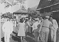
 Arak-arakkan TAMO, foto - Alffian Walukow.jpg 640 × 360; 108 KB
-
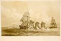 Atlas pittoresque pl 105.jpg 2,508 × 1,688; 1.07 MB
-
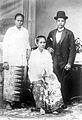
 Baju Adat Suku Sangihe. Laku Tepu, foto - alffian walukow.jpg 480 × 640; 127 KB
-
 Bayi Kus-kus kecil Sangihe kehilangan induknya.jpg 736 × 832; 265 KB
-

-

-

-
-

-
-

-

-

-

-

-

-

-

-

-

-

-

-
 COLLECTIE TROPENMUSEUM Kustgezicht Poelau Sangihe TMnr 60018646.jpg 700 × 506; 39 KB
-
 COLLECTIE TROPENMUSEUM Kustgezicht Poelau Sangihe TMnr 60018647.jpg 700 × 505; 80 KB
-

-

-

-

-

-

-

-

-
 DPRD Kabupaten Kepulauan Sangihe 2019.svg 360 × 185; 3 KB
-
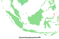 ID Sangir islands.PNG 824 × 559; 28 KB
-
 Lambang Kabupaten Kepulauan Sangihe.jpeg 814 × 799; 150 KB
-
 Lautan Marore.jpg 1,920 × 1,280; 905 KB
-
 Lokasi Sulawesi Utara Kabupaten Kepulauan Sangihe.svg 1,773 × 1,185; 877 KB
-
 Marore Beach - panoramio.jpg 2,000 × 1,333; 2.46 MB
-
 Pelangi Pelabuhan Marore.jpg 1,920 × 1,280; 725 KB
-
 Pulau Sangihe, Kab. Sangihe, Sulut - panoramio.jpg 2,576 × 1,932; 1.25 MB
-
 Puncak Gunung Awu.jpg 5,184 × 2,912; 3.81 MB
-
 Ritual Adat Melombo Salurang Sangihe Island.jpg 448 × 336; 90 KB
-
 Sangihe Island, Indonesia (ASTER).jpg 2,420 × 2,809; 937 KB
-
 Tahuna, Sangihe Islands.jpg 1,323 × 695; 207 KB
-
 Tari Salo. foto - Alffian Walukow.jpg 5,152 × 2,896; 2.98 MB
-
 Teluk Tahuna.jpg 5,184 × 2,912; 4.38 MB
-

-

-
 UvA-BC 300.218 - Siboga - Siaoe (Siau).jpg 1,398 × 996; 601 KB
.jpg)


.jpg)


_(cropped).jpg)
.jpg)
.jpg)