Category:Sanborn Fire Insurance Map from Nogales, Santa Cruz County, Arizona
Jump to navigation
Jump to search
Subcategories
This category has the following 2 subcategories, out of 2 total.
Media in category "Sanborn Fire Insurance Map from Nogales, Santa Cruz County, Arizona"
The following 20 files are in this category, out of 20 total.
-
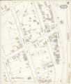
 Sanborn Fire Insurance Map from Nogales, Santa Cruz County, Arizona. LOC sanborn00164 001.tif 6,510 × 7,680; 143.04 MB
-
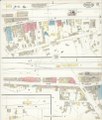
 Sanborn Fire Insurance Map from Nogales, Santa Cruz County, Arizona. LOC sanborn00164 002-1.tif 6,510 × 7,680; 143.04 MB
-
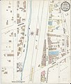
 Sanborn Fire Insurance Map from Nogales, Santa Cruz County, Arizona. LOC sanborn00164 002-2.tif 6,510 × 7,680; 143.04 MB
-
 Sanborn Fire Insurance Map from Nogales, Santa Cruz County, Arizona. LOC sanborn00164 002-3.tif 6,510 × 7,680; 143.04 MB
-
 Sanborn Fire Insurance Map from Nogales, Santa Cruz County, Arizona. LOC sanborn00164 003-1.tif 6,510 × 7,680; 143.04 MB
-
 Sanborn Fire Insurance Map from Nogales, Santa Cruz County, Arizona. LOC sanborn00164 003-2.tif 6,510 × 7,680; 143.04 MB
-
 Sanborn Fire Insurance Map from Nogales, Santa Cruz County, Arizona. LOC sanborn00164 003-3.tif 6,510 × 7,680; 143.04 MB
-
 Sanborn Fire Insurance Map from Nogales, Santa Cruz County, Arizona. LOC sanborn00164 004-1.tif 6,510 × 7,680; 143.04 MB
-
 Sanborn Fire Insurance Map from Nogales, Santa Cruz County, Arizona. LOC sanborn00164 004-2.tif 6,510 × 7,680; 143.04 MB
-
 Sanborn Fire Insurance Map from Nogales, Santa Cruz County, Arizona. LOC sanborn00164 004-3.tif 6,510 × 7,680; 143.04 MB
-
-

-

-

-

-

-

-

-

-


