Category:Sanborn Fire Insurance Map from Carroll County, Ohio
Jump to navigation
Jump to search
Subcategories
This category has the following 2 subcategories, out of 2 total.
Media in category "Sanborn Fire Insurance Map from Carroll County, Ohio"
The following 7 files are in this category, out of 7 total.
-
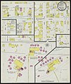 Malvern, Carroll County, Ohio, 1899 - DPLA - afc26fb092a37a40680b161573d26fd0.jpg 6,522 × 7,771; 11.54 MB
-
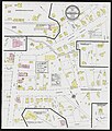
 Malvern, Carroll County, Ohio, 1911 - DPLA - f01597d03062a26f265ceeef1e5ed36e (page 1).jpg 6,586 × 7,782; 11.48 MB
-
 Malvern, Carroll County, Ohio, 1911 - DPLA - f01597d03062a26f265ceeef1e5ed36e (page 2).jpg 6,597 × 7,820; 11.2 MB
-
 Sherrodsville, Carroll County, Ohio, 1895 - DPLA - da4f52e56f26e0b6fc0e7809f1b1b1f4.jpg 6,525 × 7,710; 8.54 MB
-
 Sherrodsville, Carroll County, Ohio, 1901 - DPLA - e281e459c232d713d8c1b0d4f949cfd3.jpg 6,544 × 7,712; 7.83 MB
-
 Sherrodsville, Carroll County, Ohio, 1915 - DPLA - d6e871d77c937ab5c1cce599d35b613d.jpg 6,542 × 7,729; 8.8 MB
-
 Sherrodsville, Carroll County, Ohio, 1929 - DPLA - cec4e44419fc8c4c965ec880cfb82423.jpg 6,648 × 7,839; 9.27 MB

.jpg)
.jpg)


