Category:San Francisco earthquake of 1906 in Mendocino County
Jump to navigation
Jump to search
Media in category "San Francisco earthquake of 1906 in Mendocino County"
The following 30 files are in this category, out of 30 total.
-
 Bald Rock.jpg 601 × 457; 90 KB
-
 Big Rock - Pliny E. Goddard.jpg 600 × 455; 72 KB
-
 Bill Ray's house and Rose Ray's family.jpg 602 × 455; 100 KB
-
 Cecilia Ray.jpg 603 × 454; 96 KB
-
 Crack on Eel River East of Laytonville.jpg 750 × 627; 120 KB
-
 Curtz's house.jpg 604 × 458; 79 KB
-

-

-

-
 Eel River Bridge, 8 miles East of Laytonville.jpg 750 × 627; 92 KB
-
 Eel River, East of Laytonville.jpg 750 × 622; 100 KB
-
 Effect of earthquake on rock - 2.jpg 598 × 455; 91 KB
-
 Effect of earthquake on rock.jpg 602 × 455; 104 KB
-
 Extensive landslide east of Bridgeport P.O. (south of Navarro).jpg 750 × 679; 65 KB
-
 Gene Ray.jpg 605 × 452; 101 KB
-
 Horse and rider - Pliny E. Goddard.jpg 602 × 456; 84 KB
-
 Horse and rider.jpg 600 × 455; 94 KB
-
 Indian camp.jpg 601 × 454; 68 KB
-
 Laytonville - 2.jpg 603 × 459; 69 KB
-
 Laytonville by moonlight.jpg 604 × 458; 45 KB
-
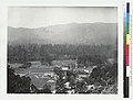
 Laytonville.jpg 603 × 458; 52 KB
-
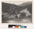
 Long Valley.jpg 603 × 455; 59 KB
-
 Mud Springs - Pliny E. Goddard.jpg 603 × 455; 89 KB
-
 Mud Springs.jpg 600 × 454; 73 KB
-
 Pictured rock.jpg 602 × 454; 100 KB
-
 Rose Ray and family.jpg 602 × 457; 76 KB
-
 Village site - Pliny E. Goddard.jpg 604 × 454; 72 KB
-
 Village site 2.jpg 603 × 455; 112 KB
-
 Village site 3.jpg 577 × 510; 100 KB
-
 Wrecked brick building at Point Arena.jpg 750 × 679; 92 KB


.jpg)


.jpg)


