Category:Salyersville, Kentucky
Jump to navigation
Jump to search
city in Magoffin County, Kentucky   | |||||
| Upload media | |||||
| Instance of | |||||
|---|---|---|---|---|---|
| Location | Magoffin County, Kentucky | ||||
| Inception |
| ||||
| Population |
| ||||
| Area |
| ||||
| Elevation above sea level |
| ||||
 | |||||
Subcategories
This category has only the following subcategory.
M
- Magoffin County Pioneer Village and Museum (1 P, 4 F)
Media in category "Salyersville, Kentucky"
The following 8 files are in this category, out of 8 total.
-
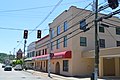 Grover Law Office in Salyersville.jpg 6,016 × 4,000; 6.32 MB
-
 KYMap-doton-Salyersville.PNG 300 × 132; 10 KB
-
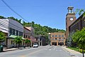
 Magoffin County Courthouse.jpg 6,016 × 4,000; 6.68 MB
-
 Magoffin County Justice Center.jpg 6,016 × 4,000; 6.17 MB
-
 Maple from Church in Salyersville.jpg 6,016 × 4,000; 6.39 MB
-
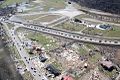 March 02, 2012 Salyersville, KY Aerial Tornado Damage.jpg 960 × 642; 185 KB
-
 Prater Memorial UMC.jpg 6,016 × 4,000; 6.29 MB
-
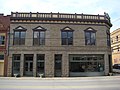 Salyersville Bank building; Salyersville, Kentucky.JPG 3,264 × 2,448; 2.49 MB


