Category:Salisbury Plain
Jump to navigation
Jump to search
Deutsch: Salisbury Plain ist eine rund 780 km² große Hochebene aus Kreide im zentralen Südengland und gehört zur südenglischen Kreideformation. Der größte Teil der Ebene liegt in der Grafschaft Wiltshire nördlich von Salisbury, der Rest in Berkshire. Die Ebene ist bekannt für ihre zahlreichen archäologischen Fundstellen, von denen Stonehenge am bekanntesten ist. Die nur dünn besiedelte Region wird forst- und landwirtschaftlich genutzt. Die Ebene und einige umliegende Gebiete sind als Area of Outstanding Natural Beauty klassifiziert.
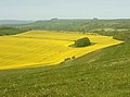
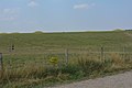
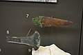
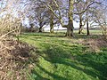
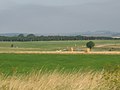
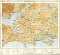
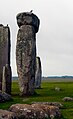
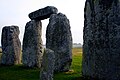
English: Salisbury Plain is a chalk plateau in central southern England covering . It is part of the Southern England Chalk Formation and largely lies within the county of Wiltshire, with a little in Hampshire. The plain is famous for its rich archaeology, including Stonehenge, one of England's best known landmarks. Largely as a result of the establishment of the Army Training Estate Salisbury Plain (ATE SP), the plain is sparsely populated and is the largest remaining area of calcareous grassland in north-west Europe. Additionally the plain has arable land, and a few small areas of beech trees and coniferous woodland.
{{nn| [[:nn:Fil:Summer Solstice Sunrise over Stonehenge 2005.jpg|mini|Stonehenge, det mest kjende landemerket på Salisbury Plain}}
Polski: Salisbury Plain (Równina Salisbury) – równina w południowo-środkowej Anglii, na obszarze hrabstwa Wiltshire. Obejmuje powierzchnię ok. 775 km². Teren jest słabo zalesiony, odwadniany przez rzekę Avon i jej dopływy; występują pokłady kredy. Na równinie znajdują się prehistoryczne monumenty i budowle megalityczne, m.in. Stonehenge. Duża część obszaru wykorzystywana jest do ćwiczeń wojskowych.
Simple English: Salisbury Plain is a chalk plateau in central southern England covering . It largely lies within the county of Wiltshire, with a little in Hampshire.
chalk plateau in England | |||||
| Upload media | |||||
| Instance of | |||||
|---|---|---|---|---|---|
| Location |
| ||||
 | |||||
Subcategories
This category has the following 4 subcategories, out of 4 total.
A
C
N
S
Media in category "Salisbury Plain"
The following 139 files are in this category, out of 139 total.
-
 Amesbury Archer.jpg 6,000 × 4,000; 11.79 MB
-
 An emerald isle set in a golden sea - geograph.org.uk - 1303938.jpg 640 × 477; 131 KB
-
 Barn near Stonehenge - geograph.org.uk - 491375.jpg 640 × 480; 121 KB
-
 Barrows north of Stonehenge.jpg 6,000 × 4,000; 10.35 MB
-
 Boles Barrow Bluestone.jpg 4,000 × 6,000; 7.92 MB
-
 Boreham Down from Imber Road - geograph.org.uk - 538729.jpg 640 × 477; 92 KB
-
 Bridleway from B390 - geograph.org.uk - 1158778.jpg 640 × 481; 155 KB
-
 Bridleway to Figheldean Down - geograph.org.uk - 1180365.jpg 640 × 482; 121 KB
-
 Broomrape - geograph.org.uk - 457124.jpg 480 × 640; 219 KB
-
 Bushes, South Down Sleight, Wiltshire - geograph.org.uk - 1093999.jpg 640 × 480; 130 KB
-
 Byway above Market Lavington - geograph.org.uk - 846514.jpg 640 × 427; 101 KB
-
 Byway from Chitterne Road - geograph.org.uk - 1158767.jpg 640 × 480; 164 KB
-
 Byway from the B390 - geograph.org.uk - 1158773.jpg 640 × 480; 167 KB
-
 Byway from the B390 - geograph.org.uk - 1158775.jpg 640 × 481; 182 KB
-
 Byway from the B390 - geograph.org.uk - 1158782.jpg 640 × 481; 163 KB
-
 Byway from the B390 near Chitterne - geograph.org.uk - 1158801.jpg 640 × 480; 148 KB
-

-
 Byway on Stoke Hill - geograph.org.uk - 1740130.jpg 640 × 476; 111 KB
-
 Byway to Quebec Farm - geograph.org.uk - 1159539.jpg 640 × 481; 140 KB
-

-
 Byway to Upavon, Salisbury Plain - geograph.org.uk - 1261569.jpg 640 × 480; 182 KB
-
 Byway to Urchfont Hill, Salisbury Plain - geograph.org.uk - 1261576.jpg 640 × 480; 146 KB
-
 Byway towards Stonehenge - geograph.org.uk - 1621197.jpg 574 × 640; 103 KB
-
 Byway towards Upton Great Barrow - geograph.org.uk - 1159501.jpg 640 × 481; 144 KB
-
 Byway, Chitterne Down - geograph.org.uk - 1158791.jpg 640 × 480; 171 KB
-
 Charlton Drove - geograph.org.uk - 1261601.jpg 640 × 480; 122 KB
-
 Chitterne Road - geograph.org.uk - 1206121.jpg 640 × 480; 72 KB
-
 Chlorops serenus female, Salisbury Plain, Nine-mile River.jpg 3,721 × 2,494; 4.78 MB
-
 Copehill Down - geograph.org.uk - 850541.jpg 640 × 480; 62 KB
-
 Copehill Down Railway - geograph.org.uk - 850545.jpg 640 × 480; 60 KB
-
 Copper alloy dagger blade and axehead.jpg 6,000 × 4,000; 11.19 MB
-
 Copse South of Maddington Down - geograph.org.uk - 361683.jpg 640 × 480; 176 KB
-
 Cremation from Stonehenge ditch fill.jpg 4,000 × 6,000; 7.23 MB
-
 Cuckoo Stone facing Westward.jpg 4,788 × 2,643; 8.19 MB
-
 Deptford Down Airstrip - geograph.org.uk - 1152026.jpg 640 × 426; 53 KB
-
 Durrington Walls house.jpg 4,000 × 6,000; 7.56 MB
-
 East from a byway, near Upavon - geograph.org.uk - 1261783.jpg 640 × 480; 157 KB
-
 End of the byway, near Wilsford Down - geograph.org.uk - 1260210.jpg 640 × 480; 185 KB
-
 English Countryside Shrewton United Kingdom Landscape Photography (168525949).jpeg 2,000 × 1,125; 968 KB
-
 Farm Land on Salisbury plain - geograph.org.uk - 974080.jpg 640 × 480; 86 KB
-
 Farmland near Rollestone - geograph.org.uk - 489494.jpg 640 × 480; 178 KB
-
 Farmland north of Westdown Camp - geograph.org.uk - 874197.jpg 640 × 395; 99 KB
-
 Fields on Salisbury Plain near Orcheston geograph-2506663-by-Maurice-Pullin.jpg 3,000 × 1,781; 1.36 MB
-
 Figheldean Jade Axe.jpg 4,000 × 6,000; 7.2 MB
-
 Geological Map Hampshire Basin Chatwin.jpg 3,242 × 2,874; 721 KB
-
 Hawthorn bushes coming into fruit, Imber - geograph.org.uk - 539271.jpg 640 × 480; 140 KB
-

-
 Inside the stones at Stonehenge.jpg 2,500 × 1,667; 3.35 MB
-
 John Constable - Salisbury Plain from Old Sarum - Google Art Project.jpg 5,677 × 3,931; 6.74 MB
-
 Johnson visited Salisbury Plain for UK Army (1).jpg 3,000 × 2,191; 1.02 MB
-
 Johnson visited Salisbury Plain for UK Army (2).jpg 4,096 × 2,731; 1.21 MB
-
 Johnson visited Salisbury Plain for UK Army (4).jpg 3,000 × 2,359; 1.03 MB
-
 Junction of byways, Netheravon - geograph.org.uk - 1057021.jpg 640 × 438; 84 KB
-
 Junction on Tinhead Hill - geograph.org.uk - 886491.jpg 640 × 450; 59 KB
-
 Knook Down from Quebec Farm - geograph.org.uk - 1423343.jpg 640 × 459; 134 KB
-
 Look out^ Its the copse - geograph.org.uk - 1426002.jpg 640 × 504; 113 KB
-
 Lowering skies on Chitterne Road - geograph.org.uk - 1416814.jpg 640 × 562; 149 KB
-
 Maddington Down - geograph.org.uk - 947881.jpg 640 × 480; 48 KB
-
 Maddington Down - geograph.org.uk - 947890.jpg 640 × 480; 78 KB
-
 Netheravon Down - geograph.org.uk - 453576.jpg 640 × 480; 123 KB
-
 Netheravon Down - geograph.org.uk - 457147.jpg 640 × 480; 131 KB
-
 Netheravon Down - geograph.org.uk - 457150.jpg 640 × 480; 132 KB
-
 North east from the B390 - geograph.org.uk - 1426021.jpg 640 × 494; 132 KB
-

-
 North east from White Hill - geograph.org.uk - 1316430.jpg 640 × 505; 154 KB
-
 North north east near Upton Scudamore - geograph.org.uk - 1057648.jpg 640 × 472; 187 KB
-

-

-
 Ordnance Survey One-Inch Sheet 112 Marlborough and Devizes, Published 1919.jpg 12,194 × 8,530; 10.31 MB
-
 Ordnance Survey One-Inch Sheet 167 Salisbury, Published 1940.jpg 8,211 × 9,424; 9.6 MB
-
 Ordnance Survey One-Inch Sheet 167 Salisbury, Published 1960.jpg 8,314 × 9,952; 11.27 MB
-
 Ordnance Survey One-Inch Sheet 167 Salisbury, Published 1971.jpg 11,130 × 13,186; 42.09 MB
-
 Ordnance Survey Popular Edition Sheet 112 Marlborough, Published 1919.jpg 12,374 × 8,287; 14.11 MB
-
 Ordnance Survey Quarter-inch Sheet 16 Southern England, Published 1966.jpg 9,646 × 8,909; 12.19 MB
-
 Parsonage Down - geograph.org.uk - 1314253.jpg 640 × 426; 87 KB
-
-
 Pre-WWII signpost on the old Salisbury to Lavington Road - panoramio.jpg 2,000 × 2,987; 778 KB
-
 Prominent Objects on the B390 - geograph.org.uk - 974115.jpg 640 × 480; 60 KB
-

-
-
 Rook sitting on top of a Stonehenge lintel stone.jpg 1,529 × 2,500; 3.68 MB
-
 Rough Down, near Little Cheverell (1) - geograph.org.uk - 1449192.jpg 640 × 480; 148 KB
-
 Rough Down, near Little Cheverell (2) - geograph.org.uk - 1449193.jpg 640 × 480; 152 KB
-
 Salisbury Plain - Byway - geograph.org.uk - 1717661.jpg 1,024 × 768; 142 KB
-
 Salisbury Plain - Byway - geograph.org.uk - 1717671.jpg 1,024 × 768; 186 KB
-
 Salisbury Plain - Byway - geograph.org.uk - 1717784.jpg 1,024 × 768; 176 KB
-
 Salisbury Plain - Byway Junction - geograph.org.uk - 1717743.jpg 1,024 × 768; 155 KB
-
 Salisbury Plain - geograph.org.uk - 1390541.jpg 640 × 480; 61 KB
-
 Salisbury Plain - Hazy Rolling View to Manningford Bohune - panoramio.jpg 1,600 × 1,200; 243 KB
-
 Salisbury Plain near Everleigh - geograph.org.uk - 1453730.jpg 640 × 480; 112 KB
-
 Salisbury Plain, east of Netheravon - geograph.org.uk - 710839.jpg 640 × 480; 96 KB
-
 Shrewton Beaker Burial.jpg 6,000 × 4,000; 11.15 MB
-
 Sign for the Imber Range Path - geograph.org.uk - 1159624.jpg 480 × 640; 203 KB
-
 Signpost on Salisbury Plain - geograph.org.uk - 1093181.jpg 640 × 512; 43 KB
-
 Silage bales near Gore Cross - geograph.org.uk - 1576643.jpg 640 × 480; 125 KB
-
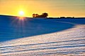 Snowy Sunset on Salisbury Plain.jpg 5,941 × 3,962; 7.95 MB
-
 South of West Lavington Down, Wiltshire - geograph.org.uk - 1092822.jpg 640 × 480; 134 KB
-
 Stonehenge Archer.jpg 6,000 × 4,000; 10.28 MB
-
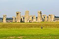 Stonehenge from SW with henge.jpg 6,000 × 4,000; 9.11 MB
-
 Stonehenge inner circle.jpg 1,211 × 1,600; 1.87 MB
-
 Stonehenge Landscape.jpg 6,000 × 4,000; 8.75 MB
-
 Stonehenge outer stones.jpg 2,500 × 1,667; 3.17 MB
-
 Stonehenge tall inner stones and outer stones, with lintels.jpg 1,667 × 2,267; 2.83 MB
-
 Stonehenge with sky from the SW.jpg 6,000 × 4,000; 6.63 MB
-
 Stormy weather near Salisbury Plain - geograph.org.uk - 762087.jpg 640 × 480; 59 KB
-
 The Cuckoo Stone facing East.jpg 4,762 × 2,714; 8.26 MB
-
 The Cuckoo Stone, Wiltshire.jpg 4,896 × 2,752; 11.92 MB
-
 The River Avon, Normanton - geograph.org.uk - 491459.jpg 640 × 480; 145 KB
-
The Sheep of Stonehenge.webm 30 s, 1,920 × 1,080; 55.49 MB
-
 The track through Water Dean Bottom - geograph.org.uk - 711266.jpg 640 × 480; 101 KB
-
 Towards Upton Cow Down - geograph.org.uk - 538964.jpg 477 × 640; 82 KB
-
 Track and farmland above Rushall - geograph.org.uk - 1560590.jpg 640 × 480; 156 KB
-

-
 Track on the downs at Everleigh - geograph.org.uk - 491438.jpg 640 × 480; 98 KB
-
 Track over Claypit Hill - geograph.org.uk - 1427777.jpg 640 × 473; 169 KB
-
 Track to Clay Pit Hill - geograph.org.uk - 1427822.jpg 640 × 468; 127 KB
-
 Track to Imber - geograph.org.uk - 1640152.jpg 640 × 426; 57 KB
-
 Track, Baden's Clump - geograph.org.uk - 491418.jpg 640 × 480; 109 KB
-
 Track, Larkhill Artillery Range - geograph.org.uk - 522688.jpg 640 × 480; 162 KB
-
 Track, Larkhill Artillery Range - geograph.org.uk - 524918.jpg 640 × 480; 173 KB
-
 Tracks on Imber Range - geograph.org.uk - 538836.jpg 640 × 477; 116 KB
-
 Tracks towards Fore Down, Imber Range - geograph.org.uk - 538823.jpg 640 × 477; 84 KB
-

-
 Tree-lined road into Imber - geograph.org.uk - 539280.jpg 640 × 480; 136 KB
-
 Trees on downland, Orcheston - geograph.org.uk - 522717.jpg 640 × 480; 188 KB
-

-
 Tumulus, Imber Range - geograph.org.uk - 537638.jpg 640 × 477; 103 KB
-
 Unmade track, Salisbury Plain - geograph.org.uk - 535778.jpg 640 × 479; 284 KB
-

-
 View into New Copse Down - geograph.org.uk - 552194.jpg 640 × 409; 95 KB
-
 View Towards Penning Down - geograph.org.uk - 552209.jpg 640 × 427; 123 KB
-
 Weatherhill Scrub, Salisbury Plain - geograph.org.uk - 669408.jpg 640 × 479; 312 KB
-
 Wheatfield north of the B390 - geograph.org.uk - 1416641.jpg 640 × 468; 145 KB
-
-
 Windmill on Salisbury Plain - geograph.org.uk - 947864.jpg 480 × 640; 56 KB
-
 Woodland, Imber range - geograph.org.uk - 537694.jpg 640 × 477; 107 KB
-
 Woods above Imber - geograph.org.uk - 538273.jpg 640 × 480; 75 KB
-
 Woods on Imber Range, Salisbury Plain - geograph.org.uk - 538258.jpg 640 × 480; 86 KB
-
 Old Marlborough Road - geograph.org.uk - 91982.jpg 640 × 480; 68 KB


.jpeg)


.jpg)
.jpg)
.jpg)


_-_geograph.org.uk_-_1449192.jpg)
_-_geograph.org.uk_-_1449193.jpg)


