Category:SVG topographic maps of Tunisia
Jump to navigation
Jump to search
Media in category "SVG topographic maps of Tunisia"
The following 18 files are in this category, out of 18 total.
-
 Cartago location map it.svg 1,354 × 1,180; 2.21 MB
-
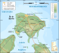
 Djerba topographic map-ar.svg 1,100 × 990; 570 KB
-
 Djerba topographic map-de.svg 1,100 × 990; 562 KB
-
 Djerba topographic map-en.svg 1,100 × 990; 564 KB
-
 Djerba topographic map-fr.svg 1,100 × 990; 564 KB
-
 Djerba topographic map-it.svg 1,100 × 990; 564 KB
-
 Djerba topographic map-sv.svg 1,100 × 990; 564 KB
-
 Jews-in-Djerba.svg 978 × 880; 94 KB
-
 Medjerda river drainage basin-fr.svg 837 × 752; 2.97 MB
-
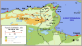
 Northern Tunisia Natural Regions-fr.svg 1,530 × 780; 430 KB
-
 Oued Miliane drainage basin-fr.svg 1,180 × 1,013; 7.55 MB
-
 Oued Zeroud Merguellil Nebhana drainage basin-fr.svg 837 × 752; 2.97 MB
-
 Tunis Gulf topo map-fr.svg 1,990 × 1,800; 2.58 MB
-
 Tunis Gulf topo map-ar.svg 1,990 × 1,800; 2.62 MB
-
 Tunis Gulf topo map-es.svg 1,990 × 1,800; 5.5 MB
-
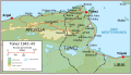 Tunisia1942-1943-es.svg 747 × 425; 136 KB
-
 Tunisia1942-1943.svg 747 × 425; 135 KB
-
 Wadi Sejenane drainage basin-fr.svg 1,712 × 963; 4.63 MB


