Category:SVG territorial growth maps of the United States
Jump to navigation
Jump to search
Media in category "SVG territorial growth maps of the United States"
The following 14 files are in this category, out of 14 total.
-
 Adams-Onís treaty map-en.svg 626 × 478; 684 KB
-
 Adams-Onís treaty map-es.svg 626 × 478; 684 KB
-
 Adams-Onís treaty map-it.svg 626 × 478; 683 KB
-
 Adquisiciones territoriales de los Estados Unidos.svg 734 × 501; 1.49 MB
-
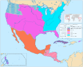
 Former territories of New Spain lost to the USA by 1900.svg 1,249 × 1,005; 2.26 MB
-
 French Louisiana map.svg 734 × 501; 968 KB
-
 Map to Illustrate the Acquisition of West Florida-es.svg 1,702 × 760; 711 KB
-
 Territorial evolution of Mexico and the USA (1800–1900) 01.svg 1,249 × 2,239; 6.58 MB
-
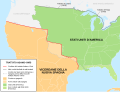
 Territorial evolution of Mexico and the USA (1800–1900) 02.svg 1,249 × 1,005; 2.41 MB
-
 Aquired Lands of the US.svg 792 × 612; 7.17 MB
-
 Texas proposed boundaries.svg 1,475 × 1,425; 697 KB
-
 United States 1803-04-1804-03-es.svg 734 × 501; 2.02 MB
-
 US states by date of statehood RWB dates.svg 972 × 648; 160 KB
-
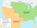
 Viceroyalty of New Spain and the United States of America 1800.svg 1,249 × 1,005; 2.37 MB


_01.svg)
_02.svg)


