Category:SVG maps of the history of Pakistan
Jump to navigation
Jump to search
Countries of Asia: Armenia‡ · Azerbaijan‡ · Bangladesh · People's Republic of China · Egypt‡ · Georgia‡ · India · Indonesia‡ · Pakistan · Russia‡
‡: partly located in Asia
‡: partly located in Asia
Media in category "SVG maps of the history of Pakistan"
The following 20 files are in this category, out of 20 total.
-
 Balochistan districts 1973.svg 512 × 393; 284 KB
-
 Dispartigo de Barato 1947.svg 1,189 × 1,170; 223 KB
-
 East Pakistan (orthographic projection).svg 553 × 553; 329 KB
-
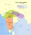
 Indian Kanauj triangle map-es.svg 1,539 × 1,735; 1.8 MB
-
 Indian Kanauj triangle map.svg 1,639 × 1,852; 389 KB
-
 Kannauj-triangelet år 750-900.svg 1,639 × 1,852; 387 KB
-
 Pakistan Ost- und West 1971 (2)-hu.svg 556 × 667; 899 KB
-
 Pakistan Ost- und West 1971 (2).svg 556 × 667; 848 KB
-
 Pakistan Ost- und West 1971-hu.svg 772 × 654; 702 KB
-
 Pakistan Ost- und West 1971.svg 772 × 654; 667 KB
-
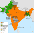 Partition of India 1947 en.svg 1,189 × 1,170; 724 KB
-
 Partition of India 1947 es.svg 1,189 × 1,170; 215 KB
-
 Partition of India 1947 fr.svg 1,189 × 1,170; 461 KB
-
 Partition of India 1947 gu.svg 1,189 × 1,170; 222 KB
-
 Partition of India 1947 it.svg 1,189 × 1,170; 162 KB
-
 Partition of India 1947 mr.svg 1,189 × 1,170; 219 KB
-
 Partition of India 1947-bn.svg 1,189 × 1,170; 231 KB
-
 Partition of India 1947-hu.svg 1,189 × 1,170; 253 KB
-
 Partition of India 1947-kn.svg 1,189 × 1,170; 229 KB
-
 Partition of India 1947-pa.svg 1,189 × 1,170; 216 KB


.svg)


-hu.svg)
.svg)


