Category:SVG maps of the history of Indonesian provinces
Jump to navigation
Jump to search
| NO WIKIDATA ID FOUND! Search for SVG maps of the history of Indonesian provinces on Wikidata | |
| Upload media |

Derived from File:Indonesia location map.svg
Subcategories
This category has only the following subcategory.
B
Media in category "SVG maps of the history of Indonesian provinces"
The following 61 files are in this category, out of 61 total.
-
 2019 Indonesian Legislative Election Map.png 1,500 × 590; 220 KB
-
 2019 Indonesian legislative election results map by electoral district.svg 1,748 × 1,137; 856 KB
-
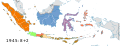 Indonesia provinces 1945.svg 1,200 × 460; 938 KB
-
 Indonesia provinces 1946.svg 1,200 × 460; 932 KB
-
 Indonesia provinces 1950.svg 1,200 × 460; 935 KB
-
 Indonesia provinces 1956-a.svg 1,200 × 460; 940 KB
-
 Indonesia provinces 1956-b.svg 1,200 × 460; 942 KB
-
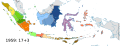
 Indonesia provinces 1958-a.svg 1,200 × 460; 942 KB
-
 Indonesia provinces 1958-b.svg 1,200 × 460; 944 KB
-
 Indonesia provinces 1958-c.svg 1,200 × 460; 945 KB
-
 Indonesia provinces 1959.svg 1,200 × 460; 946 KB
-
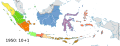
 Indonesia provinces 1960.svg 1,200 × 460; 947 KB
-
 Indonesia provinces 1963.svg 1,200 × 460; 947 KB
-
 Indonesia provinces 1964-a.svg 1,200 × 460; 948 KB
-
 Indonesia provinces 1964-b.svg 1,200 × 460; 948 KB
-
 Indonesia provinces 1964-c.svg 1,200 × 460; 950 KB
-
 Indonesia provinces 1967.svg 1,200 × 460; 952 KB
-
 Indonesia provinces 1976.svg 1,200 × 460; 950 KB
-
 Indonesia provinces 1999-a.svg 1,200 × 460; 952 KB
-
 Indonesia provinces 1999-b.svg 1,200 × 460; 952 KB
-
 Indonesia provinces 2000-a.svg 1,200 × 460; 952 KB
-
 Indonesia provinces 2000-b.svg 1,200 × 460; 952 KB
-
 Indonesia provinces 2000-c.svg 1,200 × 460; 953 KB
-
 Indonesia provinces 2001.svg 1,200 × 460; 953 KB
-
 Indonesia provinces 2002.svg 1,200 × 460; 953 KB
-
 Indonesia provinces 2004.svg 1,200 × 460; 954 KB
-
 Indonesia provinces 2012.svg 1,200 × 460; 970 KB
-
 Indonesia provinces 2022 - id.png 5,222 × 2,000; 1.64 MB
-
 Indonesia provinces 2022.svg 1,200 × 460; 1,016 KB
-
 Indonesia provinces fertility rate 2017.svg 1,185 × 450; 394 KB
-
 Indonesia provinces HDI 2014.svg 1,322 × 620; 175 KB
-
 Indonesia provinces HDI 2015.svg 1,587 × 744; 383 KB
-
 Indonesia provinces HDI 2017.svg 2,000 × 767; 433 KB
-
 Indonesia provinces HDI 2018.svg 512 × 196; 297 KB
-
 Indonesia provinces HDI 2019.svg 512 × 196; 297 KB
-
 Indonesia provinces HDI 2020.svg 1,185 × 450; 302 KB
-
 Indonesia provinces HDI 2021.svg 1,875 × 750; 370 KB
-
 Indonesia provinces population density 2015.svg 512 × 196; 297 KB
-
 Indonesia provinces population density 2020.svg 1,185 × 450; 394 KB
-

-
 Old map of Central Sumatra (before 1958).svg 245 × 210; 858 KB
-
 Old map of East Kalimantan (before 2012).svg 179 × 158; 860 KB
-
 Old map of Kalimantan (1956).svg 179 × 158; 861 KB
-
 Old map of Kalimantan (blank).svg 179 × 158; 860 KB
-
 Old map of Maluku (before 1999).svg 184 × 191; 862 KB
-
 Old map of North Sulawesi (before 1964).svg 165 × 212; 862 KB
-
 Old map of North Sulawesi (before 2000).svg 165 × 212; 863 KB
-
 Old map of North Sumatra (before 1956).svg 245 × 210; 857 KB
-
 Old map of Papua (before 2001).svg 201 × 169; 862 KB
-
 Old map of Riau (before 2002).svg 245 × 210; 866 KB
-
 Old map of South Kalimantan (before 1958).svg 179 × 158; 859 KB
-
 Old map of South Sulawesi (before 1964).svg 165 × 212; 862 KB
-
 Old map of South Sulawesi (before 2004).svg 165 × 212; 863 KB
-
 Old map of South Sumatra (before 1964).svg 245 × 210; 862 KB
-
 Old map of South Sumatra (before 1967).svg 245 × 210; 864 KB
-
 Old map of South Sumatra (before 2000).svg 245 × 210; 866 KB
-
 Old map of Sulawesi (1960).svg 165 × 212; 864 KB
-
 Old map of Sulawesi (blank).svg 165 × 212; 864 KB
-
 Old map of Sumatra (1950).svg 245 × 210; 859 KB
-
 Old map of Sumatra (blank).svg 245 × 210; 859 KB
-
 Old map of West Java (before 2000).svg 187 × 65; 862 KB


.svg)
.svg)
.svg)
.svg)
.svg)
.svg)
.svg)
.svg)
.svg)
.svg)
.svg)
.svg)
.svg)
.svg)
.svg)
.svg)
.svg)
.svg)
.svg)
.svg)
.svg)
.svg)