Category:SVG maps of the enlargement of the European Union
Jump to navigation
Jump to search
Subcategories
This category has only the following subcategory.
Media in category "SVG maps of the enlargement of the European Union"
The following 60 files are in this category, out of 60 total.
-
 EC-EU enlargement.svg 680 × 520; 570 KB
-
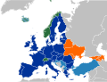
 EC06-1957-58 EC and USSR map.svg 680 × 520; 510 KB
-
 EC06-1957-58 European Community map.svg 680 × 520; 511 KB
-
 EC06-1962 (Decolonisation) European Community map.svg 680 × 520; 511 KB
-
 EC09-1973 European Community map enlargement.svg 680 × 520; 511 KB
-
 EC09-1973 European Community map.svg 680 × 520; 511 KB
-
 EC10-1981 European Community map enlargement.svg 680 × 520; 511 KB
-
 EC10-1981 European Community map.svg 680 × 520; 511 KB
-
 EC10-1985 (Greenland withdrawal) European Community map.svg 680 × 520; 511 KB
-
 EC12-1986 EC and USSR map.svg 680 × 520; 511 KB
-
 EC12-1986 European Community map enlargement.svg 680 × 520; 511 KB
-
 EC12-1986 European Community map.svg 680 × 520; 511 KB
-
 EC12-1990 European Community map enlargement.svg 680 × 520; 511 KB
-
 EC12-1990 European Community map.svg 680 × 520; 594 KB
-
 Enlargement of the European Union SMIL.svg 512 × 512; 335 KB
-
 EU accession map.svg 800 × 520; 553 KB
-
 EU-candidate countries map.svg 680 × 520; 376 KB
-
 EU-Eastern Partnership.svg 680 × 520; 376 KB
-
 EU-Erweiterungsbeschlüsse 1999.svg 680 × 520; 372 KB
-
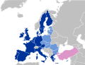
 EU-SAP-EFTA-EaP.svg 2,047 × 1,720; 622 KB
-
 EU12-1992-93 European Union map.svg 680 × 520; 515 KB
-
 EU15-1995 European Union map enlargement.svg 680 × 520; 515 KB
-
 EU15-1995 European Union map.svg 680 × 520; 515 KB
-
 EU1952-1973.svg 610 × 610; 425 KB
-
 EU1976-1995.svg 610 × 610; 482 KB
-
 EU2004-2007.svg 610 × 610; 472 KB
-
 EU25-2004 European Union map enlargement.svg 680 × 520; 516 KB
-
 EU25-2004 European Union map.svg 680 × 520; 515 KB
-
 EU25-27-2004-2007 European Union map enlargement.svg 680 × 520; 516 KB
-
 EU27-2007 European Union map enlargement.svg 680 × 520; 516 KB
-
 EU27-2009-Eastern Partnership.svg 680 × 520; 519 KB
-
 EU27-2012 EFTA and Eastern Partnership.svg 680 × 520; 525 KB
-
 EU27-2012-candidate countries map.svg 680 × 520; 374 KB
-
 EU27-2012-candidate countries only map.svg 680 × 520; 515 KB
-
 EU27-2012-states with applications.svg 680 × 520; 523 KB
-
 EU27-2020 (UK withdrawal) European Union.svg 680 × 520; 378 KB
-
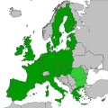
 EU27-2020 European Union map.svg 680 × 520; 343 KB
-
 EU28-2013 European Union map enlargement.svg 680 × 520; 372 KB
-
 EU28-candidate countries map.svg 680 × 520; 372 KB
-
 EU28-candidate countries only map 2.svg 689 × 519; 297 KB
-
 EU28-candidate countries only map with EU as single entity.svg 680 × 520; 417 KB
-
 EU28-candidate countries only map.svg 689 × 519; 297 KB
-
 EU28-states with applications.svg 680 × 520; 377 KB
-
 European Coal and Steel Community Map 1952.svg 246 × 251; 390 KB
-
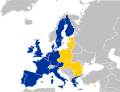
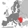
 European Union and Bulgaria and Romania.svg 610 × 610; 472 KB
-
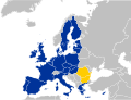
 European Union and Croatia.svg 610 × 610; 472 KB
-
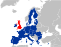
 European Union and the United Kingdom.svg 610 × 610; 473 KB
-
 European union future enlargements map fr.svg 609 × 600; 2.17 MB
-
 European Union History.svg 603 × 401; 332 KB
-
 European Union maximum enlargement.svg 537 × 536; 349 KB
-
 Evolution of the European Union SMIL.svg 512 × 512; 416 KB
-
 Flag map of European Union maxium enlargement.svg 1,197 × 881; 28 KB
-
 Inner Six and Outer Seven.svg 450 × 456; 473 KB
-
 Location European Economic Community (1993).svg 999 × 553; 573 KB
-
 Mechanism for cooperation and verification.svg 610 × 610; 472 KB
-
 NATO member states, 2023 (Finland).svg 610 × 610; 347 KB
-
 Países candidatos de la UE.svg 645 × 690; 535 KB
-
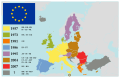
 Territorial evolution of the European Union.svg 680 × 520; 756 KB
-
 Treaty of Accession 1972 European Communities map.svg 680 × 520; 462 KB
-
 Treaty of Accession 1994 European Union map.svg 680 × 520; 515 KB


_European_Community_map.svg)


_European_Community_map.svg)


_European_Union.svg)


.svg)

.svg)


