Category:SVG maps of the Viceroyalty of Peru
Jump to navigation
Jump to search
Media in category "SVG maps of the Viceroyalty of Peru"
The following 9 files are in this category, out of 9 total.
-
 Viceroyalty of Peru (orthographic projection).svg 550 × 550; 278 KB
-
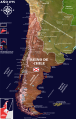
 Bandera mapa de la Capitanía General de Chile, 1775.svg 1,579 × 3,543; 1.35 MB
-
 Bandera mapa de la Capitanía General de Chile, 1776.svg 1,575 × 3,543; 3.19 MB
-
 Capitanía General de Chile, 1775, mapa satelital.svg 1,710 × 2,684; 8.84 MB
-
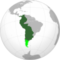
 Captaincy General of Chile (orthographic projection).svg 550 × 550; 844 KB
-
 Establecimientos del Imperio español en la Patagonia atlántica.svg 570 × 958; 4.31 MB
-
 Map of the Viceroyalty of Peru.svg 3,121 × 1,586; 1.67 MB
-
 Viceroyalty of Peru (1795).svg 550 × 550; 113 KB
-
 Virreynato del Perú.svg 722 × 722; 258 KB
.svg)


.svg)


.svg)
