Category:SVG maps of departments of France
Jump to navigation
Jump to search
Departments of Metropolitan France: Ardennes [08] · departmental district of the Rhône [69] · Rhône [69D]‡ · Metropolis of Lyon [69M]‡ · Paris [75] · Somme [80] · Territoire de Belfort [90]
Overseas departments and regions: Guadeloupe [971] · Martinique [972] · French Guiana [973] · Réunion [974] · Mayotte [976]
Overseas collectivities: Saint Pierre and Miquelon [975] · Saint Barthélemy [977] · Saint-Martin [978] · Wallis and Futuna [986] · French Polynesia [987] · French Southern and Antarctic Lands [984]+
Sui generis territories: New Caledonia [988] · Clipperton Island [989]+

Subcategories
This category has the following 3 subcategories, out of 3 total.
*
.
Media in category "SVG maps of departments of France"
The following 66 files are in this category, out of 66 total.
-
 France location map-Regions and departements 1975-2014.svg 2,000 × 1,922; 753 KB
-
 Arrondissements minéralogiques 1901.svg 507 × 553; 140 KB
-
 Arrondissements minéralogiques 1922.svg 507 × 553; 145 KB
-
 BBC 2005 rigueur climatique-2.svg 588 × 550; 197 KB
-
 BBC 2005 rigueur climatique.svg 588 × 550; 182 KB
-
 Blank map of France, with communes and departments.svg 1,000 × 900; 14.7 MB
-
 Carte Agence francaise pour la biodiversite.svg 2,000 × 1,922; 2.9 MB
-
 Carte démographique de la France.svg 588 × 550; 410 KB
-
 Carte France avec DROM COM.svg 512 × 382; 181 KB
-
 Carte vierge départements français avec DOM.svg 588 × 550; 192 KB
-
 Communes france-fr.svg 588 × 550; 106 KB
-
 Contiguite Departements de France.svg 878 × 906; 70 KB
-
 Contours des départements français (Mercator).svg 1,470 × 973; 1.01 MB
-
 Cridon.svg 530 × 550; 494 KB
-
 Densité départements-France-it.svg 620 × 750; 88 KB
-
 Densité départements-France-ru.svg 620 × 750; 165 KB
-
 Densité départements-France.svg 620 × 750; 165 KB
-
 Departamantoù Frañs.svg 588 × 550; 356 KB
-
 Departamantoù ha rannvroioù kozh.svg 588 × 550; 475 KB
-
 Departements de France map.svg 588 × 550; 273 KB
-
 Departements Lambert4Zones.svg 588 × 550; 282 KB
-
 Departements LambertCC9Zones.svg 588 × 550; 343 KB
-
 DepartementsFranceDensitePopulation.svg 507 × 553; 157 KB
-
 Dipartimenti francesi.svg 600 × 560; 364 KB
-
 Départements de France cs.svg 588 × 550; 361 KB
-
 Départements de France English.svg 588 × 550; 341 KB
-
 Départements de France he.svg 588 × 550; 343 KB
-
 Départements de France hr.svg 588 × 550; 370 KB
-
 Départements de France Korean.svg 588 × 550; 304 KB
-
 Départements de France Macedonian.svg 588 × 550; 575 KB
-
 Départements de France nom+num He.svg 635 × 580; 1.16 MB
-
 Départements de France nom+num-2015.svg 635 × 580; 477 KB
-
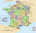 Départements de France nom+num.svg 635 × 580; 475 KB
-
 Départements de France norsk.svg 588 × 550; 335 KB
-
 Départements de France Profondeur-fondations.svg 623 × 568; 135 KB
-
 Départements de France VI.svg 588 × 550; 361 KB
-
 Départements de France-et.svg 588 × 550; 360 KB
-
 Départements de France-simple.svg 907 × 1,000; 30 KB
-
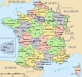
 Départements de France.svg 588 × 550; 360 KB
-
 Départements et régions de France 2016.svg 588 × 550; 226 KB
-
 Départements et régions de France2.svg 588 × 550; 262 KB
-
 Départements und Regionen in Frankreich.svg 629 × 578; 437 KB
-
 Départements+régions (France)-2016.svg 677 × 618; 431 KB
-
 Départements+régions (France).svg 588 × 550; 480 KB
-
 Départements+régions+capitales(France).svg 588 × 550; 488 KB
-
 Départements-conseils.svg 588 × 550; 236 KB
-
 Fr-action-sociale-dep-2012.svg 510 × 543; 232 KB
-
 FR-Departements-collect-statut-part.svg 512 × 483; 310 KB
-
 France - Density of Monuments historiques by commune, with departments.svg 1,000 × 900; 5.38 MB
-
 France - Production de pomme s de terre.svg 617 × 585; 195 KB
-
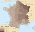
 France Density of Monuments historiques by department.svg 2,000 × 1,898; 1.45 MB
-
 France départementale frp.svg 2,000 × 1,898; 4.55 MB
-
 France départementale mk.svg 2,000 × 1,898; 5.18 MB
-
 France départementale-ca.svg 2,000 × 1,898; 4.84 MB
-
 France départementale.svg 2,000 × 1,898; 1.87 MB
-
 France location map – regions and departments (including overseas).svg 2,000 × 1,922; 1,005 KB
-
 France location map-Departements-2015+ROM.svg 2,000 × 1,922; 840 KB
-
 France location map-Departements-2015.svg 2,000 × 1,922; 783 KB
-
 France location map-Regions and departements-2015.svg 2,000 × 1,922; 699 KB
-
 France location map-Regions and departements-2016.svg 2,000 × 1,922; 551 KB
-
 France location map-Regions and departments with Paris and inner ring in a box-2016.svg 2,000 × 1,922; 598 KB
-
 France map Lambert-93-Maximum altitude.svg 2,000 × 1,898; 1.45 MB
-
 France maximale 2016.svg 2,000 × 1,898; 4.82 MB
-
 Map - France - deprtements - forests.jpg 1,118 × 1,188; 321 KB
-
 Map of urban areas of France, with communes and departments.svg 1,000 × 900; 14.7 MB
-
 Overzichtskaart Franse Departementen.svg 625 × 625; 481 KB


.svg)


-2016.svg)
.svg)
.svg)


.svg)


