Category:SVG maps of Taitung County
Jump to navigation
Jump to search
Subcategories
This category has only the following subcategory.
T
Media in category "SVG maps of Taitung County"
The following 9 files are in this category, out of 9 total.
-
 1930 Taito Cho.svg 1,400 × 2,300; 87 KB
-
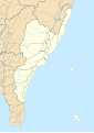
 Huatung Valley de.svg 528 × 720; 55 KB
-
 Huatung Valley.svg 900 × 1,270; 65 KB
-
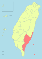
 Taitung County in Taiwan.svg 1,016 × 1,221; 411 KB
-
 Taitung County.svg 1,200 × 2,200; 208 KB
-
 Taiwan ROC political division map Taitung County.svg 850 × 1,200; 119 KB
-
 Valangaw - Tâitang - (Taitung County) location map.svg 744 × 1,052; 340 KB
-
 臺東縣東北海岸公路地圖.svg 2,459 × 522; 326 KB
-
 臺東縣東南海岸公路地圖.svg 1,508 × 266; 280 KB


_location_map.svg)