Category:SVG maps of South Africa
Jump to navigation
Jump to search
Subcategories
This category has the following 4 subcategories, out of 4 total.
Media in category "SVG maps of South Africa"
The following 18 files are in this category, out of 18 total.
-
 Boer republics nl.svg 1,146 × 828; 78 KB
-
 Complexe igné du Bushveld.svg 1,259 × 835; 275 KB
-
 De Waterkant map.svg 976 × 840; 1.64 MB
-
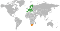 European Union South Africa Locator.svg 638 × 328; 1.69 MB
-
 Map of South Africa-ar.svg 1,000 × 1,000; 287 KB
-
 Map of South Africa.svg 1,000 × 1,000; 475 KB
-
 Nguni group speakers density ZA.svg 995 × 768; 900 KB
-
 Nguni group speakers proportion ZA.svg 995 × 768; 899 KB
-
 Províncias da África do Sul.svg 1,071 × 934; 287 KB
-
 South Africa & South West Africa Bantustans Map.svg 1,000 × 882; 171 KB
-
 South Africa 2001 Nguni speakers density map.svg 1,072 × 933; 1.47 MB
-
 South Africa 2001 Nguni speakers proportion map.svg 1,072 × 933; 458 KB
-
 South Africa adm location map.svg 2,031 × 1,741; 458 KB
-
 South Africa blank.svg 1,146 × 828; 106 KB
-
 South Africa Republic Referendum 1960 variant.svg 528 × 452; 124 KB
-
 South Africa Republic Referendum 1960.svg 1,032 × 874; 362 KB
-
 SVG-Koort Südafrika.svg 850 × 650; 398 KB
-
 Wikimania cape town eat map.svg 435 × 257; 1.11 MB


