Category:SVG locator maps of states in Palau (location map scheme)
Jump to navigation
Jump to search

|
SVG maps in this category are part of a locator map series applying the (de) widespread location map scheme. Please see root category to browse for more. |
.svg)
.svg)
.svg)
.svg)
.svg)
.svg)
.svg)
Locator maps design recommendations ▼ | |
|---|---|
Principles
Design Guidelines are based on ▸location map design of the German map shop (in German). It's preferable to derive new locator maps from existing location maps. Please keep both size and ratio in this case. Thus the new locator maps may still be applied as location map (▸Guide). Marker color is supposed to be darkred. Waterbodies may be transparent, to show other objects better. Please be aware that this guide is only a recommendation. It’s not an inevitable law!
Highlight small areas
“Remote” areas and mini maps
Mini maps show where the depicted area actually is situated. Check out ▸Vorlage:Positionskarte+ (in German) and ▸Modèle:Carte en coin (in French) of how to insert a mini map in virtually every map.
Disputed areas
Greyed special objects
Backgrounds
|

-en.svg)

.svg)
.svg)
.svg)

_(US48).svg)
_(small_islands_magnified)_(-mini_map_-rivers).svg)
.svg)
_(extra_close)_(US48).svg)
.svg)
_(zoom).svg)

.svg)


_(UNMIK).svg)
.svg)
_(disputed_hatched).svg)
_(claimed_and_disputed_hatched).svg)
.svg)
.svg)
_(%2Ball_claims_hatched).svg)

.svg)
_(shade).svg)
_(shade)_(special_marker).svg)
_(-mini_map).svg)
_(-mini_map).svg)
_(-mini_map).svg)


.svg)

.svg)
Media in category "SVG locator maps of states in Palau (location map scheme)"
The following 23 files are in this category, out of 23 total.
-
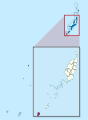
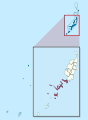
 Aimeliik in Palau.svg 520 × 709; 133 KB
-
 Airai in Palau.svg 520 × 709; 133 KB
-
 Angaur in Palau (zoom).svg 520 × 709; 134 KB
-
 Angaur in Palau.svg 520 × 709; 134 KB
-
 Babeldaob in Palau.svg 520 × 709; 133 KB
-
 Hatohobei in Palau.svg 520 × 709; 134 KB
-
 Hatohobei State map.svg 797 × 849; 156 KB
-
 Kayangel in Palau.svg 520 × 709; 134 KB
-
 Koror in Palau.svg 520 × 709; 134 KB
-
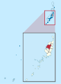
 Melekeok in Palau.svg 520 × 709; 133 KB
-
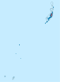
 Ngaraard in Palau.svg 520 × 709; 133 KB
-
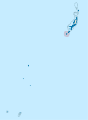
 Ngarchelong in Palau.svg 520 × 709; 133 KB
-
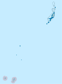
 Ngardmau in Palau.svg 520 × 709; 133 KB
-
 Ngaremlengui in Palau.svg 520 × 709; 133 KB
-
 Ngatpang in Palau.svg 520 × 709; 133 KB
-
 Ngchesar in Palau.svg 520 × 709; 133 KB
-
 Ngiwal in Palau.svg 520 × 709; 133 KB
-
 Peleliu in Palau.svg 520 × 709; 134 KB
-
 Puro Island (Palau).svg 1,344 × 995; 64 KB
-
 Sonsorol (île).svg 7,751 × 6,527; 57 KB
-
 Sonsorol in Palau.svg 520 × 709; 134 KB
-
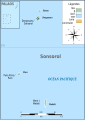
 Sonsorol State map.png 4,150 × 5,824; 554 KB
-
 Sonsorol State.svg 4,147 × 5,824; 155 KB


.svg)


.svg)
.svg)


