Category:SVG locator maps of municipalities in the Marshall Islands (location map scheme)
Jump to navigation
Jump to search

|
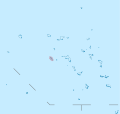
SVG maps in this category are part of a locator map series applying the (de) widespread location map scheme. Please see root category to browse for more. |
.svg)
.svg)
.svg)
.svg)
.svg)
.svg)
.svg)
Locator maps design recommendations ▼ | |
|---|---|
Principles
Design Guidelines are based on ▸location map design of the German map shop (in German). It's preferable to derive new locator maps from existing location maps. Please keep both size and ratio in this case. Thus the new locator maps may still be applied as location map (▸Guide). Marker color is supposed to be darkred. Waterbodies may be transparent, to show other objects better. Please be aware that this guide is only a recommendation. It’s not an inevitable law!
Highlight small areas
“Remote” areas and mini maps
Mini maps show where the depicted area actually is situated. Check out ▸Vorlage:Positionskarte+ (in German) and ▸Modèle:Carte en coin (in French) of how to insert a mini map in virtually every map.
Disputed areas
Greyed special objects
Backgrounds
|

-en.svg)

.svg)
.svg)
.svg)

_(US48).svg)
_(small_islands_magnified)_(-mini_map_-rivers).svg)
.svg)
_(extra_close)_(US48).svg)
.svg)
_(zoom).svg)

.svg)


_(UNMIK).svg)
.svg)
_(disputed_hatched).svg)
_(claimed_and_disputed_hatched).svg)
.svg)
.svg)
_(%2Ball_claims_hatched).svg)

.svg)
_(shade).svg)
_(shade)_(special_marker).svg)
_(-mini_map).svg)
_(-mini_map).svg)
_(-mini_map).svg)


.svg)

.svg)
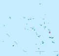
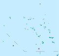
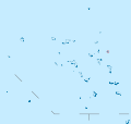
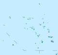
Media in category "SVG locator maps of municipalities in the Marshall Islands (location map scheme)"
The following 24 files are in this category, out of 24 total.
-
 Ailinglaplap Atoll in Marshall Islands.svg 780 × 738; 205 KB
-
 Ailuk Atoll in Marshall Islands.svg 780 × 738; 205 KB
-
 Arno Atoll in Marshall Islands.svg 780 × 738; 205 KB
-
 Aur Atoll in Marshall Islands.svg 780 × 738; 205 KB
-
 Ebon Atoll in Marshall Islands.svg 780 × 738; 205 KB
-
 Enewetak Atoll in Marshall Islands.svg 780 × 738; 205 KB
-
 Jabat Island in Marshall Islands.svg 780 × 738; 205 KB
-
 Jaluit Atoll in Marshall Islands.svg 780 × 738; 205 KB
-
 Kili Island in Marshall Islands.svg 780 × 738; 205 KB
-
 Kwajalein Atoll in Marshall Islands.svg 780 × 738; 204 KB
-
 Lae Atoll in Marshall Islands.svg 780 × 738; 205 KB
-
 Lib Island in Marshall Islands.svg 780 × 738; 205 KB
-
 Likiep Atoll in Marshall Islands.svg 780 × 738; 205 KB
-
 Majuro Atoll in Marshall Islands.svg 780 × 738; 205 KB
-
 Maloelap Atoll in Marshall Islands.svg 780 × 738; 205 KB
-
 Mejit Island in Marshall Islands.svg 780 × 738; 205 KB
-
 Mili Atoll in Marshall Islands.svg 780 × 738; 205 KB
-
 Namorik Atoll in Marshall Islands.svg 780 × 738; 205 KB
-
 Namu Atoll in Marshall Islands.svg 780 × 738; 205 KB
-
 Rongelap Atoll in Marshall Islands.svg 780 × 738; 205 KB
-
 Ujae Atoll in Marshall Islands.svg 780 × 738; 205 KB
-
 Utirik Atoll in Marshall Islands.svg 780 × 738; 205 KB
-
 Wotho Atoll in Marshall Islands.svg 780 × 738; 205 KB
-
 Wotje Atoll in Marshall Islands.svg 780 × 738; 205 KB


