Category:SVG locator maps of former districts in Northern Ireland (location map scheme)
Jump to navigation
Jump to search
Media in category "SVG locator maps of former districts in Northern Ireland (location map scheme)"
The following 27 files are in this category, out of 27 total.
-
 Antrim in Northern Ireland.svg 1,208 × 1,027; 295 KB
-
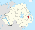
 Ards in Northern Ireland.svg 1,208 × 1,027; 295 KB
-
 Armagh in Northern Ireland.svg 1,208 × 1,027; 295 KB
-
 Ballymena in Northern Ireland.svg 1,208 × 1,027; 295 KB
-
 Ballymoney in Northern Ireland.svg 1,208 × 1,027; 295 KB
-
 Banbridge in Northern Ireland.svg 1,208 × 1,027; 295 KB
-
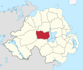
 Belfast in Northern Ireland.svg 1,208 × 1,027; 295 KB
-
 BLANK in Northern Ireland.svg 1,208 × 1,027; 295 KB
-
 Carrickfergus in Northern Ireland.svg 1,208 × 1,027; 295 KB
-
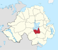
 Castlereagh in Northern Ireland.svg 1,208 × 1,027; 295 KB
-
 Coleraine in Northern Ireland.svg 1,208 × 1,027; 295 KB
-
 Cookstown in Northern Ireland.svg 1,208 × 1,027; 295 KB
-
 Craigavon in Northern Ireland.svg 1,208 × 1,027; 295 KB
-
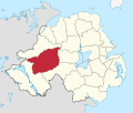
 Derry in Northern Ireland.svg 1,208 × 1,027; 295 KB
-
 Down in Northern Ireland.svg 1,208 × 1,027; 295 KB
-
 Dungannon and South Tyrone in Northern Ireland.svg 1,208 × 1,027; 295 KB
-
 Fermanagh in Northern Ireland.svg 1,208 × 1,027; 295 KB
-
 Larne in Northern Ireland.svg 1,208 × 1,027; 295 KB
-
 Limavady in Northern Ireland.svg 1,208 × 1,027; 295 KB
-
 Lisburn in Northern Ireland.svg 1,208 × 1,027; 295 KB
-
 Magherafelt in Northern Ireland.svg 1,208 × 1,027; 295 KB
-
 Moyle in Northern Ireland.svg 1,208 × 1,027; 295 KB
-
 Newry and Mourne in Northern Ireland.svg 1,208 × 1,027; 295 KB
-
 Newtownabbey in Northern Ireland.svg 1,208 × 1,027; 295 KB
-
 North Down in Northern Ireland.svg 1,208 × 1,027; 295 KB
-
 Omagh in Northern Ireland.svg 1,208 × 1,027; 295 KB
-
 Strabane in Northern Ireland.svg 1,208 × 1,027; 295 KB


