Category:SVG locator maps of districts of Warsaw (location map scheme)
Jump to navigation
Jump to search

|
SVG maps in this category are part of a locator map series applying the (de) widespread location map scheme. Please see root category to browse for more. |
.svg)
.svg)
.svg)
.svg)
.svg)
.svg)
.svg)
Locator maps design recommendations ▼ | |
|---|---|
Principles
Design Guidelines are based on ▸location map design of the German map shop (in German). It's preferable to derive new locator maps from existing location maps. Please keep both size and ratio in this case. Thus the new locator maps may still be applied as location map (▸Guide). Marker color is supposed to be darkred. Waterbodies may be transparent, to show other objects better. Please be aware that this guide is only a recommendation. It’s not an inevitable law!
Highlight small areas
“Remote” areas and mini maps
Mini maps show where the depicted area actually is situated. Check out ▸Vorlage:Positionskarte+ (in German) and ▸Modèle:Carte en coin (in French) of how to insert a mini map in virtually every map.
Disputed areas
Greyed special objects
Backgrounds
|

-en.svg)

.svg)
.svg)
.svg)

_(US48).svg)
_(small_islands_magnified)_(-mini_map_-rivers).svg)
.svg)
_(extra_close)_(US48).svg)
.svg)
_(zoom).svg)

.svg)


_(UNMIK).svg)
.svg)
_(disputed_hatched).svg)
_(claimed_and_disputed_hatched).svg)
.svg)
.svg)
_(%2Ball_claims_hatched).svg)

.svg)
_(shade).svg)
_(shade)_(special_marker).svg)
_(-mini_map).svg)
_(-mini_map).svg)
_(-mini_map).svg)


.svg)

.svg)
Media in category "SVG locator maps of districts of Warsaw (location map scheme)"
The following 17 files are in this category, out of 17 total.
-
 Bemowo in Warsaw.svg 512 × 377; 1.17 MB
-
 Bialoleka in Warsaw.svg 512 × 377; 1.17 MB
-
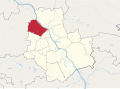 Bielany in Warsaw.svg 512 × 377; 1.17 MB
-
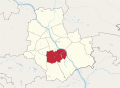 Mokotow in Warsaw.svg 512 × 377; 1.17 MB
-
 Ochota in Warsaw.svg 512 × 377; 1.17 MB
-
 Praga Polnoc in Warsaw.svg 512 × 377; 1.17 MB
-
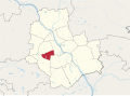
 Praga Poludnie in Warsaw.svg 512 × 377; 1.17 MB
-
 Rembertow in Warsaw.svg 512 × 377; 1.17 MB
-
 Targowek in Warsaw.svg 512 × 377; 1.17 MB
-
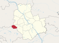 Ursus in Warsaw.svg 512 × 377; 1.17 MB
-
 Ursynow in Warsaw.svg 512 × 377; 1.17 MB
-
 Warszawa-Srodmiescie in Warsaw.svg 512 × 377; 1.17 MB
-
 Wawer in Warsaw.svg 512 × 377; 1.17 MB
-
 Wesola in Warsaw.svg 512 × 377; 1.17 MB
-
 Wilanow in Warsaw.svg 512 × 377; 1.17 MB
-
 Wlochy in Warsaw.svg 512 × 377; 1.17 MB
-
 Wola in Warsaw.svg 512 × 377; 1.17 MB


