Category:SVG locator maps of countries of Oceania (gray and green globe scheme)
Jump to navigation
Jump to search
Temperate regions: North America · South America · Africa · Europe · Asia · Oceania – Polar regions: – Other regions:

Countries of Oceania: Australia · Fiji · the Federated States of Micronesia ≈ Federated States of Micronesia · Kiribati · the Marshall Islands ≈ Marshall Islands · Nauru · New Zealand · Palau · Papua New Guinea · Samoa · the Solomon Islands ≈ Solomon Islands · Tonga · Tuvalu · Vanuatu
Other areas: American Samoa · Clipperton Island · the Cocos (Keeling) Islands ≈ Cocos (Keeling) Islands · the Cook Islands ≈ Cook Islands · French Polynesia · Guam · Hawaii · New Caledonia · Niue · Norfolk Island · the Northern Mariana Islands ≈ Northern Mariana Islands · the Pitcairn Islands ≈ Pitcairn Islands · Tokelau · Wallis and Futuna – Partly: the British Overseas Territories ≈ British Overseas Territories · Overseas France · Indonesia · the French Southern and Antarctic Lands ≈ French Southern and Antarctic Lands · the United States Minor Outlying Islands ≈ United States Minor Outlying Islands
Other areas: American Samoa · Clipperton Island · the Cocos (Keeling) Islands ≈ Cocos (Keeling) Islands · the Cook Islands ≈ Cook Islands · French Polynesia · Guam · Hawaii · New Caledonia · Niue · Norfolk Island · the Northern Mariana Islands ≈ Northern Mariana Islands · the Pitcairn Islands ≈ Pitcairn Islands · Tokelau · Wallis and Futuna – Partly: the British Overseas Territories ≈ British Overseas Territories · Overseas France · Indonesia · the French Southern and Antarctic Lands ≈ French Southern and Antarctic Lands · the United States Minor Outlying Islands ≈ United States Minor Outlying Islands
Media in category "SVG locator maps of countries of Oceania (gray and green globe scheme)"
The following 16 files are in this category, out of 16 total.
-
 AUS orthographic.svg 550 × 550; 761 KB
-
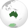
 Australia (orthographic projection).svg 541 × 541; 286 KB
-
 Australia map with outlying islands.svg 541 × 541; 285 KB
-
 Australia with AAT (orthographic projection).svg 791 × 790; 48 KB
-
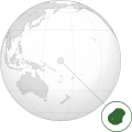
 Fiji (orthographic projection).svg 550 × 550; 318 KB
-
 French Polynesia (orthographic projection).svg 550 × 550; 744 KB
-
 New Zealand (orthographic projection) 2.svg 550 × 550; 292 KB
-
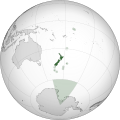
 New Zealand (orthographic projection).svg 541 × 541; 276 KB
-
 NRU orthographic.svg 600 × 600; 781 KB
-
 NZL orthographic NaturalEarth.svg 512 × 512; 574 KB
-
 NZL orthographic.svg 550 × 550; 598 KB
-
 Oceania (centered orthographic projection).svg 600 × 600; 1.18 MB
-
 Oceania (orthographic projection).svg 541 × 541; 63 KB
-
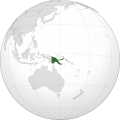
 Papua New Guinea (orthographic projection).svg 541 × 541; 260 KB
-
 PNG orthographic.svg 550 × 550; 756 KB
-
 Австралия на карте южного полушария.png 1,024 × 1,024; 207 KB

.svg)

.svg)
.svg)
.svg)
_2.svg)
.svg)


.svg)
.svg)
.svg)


Categories:
- SVG locator maps of countries (gray and green globe scheme)
- SVG locator maps of countries of Oceania (gray and green scheme)
- SVG locator maps of countries of Oceania (gray globe scheme)
- SVG locator maps of Oceania (gray and green globe scheme)
- Locator maps of countries of Oceania (gray and green globe scheme)