Category:SVG locator maps of Metro Vancouver (location map scheme)
Jump to navigation
Jump to search

|
SVG maps in this category are part of a locator map series applying the (de) widespread location map scheme. Please see root category to browse for more. |
.svg)
.svg)
.svg)
.svg)
.svg)
.svg)
.svg)
Locator maps design recommendations ▼ | |
|---|---|
Principles
Design Guidelines are based on ▸location map design of the German map shop (in German). It's preferable to derive new locator maps from existing location maps. Please keep both size and ratio in this case. Thus the new locator maps may still be applied as location map (▸Guide). Marker color is supposed to be darkred. Waterbodies may be transparent, to show other objects better. Please be aware that this guide is only a recommendation. It’s not an inevitable law!
Highlight small areas
“Remote” areas and mini maps
Mini maps show where the depicted area actually is situated. Check out ▸Vorlage:Positionskarte+ (in German) and ▸Modèle:Carte en coin (in French) of how to insert a mini map in virtually every map.
Disputed areas
Greyed special objects
Backgrounds
|

-en.svg)

.svg)
.svg)
.svg)

_(US48).svg)
_(small_islands_magnified)_(-mini_map_-rivers).svg)
.svg)
_(extra_close)_(US48).svg)
.svg)
_(zoom).svg)

.svg)


_(UNMIK).svg)
.svg)
_(disputed_hatched).svg)
_(claimed_and_disputed_hatched).svg)
.svg)
.svg)
_(%2Ball_claims_hatched).svg)

.svg)
_(shade).svg)
_(shade)_(special_marker).svg)
_(-mini_map).svg)
_(-mini_map).svg)
_(-mini_map).svg)


.svg)

.svg)
Media in category "SVG locator maps of Metro Vancouver (location map scheme)"
The following 25 files are in this category, out of 25 total.
-
 Anmore in Metro Vancouver.svg 907 × 737; 822 KB
-
 Belcarra in Metro Vancouver.svg 907 × 737; 822 KB
-
 BLANK in Metro Vancouver.svg 907 × 737; 822 KB
-
 Bowen Island in Metro Vancouver.svg 907 × 737; 822 KB
-
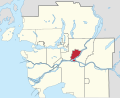
 Burnaby in Metro Vancouver.svg 907 × 737; 827 KB
-
 City of Langley in Metro Vancouver.svg 907 × 737; 822 KB
-
 City of North Vancouver in Metro Vancouver.svg 907 × 737; 827 KB
-
 Coquitlam in Metro Vancouver.svg 907 × 737; 822 KB
-
 Delta in Metro Vancouver.svg 907 × 737; 822 KB
-
 District of North Vancouver in Metro Vancouver.svg 907 × 737; 827 KB
-
 Electoral Area A in Metro Vancouver.svg 907 × 737; 827 KB
-
 Lions Bay in Metro Vancouver.svg 907 × 737; 827 KB
-
 Maple Ridge in Metro Vancouver.svg 907 × 737; 822 KB
-
 New Westminster in Metro Vancouver.svg 907 × 737; 827 KB
-
 Pitt Meadows in Metro Vancouver.svg 907 × 737; 822 KB
-
 Port Coquitlam in Metro Vancouver.svg 907 × 737; 822 KB
-
 Port Moody in Metro Vancouver.svg 907 × 737; 822 KB
-
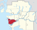 Richmond in Metro Vancouver.svg 907 × 737; 827 KB
-
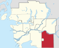
 Surrey in Metro Vancouver.svg 907 × 737; 822 KB
-
 Township of Langley in Metro Vancouver.svg 907 × 737; 822 KB
-
 Tsawwassen in Metro Vancouver.svg 907 × 737; 827 KB
-
 UEL in Metro Vancouver.svg 907 × 737; 830 KB
-
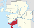
 Vancouver in Metro Vancouver.svg 907 × 737; 827 KB
-
 West Vancouver in Metro Vancouver.svg 907 × 737; 827 KB
-
 White Rock in Metro Vancouver.svg 907 × 737; 822 KB


