Category:SVG election maps of Colombia
Jump to navigation
Jump to search
Subcategories
This category has only the following subcategory.
Media in category "SVG election maps of Colombia"
The following 19 files are in this category, out of 19 total.
-
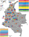 2014 Colombian parliamentary election - Results.svg 652 × 820; 1.18 MB
-
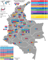 2018 Colombian parliamentary election - Results.svg 652 × 820; 1.17 MB
-
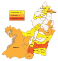 Alerta electoral Valle del Cauca 2012.svg 480 × 500; 185 KB
-
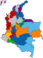
 Colombian Gubernatorial Election Results 2007.svg 1,441 × 1,921; 193 KB
-
 Colombian Gubernatorial Election Results 2011.svg 1,441 × 1,921; 193 KB
-
 Colombian Gubernatorial Election Results 2015.svg 1,677 × 2,276; 281 KB
-
 Colombian Gubernatorial Election Results 2019.svg 512 × 695; 178 KB
-
 Colombian House of Representatives 2014 Map.svg 1,650 × 1,950; 469 KB
-
 Elecciones 2007 Amazonas-alcaldía.svg 1,572 × 1,366; 90 KB
-
 Elecciones 2007 Amazonas-concejo.svg 1,572 × 1,366; 87 KB
-
 Elecciones 2007 Atlántico-alcaldía.svg 458 × 675; 64 KB
-
 Elecciones 2007 Atlántico-concejo.svg 458 × 675; 67 KB
-
 Elecciones 2007 Colombia-asamblea.svg 1,301 × 1,708; 267 KB
-
 Elecciones 2007 Colombia-gobernación.svg 1,301 × 1,708; 266 KB
-
 Mapa de Colombia (resultados plebiscito acuerdo de paz 2016 por departamentos).svg 1,420 × 1,896; 314 KB
-
 Mapa de Colombia (resultados plebiscito acuerdo de paz 2016 por municipios).svg 3,731 × 5,050; 4.66 MB
-
 Mapa de Colombia (resultados plebiscito acuerdo de paz 2016 total).svg 1,420 × 2,711; 593 KB
-
 PlebiscitoPazColombia2016.svg 1,420 × 1,896; 376 KB
-
 Resultados Elecciones Valle del Cauca 2012.svg 480 × 500; 176 KB


.svg)
.svg)
.svg)

