Category:SRTM-Chile
| choose map | Instructions |
|---|---|
 |
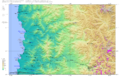
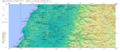
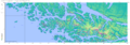
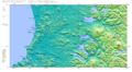
Castellano[edit]Los mapas a que puedes acceder con un click sobre el siguiente imagemap fueron generados con Generic Maping Tools (http://gmt.soest.hawaii.edu/) y utilizan los registros topográficos de la Shuttle Radar Topography Mission (SRTM) (ftp://e0srp01u.ecs.nasa.gov/srtm/version2/SRTM3/) que registran los cambios cada 3 segundos de grado, es decir cada 90 metros. La toponimia fue obtenida de http://earth-info.nga.mil/gns/html/cntry_files.html y no es muy exacta. Clica sobre la imagen para abrir una imagen más detallada de cada zona. Deutsch[edit]Die folgenden Landkarten sind mit Generic Maping Tools (http://gmt.soest.hawaii.edu/) erstellt worden und sie verwenden die topographischen Daten aus Shuttle Radar Topography Mission (SRTM) (ftp://e0srp01u.ecs.nasa.gov/srtm/version2/SRTM3/) die die Höhen jede 3 Sekunden gemessen haben, d.h. jede 90 m. Die Ortsnamen wurden aus http://earth-info.nga.mil/gns/html/cntry_files.html geholt und sie sind nicht sehr exakt. Du kannst auf die gewünschte Region auf der Chile-Karte oder direkt auf die erstellte Karte clicken. English[edit]Topographic Maps generated with Generic Maping Tools (http://gmt.soest.hawaii.edu/) and the topographic data from Shuttle Radar Topography Mission (SRTM) (ftp://e0srp01u.ecs.nasa.gov/srtm/version2/SRTM3/) (90 m resolution). The toponymy is from http://earth-info.nga.mil/gns/html/cntry_files.html, but it is not exact. עברית[edit]את המפות ניתן לגשת באמצעות לחץ על המפה שמאלה היו שנוצר עם Generic MapingTools(http://gmt.soest.hawaii.edu/) ולהשתמש רשומות של theShuttle טופוגרפיות רדאר טופוגרפיהמיסיון (SRTM) (ftp://e0srp01u.ecs.nasa.gov/srtm/version2/SRTM3/) כי שינויים שיא כל תואר של 3 שניות, כלומר כל 90 מטרים. שמות מקום נתקבלו http://earth-info.nga.mil/gns/html/cntry_files.html ולא מאוד מדויק. לחץ על התמונה כדי לפתוח תמונה מפורטת יותר של כל אזור. |
Media in category "SRTM-Chile"
The following 41 files are in this category, out of 41 total.
-
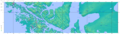
 Península de Comau.png 838 × 559; 444 KB
-
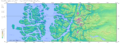
 Region-del-biobío.png 1,699 × 1,518; 4.22 MB
-
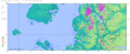
 SRTM-S24.00N23.00W070.80E067.00.Antofagasta.png 2,482 × 791; 3.47 MB
-
 SRTM-W70.33E67.34S22.00N21.00.Quillagua.png 2,482 × 954; 3.87 MB
-
 SRTM-W70.33E68.34S21.00N19.00.Iquique.png 1,915 × 1,952; 5.82 MB
-
 SRTM-W70.50E67.00S23.00N22.00.Calama.png 2,482 × 841; 3.72 MB
-
 SRTM-W70.50E68.34S20.00N19.00.Pisagua.png 1,915 × 974; 2.76 MB
-
 SRTM-W70.50E68.80S19.00N17.40.Arica.png 1,915 × 1,819; 6.07 MB
-
 SRTM-W70.66E67.00S25.00N24.00.Paranal.png 2,482 × 821; 3.63 MB
-
 SRTM-W71.00E68.10S27.00N26.00.Salvador.png 1,915 × 796; 2.43 MB
-
 SRTM-W71.00E68.30S26.00N25.00.Taltal.png 1,915 × 838; 2.66 MB
-
 SRTM-W71.30E68.00S28.00N27.00.Copiapo.png 2,482 × 915; 4.04 MB
-
 SRTM-W71.60E69.20S29.00N28.00.Vallenar.png 1,915 × 946; 3.18 MB
-
 SRTM-W71.70E69.70S30.00N29.00.LaSerena.png 1,915 × 1,116; 3.46 MB
-
 SRTM-W71.70E69.90S33.00N32.00.Quillota.png 1,915 × 1,259; 3.21 MB
-
 SRTM-W71.70E71.20S32.00N31.00.Illapel.png 1,348 × 998; 2.29 MB
-
 SRTM-W71.90E69.70S31.00N30.00.Ovalle.png 1,915 × 1,037; 3.08 MB
-
 SRTM-W72.00E66.00S56.00N54.70.CanalBeagle.png 3,616 × 1,438; 2.67 MB
-
 SRTM-W72.00E69.70S34.00N33.00.Talagante.png 1,915 × 1,027; 2.6 MB
-
 SRTM-W72.30E69.70S35.00N34.00.Chimbarongo.png 2,482 × 1,198; 4.09 MB
-
 SRTM-W73.00E70.00S36.00N35.00.Talca.png 1,915 × 837; 2.3 MB
-
 SRTM-W73.30E70.33S37.00N36.00.Chillan.png 2,482 × 1,090; 4.35 MB
-
 SRTM-W73.50E68.33S55.00N54.00.IslaNoir.png 3,616 × 1,275; 3.86 MB
-
 SRTM-W73.75E71.33S40.00N39.00.Valdivia.png 1,915 × 1,051; 3.08 MB
-
 SRTM-W74.00E70.70S39.00N38.00.Temuco.png 2,482 × 1,018; 4.35 MB
-
 SRTM-W74.00E71.00S38.00N37.00.Nacimiento.png 1,915 × 856; 2.62 MB
-
 SRTM-W74.00E71.50S41.00N40.00.Osorno.png 1,915 × 1,035; 2.76 MB
-
 SRTM-W74.20E71.70S42.00N41.00.PuertoMontt.png 2,482 × 1,351; 3.49 MB
-
 SRTM-W74.30E71.70S43.00N42.00.Chiloe.png 2,482 × 1,323; 3.07 MB
-
 SRTM-W74.50E68.33S54.00N53.00.PuntaArenas.png 4,183 × 1,223; 4.92 MB
-
 SRTM-W75.00E71.00S45.00N44.00.Puyuguapi.png 2,482 × 936; 2.63 MB
-
 SRTM-W75.00E71.50S44.00N43.00.Melinka.png 2,482 × 1,034; 2.11 MB
-
 SRTM-W75.10E68.33S53.00N52.00.PuntaDelgada.png 4,749 × 1,242; 5.7 MB
-
 SRTM-W75.10E71.25S46.00N45.00.Coihaique.png 3,049 × 1,191; 4.63 MB
-
 SRTM-W75.40E71.80S52.00N51.00.PuertoNatales.png 3,049 × 1,406; 4.06 MB
-
 SRTM-W75.50E71.70S48.00N47.00.Cochrane.png 3,049 × 1,245; 3.78 MB
-
 SRTM-W75.66E72.00S51.00N50.00.IslaMadredeDios.png 2,482 × 1,115; 2.94 MB
-
 SRTM-W75.80E71.50S47.00N46.00.Chilechico.png 3,049 × 1,099; 3.69 MB
-
 SRTM-W75.90E72.00S49.00N48.00.VillaOHiggins.png 2,482 × 1,019; 2.83 MB
-
 SRTM-W75.90E72.00S50.00N49.00.PuertoEden.png 2,758 × 1,152; 3.09 MB
-


_and_Digital_Terrain_Models_(DTM)_when_talking_about_Digital_Elevation_models_(DEM).svg)