Category:Südwestkirchhof Stahnsdorf
Jump to navigation
Jump to search
German cemetery in Stahnsdorf, a city outside of Berlin  | |||||
| Upload media | |||||
| Instance of | |||||
|---|---|---|---|---|---|
| Location | Stahnsdorf, Potsdam-Mittelmark District, Brandenburg, Germany | ||||
| Heritage designation | |||||
| Inception |
| ||||
 | |||||
Subcategories
This category has the following 20 subcategories, out of 20 total.
B
C
D
- Grave of Hugo Distler (3 F)
G
- Grabmal Solmssen (2 F)
- Grabmal Wissinger (6 F)
H
- Grave of Dieter Thomas Heck (2 F)
K
- Grave of Alexander von Kluck (3 F)
- Grave of Emil Krebs (4 F)
- Grave of Wilhelm Kuhnert (3 F)
- Grave of Julius Kühns (2 F)
M
- Grave of Karl Ludwig Manzel (3 F)
S
- Siemens family grave (10 F)
W
- Grave of Friedrich Weißler (2 F)
Z
- Grave of Heinrich Zille (7 F)
Pages in category "Südwestkirchhof Stahnsdorf"
This category contains only the following page.
Media in category "Südwestkirchhof Stahnsdorf"
The following 200 files are in this category, out of 207 total.
(previous page) (next page)-
 2018-08-08 Familiengrab Ripperger.jpg 3,105 × 1,745; 1.66 MB
-
 Grab Julius Arnold Stahnsdorf.jpg 2,056 × 3,088; 3.42 MB
-
 Südwestkirchhof stahnsdorf jan2017 satz1 - 5.jpg 2,336 × 4,160; 2.82 MB
-
 Südwestkirchhof stahnsdorf jan2017 satz1 - 2.jpg 2,336 × 4,160; 3.82 MB
-
 Südwestkirchhof stansdorf jan2017 satz2 - 22.jpeg 4,160 × 2,336; 3.47 MB
-
 Berlin-grab-schaarwaechter01.jpg 2,448 × 3,264; 4 MB
-
 Suedwestkirchhof Grab Eichler-Bischoff Kroner-Figur.jpg 669 × 665; 347 KB
-
 Südwestkirchhof stahnsdorf jan2017 satz1 - 6.jpg 4,160 × 2,336; 3.72 MB
-
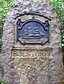 Stahnsdorf, Grabmal Bolstorff.jpg 1,848 × 2,446; 4.19 MB
-
 Christusdenkmal 1.jpg 8,256 × 6,192; 62.33 MB
-
 Christusdenkmal 2.jpg 5,914 × 3,327; 25.32 MB
-
 Südwestkirchhof stahnsdorf jan2017 satz1 - 22.jpg 2,336 × 4,160; 3.83 MB
-
 Südwestkirchhof stansdorf jan2017 satz2 - 4.jpg 4,160 × 2,336; 4.04 MB
-
 Grab von Friedrich Dolezalek und Alexander Dolezalek auf dem Südwestkirchhof Stahnsdorf.jpg 4,491 × 3,368; 2.83 MB
-
 Faber Klaus Grab Stahnsdorf IMG 0242a.jpg 410 × 567; 386 KB
-
 Grab Klaus Faber.jpg 1,944 × 2,592; 1.58 MB
-
 Familiengrab Max Besckow - Mutter Erde fec.jpg 1,092 × 950; 146 KB
-
 Frank Rudolf 1a.jpg 1,536 × 1,375; 686 KB
-
 Friedländer2.jpg 1,111 × 1,370; 1.21 MB
-
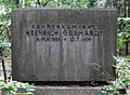 Gebhardt Heinrich 1.jpg 1,024 × 752; 232 KB
-
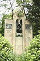
 Gedenktafel Großgörschenstr 12 (Schöb) Mausoleum Langenscheidt.JPG 1,734 × 2,275; 6.46 MB
-
 Ernst Gennat Grab.jpg 640 × 480; 157 KB
-
 Südwestkirchhof stahnsdorf jan2017 satz1 - 16.jpg 4,160 × 2,336; 4.29 MB
-
 Südwestkirchhof stansdorf jan2017 satz2 - 21.jpg 4,160 × 2,336; 4.05 MB
-
 Joachim und Meta Gottschalk Grab.JPG 1,920 × 2,560; 1,018 KB
-
 Südwestkirchhof stahnsdorf jan2017 satz1 - 1.jpg 2,336 × 4,160; 4.37 MB
-
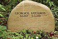 Grab Georgios Fatouros Stahnsdorf IMG 0221a.jpg 567 × 377; 307 KB
-
 Grab Hellmut Lange Stahnsdorf 20190413 170954b.jpg 727 × 567; 481 KB
-
 Grab Julius Becher Südwestkirchhof Stahnsdorf.JPG 2,056 × 3,088; 3.25 MB
-
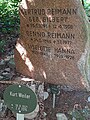 Grab Kurt Weiler Stahnsdorf.jpg 3,456 × 4,608; 3.86 MB
-
 Grab Ralf Zeitler Südwestlirchhof.jpg 709 × 465; 375 KB
-
 Grab Theodor Wedepohl 20181127 093553.jpg 1,944 × 2,592; 1.64 MB
-
 Grab von Friedrich Wilhelm Murnau.jpg 3,600 × 2,700; 6.61 MB
-
 Grab Waldemar Schupp Südwestkirchhof Stahnsdorf 2021-11-16.jpg 1,944 × 2,592; 1.2 MB
-
 Grab Willi König Stahnsdorf.jpg 2,056 × 3,088; 3.01 MB
-
 Grab.Elisabeth.von.Plotho.jpg 4,000 × 3,000; 1.73 MB
-
 Grabskulptur2.jpg 1,200 × 1,600; 591 KB
-
 Grabstein Eberhard Borkmann.jpg 1,770 × 1,304; 2.13 MB
-
 Grabstein Evelyn Gressmann.jpg 1,770 × 1,210; 1.89 MB
-
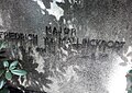 Grabstein Friedrich von Mallinckrodt Stahnsdorf.jpg 1,180 × 834; 870 KB
-
 Grabstein Gerd Gericke Stahnsdorf.jpg 3,088 × 2,056; 2.98 MB
-
 Grabstein Jürgen Kluckert.jpg 1,770 × 1,178; 1.78 MB
-
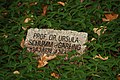 Grabstein Ursula Schumm-Garling Stahnsdorf.jpg 3,088 × 2,056; 2.54 MB
-
 Grabstein Wolfram Kleiss.jpg 925 × 1,416; 1.24 MB
-
 Grabstätte Alfred Struwe.jpg 1,536 × 2,048; 1.15 MB
-
 Grabstätte Clemens Scharschmidt.jpg 1,536 × 2,048; 1,020 KB
-
 Grabstätte Eckart Hildebrandt.jpg 1,536 × 2,048; 1.02 MB
-
 Grabstätte Franz Eulenburg.jpg 1,536 × 2,048; 1.13 MB
-
 Grabstätte Fritz Strassmann.jpg 1,536 × 2,048; 1.11 MB
-
 Grabstätte Peter Springer.jpg 1,536 × 2,048; 1.14 MB
-
 Grabstätte Rudolf Walter.jpg 2,448 × 3,264; 5.99 MB
-
 Grabtafel Harald Zielske Südwestkirchhof Stahnsdorf.jpg 492 × 340; 193 KB
-
 Grafe,Gustav-Mutter Erde fec.jpg 885 × 1,245; 229 KB
-
 Grave of Elfriede Heisler.jpg 315 × 472; 180 KB
-
 Walter Gropius Grab Stahnsdorf.jpg 6,000 × 4,000; 17.92 MB
-
 Gumpert Thomas Grab Stahnsdorf IMG 0268a.jpg 433 × 567; 353 KB
-
 Günter Ssymmank Gravestone.jpg 3,088 × 2,056; 1.57 MB
-
 Stahnsdorf, Grabmal Haller.jpg 1,920 × 2,560; 3.79 MB
-
 Harries CD 1.jpg 768 × 1,024; 167 KB
-
 Südwestkirchhof stahnsdorf jan2017 satz1 - 7.jpg 2,336 × 4,160; 4.52 MB
-
 Walter Hauschild Grabstätte.jpg 709 × 666; 549 KB
-
 Walter Hauschild Grabtafel.jpg 567 × 377; 203 KB
-
 Hermann Schröder Grab Stahnsdorf.jpg 4,000 × 6,000; 19.65 MB
-
 Hinkelstein.Suedwestkirchhof.Stahnsdorf.jpg 1,939 × 3,570; 832 KB
-
 Hydrophor-Mutter Erde fec.jpg 1,119 × 927; 246 KB
-
 Ingrid Steeger Grabstein Januar 2024 IMG 5954.jpg 1,074 × 709; 841 KB
-
 Italienischer Soldatenfriedhof Südwestkirchhof Stahnsdorf.jpg 6,000 × 4,000; 12.8 MB
-
 Siegfried Jacobsohn-Mutter Erde fec.jpg 983 × 950; 308 KB
-
 Jagor AF 1.jpg 768 × 1,024; 201 KB
-
 Südwestkirchhof stansdorf jan2017 satz2 - 17.jpg 4,160 × 2,336; 4.9 MB
-
 Jopke Georg Grab Stahnsdorf IMG 0224a.jpg 370 × 567; 308 KB
-
 Friedhof Stahnsdorf Max Jordan Jan. 2017.jpg 3,120 × 4,160; 3.33 MB
-
 Südwestkirchhof stahnsdorf jan2017 satz1 - 21.jpg 2,336 × 4,160; 3.85 MB
-
 Südwestkirchhof stahnsdorf jan2017 satz1 - 12.jpg 2,336 × 4,160; 3.79 MB
-
 Justice Anna Grab Stahnsdorf IMG 0280a.jpg 567 × 471; 354 KB
-
 Karl Strecker Grabstein.jpg 2,056 × 3,088; 3.04 MB
-
 Kirchhof stahnsdorf nebelarbeiten ohne adresse.jpg 2,391 × 1,590; 2.42 MB
-
 Kolbe Paul Grab Stahnsdorf IMG 0254a.jpg 438 × 567; 352 KB
-
 Friedrich von Koenen, Stahnsdorf - Mutter Erde fec.JPG 1,536 × 2,048; 2.73 MB
-
 Manfred Krug, Stahnsdorf - Mutter Erde fec.JPG 2,048 × 1,536; 2.78 MB
-
 Kühn1-Mutter Erde fec.jpg 1,363 × 1,520; 374 KB
-
 Kühn2-Mutter Erde fec.jpg 1,160 × 1,176; 203 KB
-
 Kühn3-Mutter Erde fec.jpg 1,104 × 1,199; 194 KB
-
 Südwestkirchhof stahnsdorf jan2017 satz3 - 33.jpg 2,336 × 4,160; 4.23 MB
-
 Suedwestkirchhof19.jpg 1,280 × 960; 588 KB
-
 Suedwestkirchhof20.jpg 1,280 × 960; 581 KB
-
 Südwestkirchhof stahnsdorf jan2017 satz1 - 13.jpg 2,336 × 4,160; 4.44 MB
-
 Maja Maranow gravestone.jpg 1,640 × 2,045; 1.2 MB
-
 Maja Maranow, Stahnsdorf - Mutter Erde fec.JPG 2,048 × 1,536; 2.69 MB
-
 Südwestkirchhof stahnsdorf jan2017 satz3 - 11.jpg 4,160 × 2,336; 3.75 MB
-
 Südwestkirchhof stansdorf jan2017 satz2 - 2.jpg 4,160 × 2,336; 3.07 MB
-
 Michael Moritz Eulenburg Stahnsdorf.png 1,891 × 1,418; 4.79 MB
-
 Naumann Max Grabstein.jpg 470 × 850; 430 KB
-
 Wilhelm Neef Grab 20161015.jpg 1,944 × 2,592; 2.28 MB
-
 Ocasek Karl-Heinz Grab Stahnsdorf IMG 0302a.jpg 427 × 567; 332 KB
-
 Oppeln-Bronikowski (1a).jpg 768 × 858; 250 KB
-
 Otto Laubinger Portrait Gravestone.jpg 2,077 × 1,876; 1.5 MB
-
 Südwestkirchhof stansdorf jan2017 satz2 - 15.jpg 4,160 × 2,336; 3.64 MB
-
 Südwestkirchhof stansdorf jan2017 satz2 - 8.jpg 4,160 × 2,336; 3.98 MB
-
 Peters Max Grab Stahnsdorf IMG 0246a.jpg 358 × 567; 312 KB
-
 Grabstein.Elisabeth.von.Plotho.jpg 4,000 × 3,000; 1.68 MB
-
 Poensgen-August Kraus-Mutter Erde fec.jpg 750 × 1,228; 235 KB
-
 Raps August 1.jpg 1,058 × 1,901; 720 KB
-
 Südwestkirchhof stahnsdorf jan2017 satz3 - 36.jpg 4,160 × 2,336; 3.86 MB
-
 Suedwestkirchhof21.jpg 960 × 1,280; 584 KB
-
 Suedwestkirchhof04.jpg 1,280 × 960; 603 KB
-
 Suedwestkirchhof09.jpg 960 × 1,280; 596 KB
-
 Schneider2.jpg 1,224 × 1,136; 542 KB
-
 Schumann Horst Grab Stahnsdorf IMG 0261a.jpg 377 × 567; 328 KB
-
 Skibicki Max Grabstein.jpg 457 × 709; 345 KB
-
 Südwestkirchhof stansdorf jan2017 satz2 - 19.jpeg 2,336 × 4,160; 3.93 MB
-
 August Sponholz, Stahnsdorf - Mutter Erde fec.JPG 1,536 × 2,048; 2.75 MB
-
 Stahnsdorf Grab Eichler Figur Kroner.jpg 620 × 606; 198 KB
-
 Stahnsdorf Suedwestkirchhof asv2018-05.jpg 5,359 × 3,573; 9.66 MB
-
 Stahnsdorf Südwestfriedhof Grabstätte Wissinger.jpg 3,872 × 2,592; 1.69 MB
-
 Stahnsdorf, Brunnen, 2.jpg 2,560 × 1,920; 2.52 MB
-
 Stahnsdorf, Brunnen.jpg 2,560 × 1,920; 4.31 MB
-
 Stahnsdorf, Christusdenkmal, Ludwig Manzel.jpg 2,459 × 1,920; 3.72 MB
-
 Stahnsdorf, Grabfiguren.jpg 2,560 × 1,920; 3.51 MB
-
 Stahnsdorf, Grabmal Klinge.jpg 1,850 × 2,529; 3.71 MB
-
 Stechbarth Horst Grab Stahnsdorf IMG 0239a.jpg 567 × 377; 302 KB
-
 Steig Reinhold (2a).jpg 552 × 1,024; 175 KB
-
 Stenger Paul 1.jpg 768 × 1,000; 221 KB
-
 Grab Max Stickel Stahnsdorf.JPG 2,056 × 3,088; 3.4 MB
-
 Suedwestkirchhof01.jpg 1,280 × 960; 593 KB
-
 Suedwestkirchhof02.jpg 1,280 × 960; 596 KB
-
 Suedwestkirchhof03.jpg 1,280 × 960; 598 KB
-
 Suedwestkirchhof05.jpg 1,280 × 960; 585 KB
-
 Suedwestkirchhof07.jpg 1,280 × 960; 599 KB
-
 Suedwestkirchhof10.jpg 1,280 × 960; 602 KB
-
 Suedwestkirchhof11.jpg 1,280 × 960; 584 KB
-
 Suedwestkirchhof13.jpg 1,280 × 960; 595 KB
-
 Suedwestkirchhof14.jpg 960 × 1,280; 595 KB
-
 Suedwestkirchhof16.jpg 1,280 × 960; 600 KB
-
 Suedwestkirchhof18.jpg 1,280 × 960; 589 KB
-
 Südwestkirchhof Stahnsdorf Anlage der Opfer für Krieg und Gewaltherrschaft 01.JPG 2,592 × 1,944; 3.64 MB
-
 Südwestkirchhof Stahnsdorf Anlage der Opfer für Krieg und Gewaltherrschaft 02.JPG 2,592 × 1,944; 3.55 MB
-
 Südwestkirchhof Stahnsdorf Brunnen 01.JPG 2,592 × 1,944; 3.76 MB
-
 Südwestkirchhof Stahnsdorf Brunnen 02.JPG 2,592 × 1,944; 4.03 MB
-
 Südwestkirchhof Stahnsdorf Christusdenkmal Ludwig Manzel.JPG 2,592 × 1,944; 3.66 MB
-
 Südwestkirchhof Stahnsdorf Grabmal Alte Umbettung.JPG 2,592 × 1,944; 3.1 MB
-
 Südwestkirchhof Stahnsdorf Grabmal Langenscheidt.jpg 4,057 × 3,120; 4.67 MB
-
 Südwestkirchhof stahnsdorf jan2017 satz1 - 10.jpg 4,160 × 2,336; 4.28 MB
-
 Südwestkirchhof stahnsdorf jan2017 satz1 - 11.jpg 2,336 × 4,160; 4.1 MB
-
 Südwestkirchhof stahnsdorf jan2017 satz1 - 14.jpg 2,336 × 4,160; 4.39 MB
-
 Südwestkirchhof stahnsdorf jan2017 satz1 - 15.jpg 2,336 × 4,160; 4.71 MB
-
 Südwestkirchhof stahnsdorf jan2017 satz1 - 18.jpg 4,160 × 2,336; 4.34 MB
-
 Südwestkirchhof stahnsdorf jan2017 satz1 - 19.jpg 4,160 × 2,336; 2.84 MB
-
 Südwestkirchhof stahnsdorf jan2017 satz1 - 23.jpg 2,336 × 4,160; 4.08 MB
-
 Südwestkirchhof stahnsdorf jan2017 satz1 - 24.jpg 2,336 × 4,160; 4.35 MB
-
 Südwestkirchhof stahnsdorf jan2017 satz1 - 25.jpg 2,336 × 4,160; 4.04 MB
-
 Südwestkirchhof stahnsdorf jan2017 satz1 - 26.jpg 2,336 × 4,160; 2.84 MB
-
 Südwestkirchhof stahnsdorf jan2017 satz1 - 27.jpg 2,336 × 4,160; 2.37 MB
-
 Südwestkirchhof stahnsdorf jan2017 satz1 - 28.jpg 2,336 × 4,160; 2.98 MB
-
 Südwestkirchhof stahnsdorf jan2017 satz1 - 29.jpg 4,160 × 2,336; 3.74 MB
-
 Südwestkirchhof stahnsdorf jan2017 satz1 - 3.jpg 4,160 × 2,336; 4.63 MB
-
 Südwestkirchhof stahnsdorf jan2017 satz1 - 30.jpg 2,336 × 4,160; 3.9 MB
-
 Südwestkirchhof stahnsdorf jan2017 satz1 - 4.jpg 4,160 × 2,336; 3.99 MB
-
 Südwestkirchhof stahnsdorf jan2017 satz1 - 8.jpg 4,160 × 2,336; 3.82 MB
-
 Südwestkirchhof stahnsdorf jan2017 satz1 - 9.jpg 2,336 × 4,160; 4.76 MB
-
 Südwestkirchhof stahnsdorf jan2017 satz3 - 1.jpg 4,160 × 2,336; 4.62 MB
-
 Südwestkirchhof stahnsdorf jan2017 satz3 - 10.jpg 4,160 × 2,336; 4.11 MB
-
 Südwestkirchhof stahnsdorf jan2017 satz3 - 13.jpg 4,160 × 2,336; 3.8 MB
-
 Südwestkirchhof stahnsdorf jan2017 satz3 - 15.jpg 2,336 × 4,160; 4.77 MB
-
 Südwestkirchhof stahnsdorf jan2017 satz3 - 16.jpg 2,336 × 4,160; 3.76 MB
-
 Südwestkirchhof stahnsdorf jan2017 satz3 - 17.jpg 2,336 × 4,160; 3.58 MB
-
 Südwestkirchhof stahnsdorf jan2017 satz3 - 19.jpg 2,336 × 4,160; 4 MB
-
 Südwestkirchhof stahnsdorf jan2017 satz3 - 2.jpg 2,336 × 4,160; 3.13 MB
-
 Südwestkirchhof stahnsdorf jan2017 satz3 - 22.jpg 2,336 × 4,160; 5.44 MB
-
 Südwestkirchhof stahnsdorf jan2017 satz3 - 23.jpg 4,160 × 2,336; 3.87 MB
-
 Südwestkirchhof stahnsdorf jan2017 satz3 - 24.jpg 2,336 × 4,160; 4.65 MB
-
 Südwestkirchhof stahnsdorf jan2017 satz3 - 25.jpg 2,336 × 4,160; 4 MB
-
 Südwestkirchhof stahnsdorf jan2017 satz3 - 28.jpg 2,336 × 4,160; 3.62 MB
-
 Südwestkirchhof stahnsdorf jan2017 satz3 - 3.jpg 2,336 × 4,160; 3.9 MB
-
 Südwestkirchhof stahnsdorf jan2017 satz3 - 30.jpg 2,336 × 4,160; 4.43 MB
-
 Südwestkirchhof stahnsdorf jan2017 satz3 - 31.jpg 4,160 × 2,336; 4.29 MB
-
 Südwestkirchhof stahnsdorf jan2017 satz3 - 34.jpg 2,336 × 4,160; 3.9 MB
-
 Südwestkirchhof stahnsdorf jan2017 satz3 - 38.jpg 2,336 × 4,160; 4.19 MB
-
 Südwestkirchhof stahnsdorf jan2017 satz3 - 39.jpg 2,336 × 4,160; 4.21 MB
-
 Südwestkirchhof stahnsdorf jan2017 satz3 - 4.jpg 2,336 × 4,160; 4.45 MB
-
 Südwestkirchhof stahnsdorf jan2017 satz3 - 6.jpg 4,160 × 2,336; 3.7 MB
-
 Südwestkirchhof stahnsdorf jan2017 satz3 - 8.jpg 4,160 × 2,336; 4.24 MB
-
 Südwestkirchhof stahnsdorf jan2017 satz3 - 9.jpg 4,160 × 2,336; 3.41 MB
-
 Südwestkirchhof stansdorf jan2017 satz2 - 1.jpg 4,160 × 2,336; 4.73 MB
-
 Südwestkirchhof stansdorf jan2017 satz2 - 10.jpg 4,160 × 2,336; 3.59 MB
-
 Südwestkirchhof stansdorf jan2017 satz2 - 11.jpg 2,336 × 4,160; 3.44 MB
-
 Südwestkirchhof stansdorf jan2017 satz2 - 12.jpg 4,160 × 2,336; 4.35 MB
-
 Südwestkirchhof stansdorf jan2017 satz2 - 13.jpg 4,160 × 2,336; 4.96 MB
-
 Südwestkirchhof stansdorf jan2017 satz2 - 14.jpg 4,160 × 2,336; 4.13 MB
-
 Südwestkirchhof stansdorf jan2017 satz2 - 16.jpg 4,160 × 2,336; 3.43 MB
-
 Südwestkirchhof stansdorf jan2017 satz2 - 18.jpg 4,160 × 2,336; 3.61 MB
-
 Südwestkirchhof stansdorf jan2017 satz2 - 20.jpg 4,160 × 2,336; 3.99 MB
-
 Südwestkirchhof stansdorf jan2017 satz2 - 24.jpg 4,160 × 2,336; 4.3 MB
-
 Südwestkirchhof stansdorf jan2017 satz2 - 25.jpg 4,160 × 2,336; 2.91 MB
-
 Südwestkirchhof stansdorf jan2017 satz2 - 26.jpg 2,336 × 4,160; 4.49 MB
-
 Südwestkirchhof stansdorf jan2017 satz2 - 27.jpg 4,160 × 2,336; 3.13 MB
-
 Südwestkirchhof stansdorf jan2017 satz2 - 29.jpg 4,160 × 2,336; 3.56 MB
-
 Südwestkirchhof stansdorf jan2017 satz2 - 3.jpg 4,160 × 2,336; 3.47 MB
-
 Südwestkirchhof stansdorf jan2017 satz2 - 30.jpg 4,160 × 2,336; 3.3 MB
-
 Südwestkirchhof stansdorf jan2017 satz2 - 5.jpg 4,160 × 2,336; 3.76 MB


_Mausoleum_Langenscheidt.JPG)


.jpg)


.jpg)


