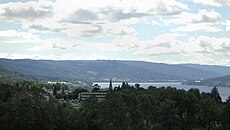
<nowiki>Søndre Land; Søndre Land; Søndre Land; Søndre Land; Søndre Land; Søndre Land; ساندر لند; 南蘭; Søndre Land Kommune; Søndre Land; Søndre Lands kommun; Søndre Land; 南蘭; Søndre Land; Søndre Land kommuna; Søndre Land; Søndre Land; Søndre Land; Søndre Land; Søndre Land; Søndre Landi vald; Søndre Land; Comuna Søndre Land; Søndre Land; Søndre Land; Søndre Land; Søndre Land; Søndre Land; Сённре-Ланн; Søndre Land; Søndre Land; Søndre Land; Søndre Land; Søndre Land; Søndre Land kommune; Søndre Land; Søndre Land; Søndre Land; Søndre Land; Søndre Land; Søndre Land; Kommun Søndre Land; Søndre Land; Søndre Land Municipality; সান্ড্রে লেন্ড; 南兰; Սյոնրե Լան; municipio en Oppland, Noruega; commune d'Oppland, Norvège; conceyu de Noruega; коммуна в губернии Оппланн (Норвегия); Kommune in Oppland in Norwegen; یک شهرداری در نروژ; 位於挪威內陸郡的市鎮; kommune i Oppland i Norge; comună în Innlandet în Norvegia; kommun i Innlandet fylke i Norge; kommune i Innlandet fylke i Noreg; kommune i Innlandet fylke i Norge; gemeente in Noorwegen; comune norvegese; manisipaa ya Oppland katika Norwei; komunumo en la provinco Innlandet de Norvegio, ĝis 2019 en Oppland; municipality in Innlandet, Norway; بلدية في أوبلاند، النرويج; municipi de Noruega; Norveç'te belediye; Sondre Land; Sondre land; Söndre Landi vald; Sondre Landi vald; Sondre Land; Soendre Land; Сендре Ланн; Sondre Land; Sondre Land; Soendre Land; Syndre Land; Søre Land; Syndre Land kommune; Kommunen Søndre Land; Söndre Land; Sondre Land; Söndre Land; Søndre Land; Søndre Land kommun; Söndre Lands kommun; conceyu de Søndre Land (Noruega); Søndre Land kommune; Søndre Land kommune</nowiki>


