Category:Ryston
Jump to navigation
Jump to search
English: Ryston is a small village and civil parish in the English county of Norfolk. It once had its own railway station.
village and civil parish in Norfolk, UK  | |||||
| Upload media | |||||
| Instance of | |||||
|---|---|---|---|---|---|
| Location | King's Lynn and West Norfolk, Norfolk, East of England, England | ||||
| Area |
| ||||
 | |||||
Subcategories
This category has the following 3 subcategories, out of 3 total.
Media in category "Ryston"
The following 166 files are in this category, out of 166 total.
-
 A blanket of snowdrops in Kett's Wood, Ryston Hall, Norfolk - geograph.org.uk - 5692434.jpg 4,889 × 3,810; 7.77 MB
-
 A10 at Stonecross Services - geograph.org.uk - 3634079.jpg 640 × 481; 50 KB
-

-
 A1122 Bexwell Road, Downham Market - geograph.org.uk - 5803081.jpg 4,608 × 3,072; 1.88 MB
-
 A1122 Bexwell Road, Downham Market - geograph.org.uk - 5803087.jpg 4,608 × 3,072; 1.9 MB
-
 A1122 to Downham Market - geograph.org.uk - 2759866.jpg 1,600 × 1,200; 788 KB
-
 A1122 westbound at Bexwell - geograph.org.uk - 3634077.jpg 640 × 481; 43 KB
-
 Arbuckles at Stonecross Services - geograph.org.uk - 2654307.jpg 3,648 × 2,736; 2.2 MB
-
 Arbuckles Restaurant and Bar - geograph.org.uk - 5350884.jpg 640 × 490; 319 KB
-
 Arbuckles Restaurant and Bar near Downham Market - geograph.org.uk - 5306194.jpg 4,320 × 3,240; 5.21 MB
-
 Arbuckles Restaurant ^ Bar - geograph.org.uk - 5290892.jpg 1,600 × 1,200; 316 KB
-

-

-

-

-
-

-

-

-

-

-
-

-

-

-

-

-

-

-

-

-

-

-

-

-

-

-
-

-

-

-

-
-

-

-

-

-

-
-

-

-

-

-

-

-

-
 Bexwell Kitchens - geograph.org.uk - 2759887.jpg 1,600 × 1,200; 532 KB
-
 Bexwell Lane - geograph.org.uk - 2759901.jpg 1,600 × 1,200; 696 KB
-
 Bexwell Lane - geograph.org.uk - 2759920.jpg 1,600 × 1,200; 729 KB
-
 Bexwell Road (A1122) - geograph.org.uk - 5391482.jpg 640 × 480; 54 KB
-
 Bexwell St Mary's church - geograph.org.uk - 3914209.jpg 640 × 480; 65 KB
-
 Blackheath Wood, West Dereham - geograph.org.uk - 2172617.jpg 640 × 480; 139 KB
-
 Building on the former WAAF site - geograph.org.uk - 5036271.jpg 640 × 597; 540 KB
-
 Building on the former WAAF site - geograph.org.uk - 5036272.jpg 640 × 480; 272 KB
-
 Building on the former WAAF site - geograph.org.uk - 5036273.jpg 640 × 501; 454 KB
-
 Cereal crop and Blackheath Wood - geograph.org.uk - 5306393.jpg 4,320 × 3,240; 6.07 MB
-
 Chamber organ at Bexwell - geograph.org.uk - 5064677.jpg 1,000 × 1,500; 565 KB
-
 Cock Fence Plantation - geograph.org.uk - 2759931.jpg 1,200 × 1,600; 1.24 MB
-
 Concrete hardstanding on a field's edge - geograph.org.uk - 4075866.jpg 640 × 480; 217 KB
-
 Cottages by Whindrove Farm, West Dereham - geograph.org.uk - 2172621.jpg 640 × 480; 118 KB
-
 Crop field and hedgerow, Ryston - geograph.org.uk - 5391468.jpg 640 × 480; 43 KB
-
 Crop field beside Whittricks Wood - geograph.org.uk - 4554339.jpg 640 × 480; 84 KB
-
 Crop field near Bexwell - geograph.org.uk - 5391476.jpg 640 × 480; 59 KB
-

-
 Crop field south of Hilgay Road - geograph.org.uk - 4554340.jpg 640 × 480; 94 KB
-
 Crossroads on Hilgay Road - geograph.org.uk - 4554334.jpg 640 × 480; 72 KB
-
 Crossways Cottages - geograph.org.uk - 2760137.jpg 1,600 × 1,200; 564 KB
-
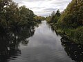 Cut-off Channel - geograph.org.uk - 5933348.jpg 3,264 × 2,448; 1.59 MB
-
 Downham Market R.A.F. station memorial - geograph.org.uk - 5643731.jpg 2,592 × 3,456; 3.22 MB
-
 Downham Market R.A.F. station memorial - geograph.org.uk - 5643737.jpg 3,456 × 2,592; 3.86 MB
-
 End of Bexwell Lane - geograph.org.uk - 2759922.jpg 1,600 × 1,200; 620 KB
-

-
 Entrance to Fenland ^ UK Power Networks - geograph.org.uk - 5803093.jpg 4,608 × 3,072; 1.84 MB
-
 Entrance ^ UK Power Networks ^ Fenland signs - geograph.org.uk - 5803120.jpg 4,608 × 3,072; 1.81 MB
-
-

-
 Factory-Warehouse unit - geograph.org.uk - 2759862.jpg 1,600 × 1,200; 545 KB
-
 Farm building, Stonehills Farm - geograph.org.uk - 5391472.jpg 640 × 480; 73 KB
-
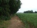
 Farm track (footpath) near Bexwell - geograph.org.uk - 5391477.jpg 640 × 480; 78 KB
-

-
 Farmland by Whindrove Wood - geograph.org.uk - 4330431.jpg 2,592 × 1,944; 1.31 MB
-
 Fields east of the A10 road - geograph.org.uk - 4075852.jpg 640 × 480; 166 KB
-
-
 Footpath to Bexwell - geograph.org.uk - 4075863.jpg 640 × 480; 166 KB
-

-

-
 Grazing, Ryston - geograph.org.uk - 5391463.jpg 640 × 480; 52 KB
-
 Hardstanding area by Bexwell Lane - geograph.org.uk - 2759908.jpg 1,600 × 1,200; 764 KB
-
 Heading east on Hilgay Road - geograph.org.uk - 4554322.jpg 640 × 480; 100 KB
-
 Hilgay Road - geograph.org.uk - 2760159.jpg 1,600 × 1,200; 828 KB
-
 Hilgay Road - geograph.org.uk - 4554326.jpg 640 × 480; 92 KB
-
 Hilgay Road - geograph.org.uk - 4554336.jpg 640 × 480; 111 KB
-
 Hilgay Road - geograph.org.uk - 4554342.jpg 640 × 480; 46 KB
-
 Historic building in Bexwell near Downham Market - geograph.org.uk - 5113040.jpg 4,206 × 3,156; 3.07 MB
-
 Horse paddock by Stonehills Farm - geograph.org.uk - 2759915.jpg 1,600 × 1,200; 485 KB
-
 Horse paddocks on Hilgay Road in Norfolk - geograph.org.uk - 5309372.jpg 4,320 × 3,240; 5.43 MB
-
 Karoo Close, Bexwell - geograph.org.uk - 5983826.jpg 1,600 × 1,143; 715 KB
-
 Kett's Oak near Ryston Hall in Norfolk - geograph.org.uk - 5692383.jpg 5,184 × 3,888; 6.61 MB
-
 Lane heading to West Dereham in Norfolk - geograph.org.uk - 5310582.jpg 4,320 × 3,240; 5.37 MB
-
 Looking north along Bexwell Lane - geograph.org.uk - 5306361.jpg 4,320 × 3,240; 5.4 MB
-
 Manor Lane, Ryston - geograph.org.uk - 4330449.jpg 2,592 × 1,944; 1.67 MB
-
 Memorial plaque by St Mary's church - geograph.org.uk - 4075909.jpg 800 × 600; 293 KB
-
 Minor road junction - geograph.org.uk - 2759929.jpg 1,600 × 1,200; 651 KB
-
 Minor road towards Bexwell - geograph.org.uk - 5391470.jpg 640 × 480; 88 KB
-
 Minor road towards Bexwell - geograph.org.uk - 5391474.jpg 640 × 480; 122 KB
-
 Minor road towards West Dereham - geograph.org.uk - 5391466.jpg 640 × 480; 113 KB
-

-
 Nissen huts on the site of former RAF Downham Market - geograph.org.uk - 5113016.jpg 4,320 × 3,240; 4.06 MB
-
 Old barn on Bexwell Lane - geograph.org.uk - 5391478.jpg 640 × 480; 74 KB
-
 Parkland at Ryston Hall in Norfolk - geograph.org.uk - 5692347.jpg 5,184 × 3,888; 5.5 MB
-
 Pasture north of Ryston Hall - geograph.org.uk - 1857645.jpg 640 × 480; 146 KB
-
 Pheasant Wood - geograph.org.uk - 4554325.jpg 478 × 640; 130 KB
-
 Phone mast, Bexwell - geograph.org.uk - 5983823.jpg 1,600 × 1,200; 746 KB
-
 Pond by Crossways Farm - geograph.org.uk - 2760133.jpg 1,600 × 1,200; 993 KB
-
 Pond in the formal garden at Ryston Hall in Norfolk - geograph.org.uk - 5692437.jpg 5,183 × 3,565; 5.34 MB
-

-
 Poplars by the lane - geograph.org.uk - 4330437.jpg 2,592 × 1,944; 1.83 MB
-
 Potato crop off Hilgay Road - geograph.org.uk - 4554331.jpg 640 × 480; 59 KB
-
 Poultry sheds at Airfield Farm - geograph.org.uk - 2759872.jpg 1,600 × 1,200; 540 KB
-
 Re-cycled railway wagon in Norfolk - geograph.org.uk - 5309378.jpg 4,320 × 3,240; 5.58 MB
-
 Remains of the southern perimeter track - geograph.org.uk - 5033738.jpg 640 × 480; 452 KB
-
 Road past Ryston Hall - geograph.org.uk - 2759942.jpg 1,600 × 1,200; 713 KB
-
 Road past Ryston Hall - geograph.org.uk - 2759946.jpg 1,600 × 1,200; 599 KB
-
 Road to Crossways Farm - geograph.org.uk - 2760118.jpg 1,600 × 1,200; 827 KB
-
 Roadsign on the A1122 Bexwell Road - geograph.org.uk - 5803103.jpg 4,608 × 3,072; 1.87 MB
-
 Robin's Wood - geograph.org.uk - 2760156.jpg 1,600 × 1,200; 670 KB
-
 Roxham Farm outbuilding - geograph.org.uk - 2760109.jpg 1,600 × 1,200; 564 KB
-
 Ryston Hall stable yard - geograph.org.uk - 5919975.jpg 3,013 × 2,260; 2.03 MB
-
 Ryston Road - geograph.org.uk - 6128570.jpg 3,575 × 2,681; 3.56 MB
-
 Ryston St. Michael's church - geograph.org.uk - 4353744.jpg 1,024 × 768; 465 KB
-
 Simkin's Spinney - geograph.org.uk - 5933351.jpg 3,264 × 2,448; 2.8 MB
-
 Snowdrops in Kett's Oak Wood - geograph.org.uk - 5692351.jpg 5,184 × 3,888; 6.37 MB
-
 Snowdrops near the walled garden, Ryston Hall, Norfolk - geograph.org.uk - 5692333.jpg 5,183 × 3,776; 6.83 MB
-
 St Mary - geograph.org.uk - 5064657.jpg 600 × 900; 255 KB
-
 St Mary's Church, Bexwell - geograph.org.uk - 5391481.jpg 640 × 452; 70 KB
-
-
 St Michael's church, Ryston - geograph.org.uk - 4330454.jpg 2,592 × 1,944; 1.88 MB
-
 St Michael's Church, Ryston - geograph.org.uk - 5391457.jpg 640 × 480; 97 KB
-
 Stubble field by Hilgay Road - geograph.org.uk - 2760142.jpg 1,600 × 1,200; 841 KB
-
 Sugar beet waiting - geograph.org.uk - 2760102.jpg 1,600 × 1,200; 569 KB
-

-
 The Bexwell Redeemer - geograph.org.uk - 5064647.jpg 1,071 × 1,600; 775 KB
-

-
 The gardener's cottage at Ryston Hall, Norfolk - geograph.org.uk - 5692340.jpg 4,947 × 3,528; 4.92 MB
-
 THE OAK OF REFORMATION - KET'S REBELLION 1549 - geograph.org.uk - 5692422.jpg 2,693 × 3,748; 3.31 MB
-

-
 Track in Pheasant Wood - geograph.org.uk - 4554324.jpg 478 × 640; 125 KB
-
 Track through Kett's Oak Wood - geograph.org.uk - 5919984.jpg 3,264 × 2,448; 2.24 MB
-
 UK Power Networks ^ Fenland signs - geograph.org.uk - 5803096.jpg 1,141 × 2,377; 2.34 MB
-
 View across Defence Site 4 - geograph.org.uk - 5033743.jpg 640 × 551; 520 KB
-
 View down track - geograph.org.uk - 525456.jpg 640 × 426; 141 KB
-
 Wall and ditch at Ryston Hall in Norfolk - geograph.org.uk - 5685990.jpg 5,184 × 3,888; 6.47 MB
-
 Wheat crop field in Bexwell - geograph.org.uk - 4075957.jpg 640 × 480; 155 KB
-
 Whindrove Wood near West Dereham - geograph.org.uk - 5306382.jpg 4,320 × 3,240; 5.93 MB
-
 Whitricks - geograph.org.uk - 2760166.jpg 1,600 × 1,200; 678 KB
-
 WW2 airfield near Downham Market - geograph.org.uk - 4075690.jpg 640 × 480; 182 KB


_-_geograph.org.uk_-_5391482.jpg)


_near_Bexwell_-_geograph.org.uk_-_5391477.jpg)


