Category:Russell's Water
Jump to navigation
Jump to search
human settlement in United Kingdom | |||||
| Upload media | |||||
| Instance of | |||||
|---|---|---|---|---|---|
| Location |
| ||||
 | |||||
Russell’s Water is a hamlet about 6 miles (9.7 km) north of Henley-on-Thames in South Oxfordshire. It is in the Chiltern Hills about 620 feet (190 m) above sea level.
Media in category "Russell's Water"
The following 13 files are in this category, out of 13 total.
-
 A local track to the Common - geograph.org.uk - 88654.jpg 640 × 481; 65 KB
-

-
 Houses, Russell's Water - geograph.org.uk - 755060.jpg 640 × 480; 137 KB
-
 Pasture, Russell's Water - geograph.org.uk - 755042.jpg 640 × 480; 128 KB
-
 Pasture, Russell's Water - geograph.org.uk - 755045.jpg 640 × 480; 128 KB
-
 Pond and village sign at Russell's Water - geograph.org.uk - 2891367.jpg 3,648 × 2,736; 1.78 MB
-
 Pond at Russell's Water - geograph.org.uk - 754688.jpg 480 × 640; 116 KB
-
 The Old Chapel, Russell's Water - geograph.org.uk - 88660.jpg 640 × 481; 55 KB
-
 Russell's Water - geograph.org.uk - 571306.jpg 640 × 427; 102 KB
-
 Russell's Water - geograph.org.uk - 754678.jpg 640 × 480; 110 KB
-
 Russell's Water - geograph.org.uk - 88791.jpg 640 × 481; 79 KB
-
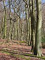
 Shambridge Wood - geograph.org.uk - 755074.jpg 640 × 480; 178 KB
-
 Shambridge Wood - geograph.org.uk - 755075.jpg 480 × 640; 207 KB


