Category:Rushmere St Andrew
Jump to navigation
Jump to search
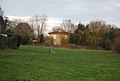
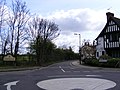
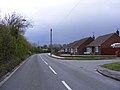
English: Rushmere St. Andrew is a village and civil parish adjacent to part of the eastern edge of the borough of Ipswich in the Suffolk Coastal district of Suffolk, England.
village and civil parish in Suffolk, United Kingdom  | |||||
| Upload media | |||||
| Instance of | |||||
|---|---|---|---|---|---|
| Location |
| ||||
 | |||||
Subcategories
This category has the following 8 subcategories, out of 8 total.
A
C
- Rushmere Community Hub (3 F)
F
- Foxhall Road, Rushmere St Andrew (16 F)
G
- Golf Hotel, Rushmere St Andrew (10 F)
S
T
V
Media in category "Rushmere St Andrew"
The following 200 files are in this category, out of 272 total.
(previous page) (next page)-
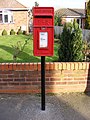
 1 Main Road Postbox - geograph.org.uk - 2713963.jpg 2,304 × 3,072; 1.51 MB
-
 1 Main Road Postbox - geograph.org.uk - 2713964.jpg 3,072 × 2,304; 1.63 MB
-
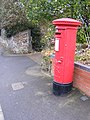
 2 Holly Lane Postbox - geograph.org.uk - 2762244.jpg 2,304 × 3,072; 1.48 MB
-
 2 Holly Lane Postbox - geograph.org.uk - 2762249.jpg 2,304 × 3,072; 1.47 MB
-
 2 Holly Lane Postbox - geograph.org.uk - 2762251.jpg 2,304 × 3,072; 1.38 MB
-
 59 Beech Road Postbox - geograph.org.uk - 2745810.jpg 3,072 × 2,304; 1.39 MB
-
 59 Beech Road Postbox - geograph.org.uk - 2745812.jpg 2,304 × 3,072; 1.48 MB
-
 59 Beech Road Postbox - geograph.org.uk - 2745823.jpg 3,072 × 2,304; 1.5 MB
-
 748 Foxhall Road Postbox - geograph.org.uk - 2757009.jpg 2,304 × 3,072; 1.43 MB
-
 748 Foxhall Road Postbox - geograph.org.uk - 2757010.jpg 2,304 × 3,072; 1.45 MB
-
 748 Foxhall Road Postbox - geograph.org.uk - 2757011.jpg 2,304 × 3,072; 1.43 MB
-
 813 Foxhall Road George V Postbox - geograph.org.uk - 2724585.jpg 3,072 × 2,304; 1.47 MB
-
 813 Foxhall Road George V Postbox - geograph.org.uk - 2724588.jpg 2,304 × 3,072; 1.47 MB
-
 813 Foxhall Road George V Postbox - geograph.org.uk - 2724589.jpg 2,304 × 3,072; 1.53 MB
-
 A flooded road, and pond with geese - geograph.org.uk - 1157613.jpg 640 × 480; 129 KB
-
 A pink painted house - geograph.org.uk - 3891249.jpg 640 × 430; 46 KB
-
 A1071 approaches junction with Beech Road - geograph.org.uk - 3548929.jpg 3,446 × 2,549; 1,003 KB
-
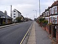 A1071 Woodbridge Road - geograph.org.uk - 1033412.jpg 3,072 × 2,304; 1.33 MB
-
 A1214 - geograph.org.uk - 3882965.jpg 640 × 430; 49 KB
-
 A1214 - geograph.org.uk - 4373943.jpg 640 × 430; 43 KB
-
 A1214 Woodbridge Road - geograph.org.uk - 2713973.jpg 3,072 × 2,304; 1.31 MB
-
 A1214 Woodbridge Road - geograph.org.uk - 2713974.jpg 3,072 × 2,304; 1.32 MB
-
 A1214, Main Rd - geograph.org.uk - 4373934.jpg 640 × 430; 58 KB
-
 Arundel Way - geograph.org.uk - 4270421.jpg 640 × 430; 69 KB
-
 Beech Road - geograph.org.uk - 2745815.jpg 3,072 × 2,304; 1.33 MB
-
 Beech Road - geograph.org.uk - 2745860.jpg 3,072 × 2,304; 1.26 MB
-
 Beech Road ^ 59 Beech Road Postbox - geograph.org.uk - 2745807.jpg 3,072 × 2,304; 1.36 MB
-
 Beech Road ^ 59 Beech Road Postbox - geograph.org.uk - 2745820.jpg 3,072 × 2,304; 1.49 MB
-
 Bent Lane - geograph.org.uk - 3882967.jpg 640 × 392; 55 KB
-
 Bent Lane sign - geograph.org.uk - 2763021.jpg 3,072 × 2,304; 1.69 MB
-
 Bent Lane, Playford Rd junction - geograph.org.uk - 3882991.jpg 640 × 430; 51 KB
-
 Bent Lane, Rushmere St Andrew - geograph.org.uk - 2763006.jpg 3,072 × 2,304; 1.33 MB
-
 Bent Lane, Rushmere St Andrew - geograph.org.uk - 2763020.jpg 3,072 × 2,304; 1.29 MB
-
 Bent Lane, Rushmere St Andrew - geograph.org.uk - 2763022.jpg 3,072 × 2,304; 1.36 MB
-

-

-

-
 Birchwood Drive - geograph.org.uk - 3891254.jpg 640 × 404; 57 KB
-
 Bixley Drive, Ipswich - geograph.org.uk - 2468263.jpg 3,648 × 2,736; 1.92 MB
-
 Bridge over the Fynn - geograph.org.uk - 4402084.jpg 1,024 × 768; 343 KB
-
 Broadlands Way - geograph.org.uk - 4273868.jpg 640 × 430; 64 KB
-
 Broadlands Way sign - geograph.org.uk - 2724568.jpg 2,640 × 1,115; 665 KB
-
 Broadlands Way, Foxhall - geograph.org.uk - 2724567.jpg 3,072 × 2,304; 1.31 MB
-
 Brookhill Way - geograph.org.uk - 4273869.jpg 640 × 430; 110 KB
-
 Bungalow, Rushmere Street - geograph.org.uk - 3891257.jpg 640 × 419; 65 KB
-
 Car park, Church of St Andrew - geograph.org.uk - 3891287.jpg 640 × 430; 99 KB
-
 Chestnut Close, Rushmere Street - geograph.org.uk - 3883027.jpg 640 × 430; 62 KB
-
 Church Hall, Rushmere St Andrew - geograph.org.uk - 3891284.jpg 640 × 413; 52 KB
-
 Church Path of St.Andrew's Church - geograph.org.uk - 4507600.jpg 2,304 × 3,072; 2.12 MB
-
 Corner at Rushmere Street - geograph.org.uk - 1305687.jpg 640 × 458; 132 KB
-
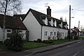
 Cottages on Holly Lane - geograph.org.uk - 2443261.jpg 3,648 × 2,736; 1.78 MB
-
 Crossroads, Playford Rd - geograph.org.uk - 4301093.jpg 640 × 430; 50 KB
-
 Dead tree, Rushmere Heath - geograph.org.uk - 3876006.jpg 640 × 430; 49 KB
-
 Digby Road, Rushmere St Andrew - geograph.org.uk - 4506284.jpg 3,072 × 2,304; 1.6 MB
-
 Digby Road, Rushmere St Andrew - geograph.org.uk - 4506291.jpg 3,072 × 2,304; 1.7 MB
-
 Digby Road, Rushmere St Andrew - geograph.org.uk - 4517234.jpg 3,072 × 2,304; 1.81 MB
-
 Digby Road, Rushmere St Andrew - geograph.org.uk - 4517268.jpg 3,072 × 2,304; 1.61 MB
-
 Digby Road, Rushmere St Andrew - geograph.org.uk - 4517282.jpg 3,072 × 2,304; 1.77 MB
-
 Digby Road, Rushmere St Andrew - geograph.org.uk - 4517291.jpg 3,072 × 2,304; 1.82 MB
-
 Dirt Bike track - geograph.org.uk - 4402109.jpg 1,024 × 768; 264 KB
-
 Dumbarton Road, Rushmere St.Andrew - geograph.org.uk - 2897438.jpg 3,072 × 2,304; 1.21 MB
-
 Dumbarton Road, Rushmere St.Andrew - geograph.org.uk - 2908763.jpg 3,072 × 2,304; 1.23 MB
-
 Eaton Place - geograph.org.uk - 3883016.jpg 640 × 430; 58 KB
-
 Entering Ipswich - geograph.org.uk - 4373954.jpg 640 × 430; 58 KB
-
 Entering Kesgrave on Penzance Road - geograph.org.uk - 2745833.jpg 3,072 × 2,304; 1.4 MB
-
 Entering Rushmere St Andrew - geograph.org.uk - 4301078.jpg 640 × 430; 72 KB
-

-
 Farmland by Rushmere Street - geograph.org.uk - 3891289.jpg 640 × 430; 49 KB
-
 Farmland, Rushmere St Andrew - geograph.org.uk - 3891273.jpg 640 × 414; 41 KB
-
 Farmland, Rushmere Street - geograph.org.uk - 3883023.jpg 640 × 396; 41 KB
-
 Farmland, Rushmere Street - geograph.org.uk - 3883024.jpg 640 × 398; 37 KB
-
 Field by Humber Doucy Lane - geograph.org.uk - 3891304.jpg 640 × 371; 44 KB
-
 Field next to Playford Lane - geograph.org.uk - 2443281.jpg 3,648 × 2,736; 2.31 MB
-
 Fields near Hill Farm - geograph.org.uk - 4734380.jpg 640 × 398; 40 KB
-

-
 Flooded Road - geograph.org.uk - 1150182.jpg 640 × 480; 90 KB
-
 Footpath by field - geograph.org.uk - 4402118.jpg 1,024 × 769; 374 KB
-
 Footpath off Rushmere Street - geograph.org.uk - 3891271.jpg 640 × 430; 69 KB
-
 Footpath onto Rushmere Heath - geograph.org.uk - 3882950.jpg 640 × 430; 87 KB
-
 Footpath to Playford Corner - geograph.org.uk - 2762112.jpg 2,304 × 3,072; 1.51 MB
-
 Footpath to Playford Road - geograph.org.uk - 4507623.jpg 3,072 × 2,304; 1.96 MB
-
 Footpath to Seven Cottages Lane - geograph.org.uk - 4507616.jpg 2,304 × 3,072; 2.71 MB
-
 Footpath, Rushmere Heath - geograph.org.uk - 3876155.jpg 640 × 430; 120 KB
-
 Footpath, Rushmere Heath - geograph.org.uk - 3876174.jpg 640 × 430; 116 KB
-
 Former Used Car Showrooms - geograph.org.uk - 1140911.jpg 3,072 × 2,304; 1.32 MB
-
 Fynn Valley - geograph.org.uk - 4402061.jpg 1,024 × 769; 193 KB
-
 Fynn valley fence - geograph.org.uk - 4402092.jpg 1,024 × 768; 239 KB
-
 Gardeners Cottage - geograph.org.uk - 3891269.jpg 640 × 401; 52 KB
-
 Geese in the road, Rushmere St Andrew - geograph.org.uk - 4780493.jpg 4,320 × 3,240; 5.56 MB
-

-
 Gorse and golf, Rushmere common - geograph.org.uk - 1223031.jpg 640 × 480; 89 KB
-
 Gorse, Rushmere Heath - geograph.org.uk - 3875999.jpg 640 × 430; 63 KB
-
 Gorse-lined track, Rushmere common - geograph.org.uk - 1223027.jpg 640 × 480; 119 KB
-
 Green, Rushmere Golf Course - geograph.org.uk - 3876163.jpg 640 × 430; 99 KB
-
 Green, Rushmere Golf Course - geograph.org.uk - 3876165.jpg 640 × 430; 91 KB
-
 Hardwick Close, Brook Hill - geograph.org.uk - 1185946.jpg 640 × 480; 57 KB
-
 Holly Lane - geograph.org.uk - 3891248.jpg 640 × 430; 57 KB
-
 Holly Lane sign - geograph.org.uk - 2762801.jpg 3,072 × 2,304; 1.66 MB
-
 Holly Lane, Rushmere - geograph.org.uk - 2762999.jpg 3,072 × 2,304; 1.36 MB
-
 Holly Lane, Rushmere - geograph.org.uk - 2763004.jpg 3,072 × 2,304; 1.24 MB
-
 Holly Lane, Rushmere ^ 2 Holy Lane Postbox - geograph.org.uk - 2762236.jpg 3,072 × 2,304; 1.18 MB
-
 Holly Lane, Rushmere ^ 2 Holy Lane Postbox - geograph.org.uk - 2762805.jpg 3,072 × 2,304; 1.32 MB
-
 Holly Lane, Rushmere ^ 2 Holy Lane Postbox - geograph.org.uk - 2762997.jpg 3,072 × 2,304; 1.29 MB
-
 Holly Road sign - geograph.org.uk - 2713968.jpg 3,072 × 2,304; 1.42 MB
-
 Holly Road, Kesgrave - geograph.org.uk - 2713977.jpg 3,072 × 2,304; 1.35 MB
-
 Holly Road, Kesgrave - geograph.org.uk - 2713980.jpg 3,072 × 2,304; 1.38 MB
-
 House across a field - geograph.org.uk - 3891303.jpg 640 × 430; 67 KB
-
 Humber Doucy Lane Postbox - geograph.org.uk - 2897329.jpg 2,304 × 3,072; 1.65 MB
-
 Humber Doucy Lane sign - geograph.org.uk - 2897449.jpg 3,072 × 2,304; 1.51 MB
-
 Humber Doucy Lane sign - geograph.org.uk - 2897489.jpg 3,072 × 2,304; 1.48 MB
-
 Humber Doucy Lane ^ The Garland Public House - geograph.org.uk - 2897572.jpg 3,072 × 2,304; 1.4 MB
-
 Humber Doucy Lane, Rushmere St.Andrew - geograph.org.uk - 2897344.jpg 3,072 × 2,304; 1.43 MB
-
 Humber Doucy Lane, Rushmere St.Andrew - geograph.org.uk - 2897358.jpg 3,072 × 2,304; 1.34 MB
-
 Humber Doucy Lane, Rushmere St.Andrew - geograph.org.uk - 2897388.jpg 3,072 × 2,304; 1.35 MB
-
 Humber Doucy Lane, Rushmere St.Andrew - geograph.org.uk - 2897437.jpg 3,072 × 2,304; 1.29 MB
-
 Humber Doucy Lane, Rushmere St.Andrew - geograph.org.uk - 2897479.jpg 3,072 × 2,304; 1.37 MB
-
 Humber Doucy Lane, Rushmere St.Andrew - geograph.org.uk - 2897556.jpg 3,072 × 2,304; 1.18 MB
-
 Humber Doucy Lane, Rushmere St.Andrew - geograph.org.uk - 2905942.jpg 2,048 × 1,536; 638 KB
-
 Humber Doucy Lane, Rushmere St.Andrew - geograph.org.uk - 2905965.jpg 3,072 × 2,304; 1.33 MB
-
 Humber Doucy Lane, Rushmere St.Andrew - geograph.org.uk - 2908684.jpg 3,072 × 2,304; 1.32 MB
-
 Humber Doucy Lane, Rushmere St.Andrew - geograph.org.uk - 2908699.jpg 3,072 × 2,304; 1.3 MB
-
 Humber Doucy Lane, Rushmere St.Andrew - geograph.org.uk - 2908708.jpg 3,072 × 2,304; 1.32 MB
-
 Humber Doucy Lane, Rushmere St.Andrew - geograph.org.uk - 2908717.jpg 3,072 × 2,304; 1.36 MB
-
 Humber Doucy Lane, Rushmere St.Andrew - geograph.org.uk - 2908749.jpg 2,039 × 1,491; 865 KB
-
 Humber Doucy Lane, Rushmere St.Andrew - geograph.org.uk - 2908754.jpg 3,072 × 2,304; 1.38 MB
-
 Humber Doucy Lane, Rushmere St.Andrew - geograph.org.uk - 2908767.jpg 3,072 × 2,304; 1.35 MB
-
 Inverness Road, Rushmere St.Andrew - geograph.org.uk - 2908691.jpg 3,072 × 2,304; 1.51 MB
-
 Ipswich FC Training Ground - geograph.org.uk - 3882974.jpg 640 × 430; 63 KB
-
 Ipswich FC Training Ground - geograph.org.uk - 3882977.jpg 640 × 430; 57 KB
-
 Laburnum Gardens - geograph.org.uk - 3891251.jpg 640 × 430; 59 KB
-
 Lambert's Lane - geograph.org.uk - 1305750.jpg 640 × 450; 125 KB
-
 Lamberts Lane - geograph.org.uk - 3891259.jpg 640 × 430; 94 KB
-
 Leopold Road, Rushmere St Andrew, Ipswich - geograph.org.uk - 4591550.jpg 3,072 × 2,304; 1.94 MB
-
 Leopold Road, Rushmere St Andrew, Ipswich - geograph.org.uk - 4591554.jpg 3,072 × 2,304; 1.92 MB
-
 Leopold Road, Rushmere St Andrew, Ipswich - geograph.org.uk - 4591569.jpg 3,072 × 2,304; 1.88 MB
-
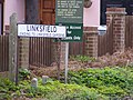
 Linksfield, Rushmere common - geograph.org.uk - 1223021.jpg 640 × 480; 112 KB
-
 Linksfield, Rushmere St Andrew - geograph.org.uk - 3307428.jpg 640 × 480; 69 KB
-
 Linksview sign - geograph.org.uk - 2897584.jpg 3,072 × 2,304; 1.4 MB
-
 Linksview, Rushmere St.Andrew - geograph.org.uk - 2897586.jpg 3,072 × 2,304; 1.28 MB
-
 Main Rd - geograph.org.uk - 4373938.jpg 640 × 430; 43 KB
-
 Main Rd, A1214 - geograph.org.uk - 4373942.jpg 640 × 430; 57 KB
-
 Marsh, Bixley Heath - geograph.org.uk - 4286936.jpg 640 × 430; 72 KB
-
 Mayfield Road, Rushmere St Andrew - geograph.org.uk - 4517273.jpg 3,072 × 2,304; 1.99 MB
-
 Meadowcroft Gardens - geograph.org.uk - 3882973.jpg 640 × 430; 50 KB
-
 Notice Board ^ 59 Beech Road Postbox - geograph.org.uk - 2745857.jpg 3,072 × 2,304; 1.4 MB
-
 P.F.K. Ling - geograph.org.uk - 4273863.jpg 640 × 430; 48 KB
-
 Parade of shops in Beech Road - geograph.org.uk - 2745854.jpg 3,072 × 2,304; 1.31 MB
-
 Path to Chatsworth Drive - geograph.org.uk - 4270416.jpg 640 × 430; 75 KB
-
 Pink cottages in Holly Lane, Rushmere - geograph.org.uk - 4537343.jpg 1,024 × 768; 251 KB
-
 Playford Lane - geograph.org.uk - 2443267.jpg 3,648 × 2,736; 2.61 MB
-
 Playford Lane - geograph.org.uk - 2443276.jpg 3,648 × 2,736; 3.58 MB
-
 Playford Lane - geograph.org.uk - 3883040.jpg 640 × 430; 60 KB
-
 Playford Lane sign - geograph.org.uk - 2762218.jpg 3,072 × 2,304; 1.35 MB
-
 Playford Lane, Rushmere - geograph.org.uk - 2762204.jpg 3,072 × 2,304; 1.38 MB
-
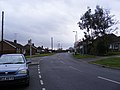
 Playford Rd - geograph.org.uk - 3882999.jpg 640 × 430; 50 KB
-
 Playford Rd - geograph.org.uk - 3883002.jpg 640 × 430; 69 KB
-
 Playford Rd - geograph.org.uk - 4301073.jpg 640 × 430; 56 KB
-
 Playford Rd - geograph.org.uk - 4301081.jpg 640 × 430; 64 KB
-
 Playford Rd - geograph.org.uk - 4301084.jpg 640 × 430; 57 KB
-
 Playford Rd - geograph.org.uk - 4301094.jpg 640 × 430; 63 KB
-
 Playford Rd - geograph.org.uk - 4301095.jpg 640 × 430; 51 KB
-
 Playford Rd, Rushmere St junction - geograph.org.uk - 3882996.jpg 640 × 430; 52 KB
-
 Playford Road, Rushmere St Andrew - geograph.org.uk - 2761824.jpg 3,072 × 2,304; 1.32 MB
-
 Pond, Rushmere - geograph.org.uk - 3891261.jpg 640 × 430; 81 KB
-
 Pond, Rushmere Street - geograph.org.uk - 3883029.jpg 640 × 393; 94 KB
-
 Quantock Close - geograph.org.uk - 2745855.jpg 3,072 × 2,304; 1.39 MB
-
 Quantock Close sign - geograph.org.uk - 2745858.jpg 3,072 × 2,304; 1.5 MB
-
 Road sign, Playford Rd - geograph.org.uk - 3883005.jpg 640 × 430; 88 KB
-
 Roxburgh Road, Rushmere St.Andrew - geograph.org.uk - 2908728.jpg 3,072 × 2,304; 1.23 MB
-
 Rush Cottage Bent Lane Postbox - geograph.org.uk - 2763012.jpg 2,304 × 3,072; 1.65 MB
-
 Rush Cottage Bent Lane Postbox - geograph.org.uk - 2763013.jpg 2,304 × 3,072; 1.65 MB
-
 Rush Cottage Bent Lane Postbox - geograph.org.uk - 2763014.jpg 2,304 × 3,072; 1.48 MB
-
 Rushmere Common - geograph.org.uk - 3307436.jpg 640 × 480; 72 KB
-
 Rushmere Golf Course - geograph.org.uk - 3875997.jpg 640 × 430; 45 KB
-
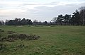 Rushmere Golf Course - geograph.org.uk - 3876113.jpg 640 × 417; 47 KB
-
 Rushmere Heath - geograph.org.uk - 3876011.jpg 640 × 430; 56 KB
-
 Rushmere Heath - geograph.org.uk - 3876025.jpg 640 × 430; 58 KB
-
 Rushmere heath - geograph.org.uk - 3876033.jpg 640 × 430; 46 KB
-
 Rushmere heath - geograph.org.uk - 3876092.jpg 640 × 430; 56 KB
-
 Rushmere Heath - geograph.org.uk - 3876096.jpg 640 × 430; 55 KB
-
 Rushmere Heath - geograph.org.uk - 3876104.jpg 640 × 430; 48 KB
-
 Rushmere Heath - geograph.org.uk - 3876108.jpg 640 × 396; 52 KB
-
 Rushmere Heath - geograph.org.uk - 3876122.jpg 640 × 430; 40 KB
-
 Rushmere Heath - geograph.org.uk - 3876136.jpg 640 × 430; 99 KB
-
 Rushmere Heath - geograph.org.uk - 3876167.jpg 640 × 430; 125 KB
-
 Rushmere Heath - geograph.org.uk - 3882911.jpg 640 × 430; 52 KB
-
 Rushmere Heath - geograph.org.uk - 3882932.jpg 640 × 430; 71 KB
-
 Rushmere Heath - geograph.org.uk - 3882939.jpg 640 × 430; 112 KB
-
 Rushmere Heath - geograph.org.uk - 3882944.jpg 640 × 430; 131 KB
-
 Rushmere Heath - geograph.org.uk - 3882971.jpg 640 × 430; 61 KB
-
 Rushmere Heath and Golf Course - geograph.org.uk - 2349935.jpg 3,648 × 2,048; 1.57 MB
-
 Rushmere Parish Boundary Oaks - geograph.org.uk - 4242594.jpg 800 × 600; 333 KB
-
 Rushmere Road, Rushmere St Andrew - geograph.org.uk - 4506280.jpg 3,072 × 2,304; 1.78 MB
-
 Rushmere Road, Rushmere St Andrew - geograph.org.uk - 4507693.jpg 3,072 × 2,304; 1.74 MB
-
 Rushmere St - geograph.org.uk - 3883008.jpg 640 × 430; 44 KB
-
 Rushmere St - geograph.org.uk - 3883010.jpg 640 × 430; 49 KB
-
 Rushmere Street - geograph.org.uk - 3883018.jpg 640 × 430; 45 KB
-
 Rushmere Street - geograph.org.uk - 3883020.jpg 640 × 430; 54 KB
-
 Rushmere Street - geograph.org.uk - 3883033.jpg 640 × 430; 61 KB
-
 Rushmere Street - geograph.org.uk - 3883035.jpg 640 × 430; 49 KB


