Category:Rue Armand-Brossard
Jump to navigation
Jump to search
| Object location | | View all coordinates using: OpenStreetMap |
|---|
thoroughfare in Nantes, France  | |||||
| Upload media | |||||
| Instance of | |||||
|---|---|---|---|---|---|
| Named after |
| ||||
| Location | Nantes, Loire-Atlantique, Pays de la Loire, Metropolitan France, France | ||||
 | |||||
Media in category "Rue Armand-Brossard"
The following 6 files are in this category, out of 6 total.
-
 1955 labour strike plaque in Nantes.JPG 1,920 × 1,080; 776 KB
-
 Nantes - France - Rue Armand Brossard - Vue depuis le sud.jpg 4,608 × 3,456; 3.36 MB
-
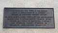
 Nantes - France - Rue Armand-Brossard - Plaque.jpg 4,608 × 3,456; 3.29 MB
-
 Nantes - France - Rue Armand-Brossard partie nord.jpg 4,608 × 3,456; 2.97 MB
-
 Nantes école publique et laïque plaque.JPG 1,920 × 1,080; 771 KB
-
 Repère altimétrique de Nantes Métropole - NM109-150.jpg 2,848 × 2,144; 467 KB


