Category:Ruckinge
Jump to navigation
Jump to search
English: The village of Ruckinge is located in Kent. It lies seven miles southeast of Ashford on the B2067 Hamstreet to Hythe road. It is the centre of a civil parish of the same name, which also includes the scattered community of Bromley Green. The population of the parish is 727 persons, and is divided in two (Upper and Lower) by a belt of woodland.
village and civil parish in Kent, England, UK  | |||||
| Upload media | |||||
| Instance of | |||||
|---|---|---|---|---|---|
| Location | Ashford, Kent, South East England, England | ||||
| Area |
| ||||
| Said to be the same as | Ruckinge (Wikimedia duplicated page, civil parish) | ||||
 | |||||
Subcategories
This category has the following 3 subcategories, out of 3 total.
Media in category "Ruckinge"
The following 200 files are in this category, out of 338 total.
(previous page) (next page)-
 A reedy, eutrophic ditch - geograph.org.uk - 5840143.jpg 1,024 × 681; 224 KB
-
 A Track in Carving Wood - geograph.org.uk - 3466876.jpg 4,320 × 3,240; 6.03 MB
-
 A2070 Capel Lane bridge crosses - geograph.org.uk - 2787150.jpg 3,368 × 2,527; 1.27 MB
-
 A2070 from Poundhurst Bridge - geograph.org.uk - 21440.jpg 587 × 373; 39 KB
-
 A2070 Road towards Ashford - geograph.org.uk - 2089550.jpg 3,072 × 2,304; 1.65 MB
-
 A2070 Road towards Hamstreet - geograph.org.uk - 2089500.jpg 3,072 × 2,304; 1.7 MB
-
 A2070 through Golden Wood - geograph.org.uk - 3387843.jpg 2,256 × 1,504; 1.01 MB
-
 A2070 towards Ashford - geograph.org.uk - 3248097.jpg 2,256 × 1,496; 901 KB
-
 A2070 towards Kingsnorth - geograph.org.uk - 3388157.jpg 1,024 × 647; 145 KB
-
 A2070 west of Brisley Farm - geograph.org.uk - 2787135.jpg 3,648 × 2,488; 1.38 MB
-
 Alder tree beside Kitsbridge Lane - geograph.org.uk - 2084957.jpg 3,072 × 2,304; 1.74 MB
-
 Anemones in Ham Street Woods - geograph.org.uk - 3466765.jpg 4,314 × 3,104; 5.49 MB
-
 Approaching Pierland Wood - geograph.org.uk - 3466854.jpg 4,320 × 3,240; 4.83 MB
-
 Ash Hill - geograph.org.uk - 1944618.jpg 1,024 × 768; 251 KB
-
 Ash Hill - geograph.org.uk - 5327454.jpg 640 × 480; 174 KB
-
 Ash Hill - geograph.org.uk - 5327461.jpg 640 × 480; 136 KB
-
 Athfas Farm - geograph.org.uk - 1720866.jpg 3,072 × 2,304; 1.88 MB
-
 B2067 at Ruckinge - geograph.org.uk - 5059833.jpg 4,211 × 2,800; 7.45 MB
-
 B2067 between Hamstreet and Ruckinge - geograph.org.uk - 5327451.jpg 640 × 428; 134 KB
-
 B2067 Hamstreet Road - geograph.org.uk - 3248079.jpg 2,256 × 1,496; 929 KB
-
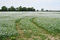
 Barley Field - geograph.org.uk - 3629728.jpg 3,696 × 2,448; 2.31 MB
-
 Barns, Briseley Farm - geograph.org.uk - 5226050.jpg 640 × 317; 24 KB
-
 Bend in canal - geograph.org.uk - 5844822.jpg 1,024 × 681; 117 KB
-
 Bend in canal - geograph.org.uk - 5844881.jpg 1,024 × 681; 150 KB
-
 Bend on the Royal Military Canal to Bilsington (2) - geograph.org.uk - 1722747.jpg 2,592 × 1,944; 891 KB
-
 Bend on the Royal Military Canal to Bilsington - geograph.org.uk - 1722732.jpg 2,592 × 1,944; 1.02 MB
-
 Blackbeams House, Ruckinge - geograph.org.uk - 1722667.jpg 2,592 × 1,944; 1.02 MB
-
 Bliby Wood - geograph.org.uk - 2089433.jpg 3,072 × 2,304; 1.25 MB
-
 Bourne Wood - geograph.org.uk - 3270332.jpg 640 × 430; 128 KB
-
 Bourne Wood - geograph.org.uk - 3270333.jpg 640 × 430; 105 KB
-
 Bourne Wood - geograph.org.uk - 3272003.jpg 640 × 430; 117 KB
-
 Bourne Wood - geograph.org.uk - 5867015.jpg 1,024 × 681; 320 KB
-
 Brenzett Sewer - geograph.org.uk - 451502.jpg 640 × 427; 87 KB
-
 Bridge to Lords Farm - geograph.org.uk - 2085309.jpg 3,072 × 2,304; 1.49 MB
-
 Brisley Farm - geograph.org.uk - 3272008.jpg 640 × 324; 35 KB
-
 Brisley Farm - geograph.org.uk - 5867017.jpg 1,024 × 681; 135 KB
-
 Brisley Farm House - geograph.org.uk - 2089455.jpg 3,072 × 2,304; 2.04 MB
-
 Brisley Lane - geograph.org.uk - 1700586.jpg 529 × 396; 106 KB
-
 Brisley Lane - geograph.org.uk - 2089459.jpg 3,072 × 2,304; 1.89 MB
-
 Brisley Lane - geograph.org.uk - 5327477.jpg 640 × 480; 147 KB
-
 Bromley Green Rd - geograph.org.uk - 5508824.jpg 640 × 426; 62 KB
-
 Bromley Green Road - geograph.org.uk - 1944608.jpg 1,024 × 768; 290 KB
-
 Bromley Green Road - geograph.org.uk - 3248113.jpg 2,256 × 1,496; 926 KB
-
 Building at Elmhurst - geograph.org.uk - 2151507.jpg 3,072 × 2,304; 1.83 MB
-
 By Ashford Rd - geograph.org.uk - 5508814.jpg 640 × 426; 59 KB
-
 Byway - geograph.org.uk - 5844829.jpg 1,024 × 681; 303 KB
-
 Byway and footpath junction in Pierland Wood - geograph.org.uk - 2089301.jpg 3,072 × 2,304; 3.19 MB
-
 Byway from Hodge's Wood - geograph.org.uk - 1722465.jpg 2,854 × 2,304; 2.43 MB
-
 Byway in Carving Wood - geograph.org.uk - 2089284.jpg 3,072 × 2,304; 3.28 MB
-
 Byway in Pierland Wood - geograph.org.uk - 2089287.jpg 2,304 × 3,072; 3.31 MB
-
 Byway junction at Kits Bridge - geograph.org.uk - 2085217.jpg 3,072 × 2,304; 2.23 MB
-
 Byway leading to Bromley Green Road - geograph.org.uk - 1720872.jpg 3,072 × 2,304; 1.9 MB
-
 Byway open to all traffic - geograph.org.uk - 4058961.jpg 4,000 × 3,000; 4.34 MB
-
 Byway reaches the A2070 - geograph.org.uk - 1720891.jpg 3,072 × 2,304; 2.39 MB
-
 Byway to Kits Bridge - geograph.org.uk - 1722742.jpg 1,600 × 1,200; 443 KB
-
 Byway to Kits Bridge - geograph.org.uk - 3629723.jpg 3,696 × 2,448; 2.35 MB
-
 Byway to Lords Farm - geograph.org.uk - 2085260.jpg 3,072 × 2,304; 1.75 MB
-
 Byway to the A2070 - geograph.org.uk - 1720879.jpg 3,031 × 2,163; 1.94 MB
-
 Byway to the A2070 - geograph.org.uk - 1720882.jpg 3,072 × 2,304; 2.91 MB
-
 Canal Farm - geograph.org.uk - 5844821.jpg 1,024 × 681; 160 KB
-
 Capel Road Bridge - geograph.org.uk - 1721089.jpg 3,072 × 2,304; 1.8 MB
-

-
 Carter Farm - geograph.org.uk - 5844834.jpg 1,024 × 681; 165 KB
-
 Chancel, Ruckinge church - geograph.org.uk - 3252410.jpg 2,256 × 1,496; 872 KB
-
 Church of St Mary Magdalene, Ruckinge - geograph.org.uk - 1944619.jpg 1,024 × 768; 241 KB
-
 Court Lodge - geograph.org.uk - 5840137.jpg 1,024 × 681; 153 KB
-
 Court Lodge - geograph.org.uk - 5840142.jpg 1,024 × 681; 169 KB
-
 Court Lodge - geograph.org.uk - 5840145.jpg 1,024 × 681; 238 KB
-
 Crops - geograph.org.uk - 5840146.jpg 1,024 × 681; 208 KB
-
 Cutting north of Golden Wood - geograph.org.uk - 3272007.jpg 640 × 430; 124 KB
-
 Drain and hedge - geograph.org.uk - 5844804.jpg 1,024 × 681; 282 KB
-
 Drainage channel - geograph.org.uk - 5844826.jpg 1,024 × 681; 153 KB
-
 Drainage ditch seen from Tar Pot Lane - geograph.org.uk - 4057763.jpg 4,000 × 3,000; 4.26 MB
-
 Drive to Ladswood Farm - geograph.org.uk - 3248105.jpg 2,256 × 1,496; 914 KB
-
 Elmhurst - geograph.org.uk - 2151505.jpg 3,072 × 2,304; 2.01 MB
-
 Entering Dicker's Wood - geograph.org.uk - 3485911.jpg 3,776 × 2,520; 4.22 MB
-
 Entrance to a farm track - geograph.org.uk - 4058939.jpg 4,000 × 3,000; 4.34 MB
-
 Entrance to Austin Bank - geograph.org.uk - 3248109.jpg 2,256 × 1,496; 929 KB
-
 Entrance to The Pheasantry - geograph.org.uk - 3248120.jpg 2,256 × 1,496; 935 KB
-
 Farm access track to Lords Farm - geograph.org.uk - 2085315.jpg 3,072 × 2,304; 1.98 MB
-
 Farmland by the Marshlink Line - geograph.org.uk - 3272005.jpg 640 × 430; 91 KB
-
 Farmland by the railway line - geograph.org.uk - 3272009.jpg 640 × 430; 61 KB
-
 Farmland, Brisley Farm - geograph.org.uk - 3226445.jpg 640 × 343; 32 KB
-
 Field near Lords Farm - geograph.org.uk - 5315519.jpg 640 × 480; 100 KB
-
 Field north of Brisley Lane - geograph.org.uk - 5327488.jpg 640 × 480; 90 KB
-
 Field north of Brisley Lane - geograph.org.uk - 5327497.jpg 640 × 480; 127 KB
-
 Field of White - geograph.org.uk - 1944504.jpg 1,024 × 683; 327 KB
-
 Field off Brisley Lane - geograph.org.uk - 1944606.jpg 1,024 × 768; 319 KB
-
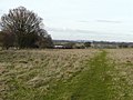
 Flat farmland - geograph.org.uk - 5840134.jpg 1,024 × 681; 199 KB
-
 Flat farmland - geograph.org.uk - 5844757.jpg 1,024 × 681; 228 KB
-
 Font, St Mary's church, Ruckinge - geograph.org.uk - 3252416.jpg 1,496 × 2,256; 705 KB
-
 Footbridge and footpath towards the Sedbrook Sewer - geograph.org.uk - 2150807.jpg 3,072 × 2,304; 1.96 MB
-
 Footbridge near Hans Farm - geograph.org.uk - 2085410.jpg 3,072 × 2,304; 2.2 MB
-
 Footbridge near the Rowans - geograph.org.uk - 2085371.jpg 3,072 × 2,304; 2.03 MB
-
 Footpath beside the A2070 - geograph.org.uk - 2089537.jpg 3,072 × 2,304; 1.68 MB
-
 Footpath crosses Swanton Lane - geograph.org.uk - 2089342.jpg 3,072 × 2,304; 2.83 MB
-
 Footpath enters Bourne Wood - geograph.org.uk - 2089597.jpg 3,072 × 2,304; 2.81 MB
-
 Footpath in Bourne Wood - geograph.org.uk - 2089641.jpg 3,072 × 2,304; 1.75 MB
-
 Footpath in Ham Street Woods - geograph.org.uk - 3466830.jpg 4,320 × 3,240; 6.27 MB
-
 Footpath in Little Hurst - geograph.org.uk - 2068318.jpg 2,304 × 3,072; 3.02 MB
-
 Footpath into Hamstreet Nature Reserve - geograph.org.uk - 1274497.jpg 640 × 480; 138 KB
-
 Footpath junction near Roughstocks Wood (2) - geograph.org.uk - 1721158.jpg 3,072 × 2,304; 3.06 MB
-
 Footpath junction near Roughstocks Wood - geograph.org.uk - 1721119.jpg 3,072 × 2,304; 3.04 MB
-
 Footpath leaves Little Hurst - geograph.org.uk - 2068321.jpg 3,072 × 2,304; 2.83 MB
-
 Footpath to Bourne Wood - geograph.org.uk - 2089571.jpg 3,072 × 2,304; 1.93 MB
-
 Footpath to Brisley Lane - geograph.org.uk - 2089437.jpg 3,072 × 2,304; 1.89 MB
-
 Footpath to Lone Barn Farm - geograph.org.uk - 1700521.jpg 685 × 513; 119 KB
-
 Footpath to Packing Wood - geograph.org.uk - 2089541.jpg 3,072 × 2,304; 2.84 MB
-
 Footpath to Wey Street - geograph.org.uk - 2150785.jpg 3,072 × 2,304; 2.27 MB
-
 Footpath towards Marsh Road - geograph.org.uk - 2085270.jpg 3,072 × 2,304; 2.18 MB
-
 Gate and stile beside Hodge's Wood - geograph.org.uk - 2089311.jpg 3,072 × 2,304; 3.13 MB
-
 Gate on Kitsbridge Lane - geograph.org.uk - 2085132.jpg 3,072 × 2,304; 1.73 MB
-
 Gate on the byway near Lords Farm - geograph.org.uk - 2085293.jpg 3,072 × 2,304; 1.63 MB
-
 Gates near Brisley Farm - geograph.org.uk - 2089447.jpg 3,072 × 2,304; 2.04 MB
-
 Gill Farm - geograph.org.uk - 3485904.jpg 3,776 × 2,520; 3.83 MB
-
 Golden Wood - geograph.org.uk - 3272006.jpg 640 × 430; 121 KB
-
 Golden Wood Farm - geograph.org.uk - 2089466.jpg 3,072 × 2,304; 1.81 MB
-
 Greensand Way beside Roughstocks Wood - geograph.org.uk - 2089471.jpg 3,072 × 2,304; 1.51 MB
-
 Hamstreet Road - geograph.org.uk - 4058923.jpg 4,000 × 3,000; 3.93 MB
-
 Harding's Bridge Cottage - geograph.org.uk - 1721059.jpg 3,072 × 2,304; 2.41 MB
-
 Harvested Field - geograph.org.uk - 4329659.jpg 640 × 427; 67 KB
-
 Hedge and drain - geograph.org.uk - 5840087.jpg 1,024 × 681; 245 KB
-
 Hedgeline - geograph.org.uk - 5844808.jpg 1,024 × 681; 317 KB
-
 Herne Hill Farm - geograph.org.uk - 5840076.jpg 1,024 × 681; 128 KB
-
 Herne House Farm - geograph.org.uk - 5836159.jpg 1,024 × 681; 126 KB
-
 Herne House Farm - geograph.org.uk - 5836163.jpg 1,024 × 681; 118 KB
-
 Horton Green - geograph.org.uk - 1722456.jpg 3,072 × 2,304; 1.4 MB
-
 Information Board near Wey Street - geograph.org.uk - 2150799.jpg 1,728 × 3,072; 1.6 MB
-
 Junction on Wey Street - geograph.org.uk - 1944492.jpg 1,024 × 683; 180 KB
-
 Kissing gate near Brockman's Farm - geograph.org.uk - 2089442.jpg 3,072 × 2,304; 1.98 MB
-
 Kits Bridge - geograph.org.uk - 2085177.jpg 3,072 × 2,304; 2.49 MB
-
 Kits Bridge Pumping Station - geograph.org.uk - 1722735.jpg 2,592 × 1,944; 835 KB
-
 Kitsbridge Lane to Lords Farm - geograph.org.uk - 2085285.jpg 3,072 × 2,304; 2.08 MB
-
 Kitsbridge Pumping Station - geograph.org.uk - 3629700.jpg 3,696 × 2,448; 2.19 MB
-
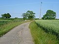 Kittsbridge Lane - geograph.org.uk - 4057769.jpg 4,000 × 3,000; 4.06 MB
-
 Lady Chapel, Ruckinge church - geograph.org.uk - 3252414.jpg 1,496 × 2,256; 634 KB
-
 Lane junction on Poundhurst Road - geograph.org.uk - 1721203.jpg 3,072 × 2,304; 2 MB
-
 Lane to Ruckinge - geograph.org.uk - 5315514.jpg 640 × 480; 104 KB
-
 Layby on A2070 - geograph.org.uk - 1385268.jpg 640 × 480; 109 KB
-
 Level Crossing near Harding's Bridge - geograph.org.uk - 1720902.jpg 3,072 × 2,304; 2.74 MB
-
 Line to Hamstreet - geograph.org.uk - 1720917.jpg 3,072 × 2,304; 1.88 MB
-
 Lone Barn Farm building - geograph.org.uk - 1720847.jpg 3,072 × 2,304; 1.78 MB
-
 Marsh Road bridge near Stone Bridge - geograph.org.uk - 2085323.jpg 3,072 × 2,304; 2.15 MB
-
 Marsh Road bridge over the Royal Military Canal (2) - geograph.org.uk - 1722696.jpg 2,592 × 1,944; 1.06 MB
-
 Marsh Road bridge over the Royal Military Canal - geograph.org.uk - 1722690.jpg 2,592 × 1,944; 874 KB
-
 Marsh Road leads toward Ruckinge - geograph.org.uk - 2085329.jpg 3,072 × 2,304; 1.66 MB
-
 Marsh Road to Ruckinge - geograph.org.uk - 3196880.jpg 2,256 × 1,496; 943 KB
-
 Mile marker on the Royal Military Canal Path - geograph.org.uk - 6347605.jpg 3,632 × 5,456; 6.27 MB
-
 Mill House - geograph.org.uk - 5840089.jpg 1,024 × 681; 171 KB
-
 Mill House - geograph.org.uk - 5840098.jpg 1,024 × 681; 178 KB
-
 Mill House overlooking Royal Military Canal - geograph.org.uk - 6347628.jpg 5,456 × 3,632; 3.88 MB
-
 Modern thatched garages - geograph.org.uk - 392952.jpg 640 × 480; 257 KB
-
 North entrance, St Mary Magdalene, Ruckinge - geograph.org.uk - 3510307.jpg 1,600 × 1,199; 666 KB
-
 Ordnance Survey Cut Mark - geograph.org.uk - 4888321.jpg 4,000 × 3,000; 4.44 MB
-
 Ordnance Survey Flush Bracket 11922 - geograph.org.uk - 4888340.jpg 4,000 × 3,000; 3.08 MB
-
 Pastoral scene near Ham Street - geograph.org.uk - 3510273.jpg 1,600 × 771; 262 KB
-
 Pasture by Royal Military Canal - geograph.org.uk - 5844801.jpg 1,024 × 681; 154 KB
-
 Pill Box on Wey Street - geograph.org.uk - 933981.jpg 640 × 480; 81 KB
-
 Pillbox - geograph.org.uk - 392408.jpg 640 × 480; 346 KB
-
 Pillbox alongside the Royal Military Canal at Ruckinge - geograph.org.uk - 6347609.jpg 5,456 × 3,632; 4.59 MB
-
 Pillbox by Royal Military Canal - geograph.org.uk - 5840113.jpg 1,024 × 681; 206 KB
-
 Pillbox by Royal Military Canal - geograph.org.uk - 5840117.jpg 1,024 × 681; 191 KB
-
 Pillbox by Royal Military Canal - geograph.org.uk - 5840118.jpg 1,024 × 681; 167 KB
-
 Pond in a field - geograph.org.uk - 1720860.jpg 3,072 × 2,304; 1.74 MB
-
 Ponds in Weston's Wood - geograph.org.uk - 1722516.jpg 3,072 × 2,304; 2.37 MB
-
 Poundhurst Road bridge - geograph.org.uk - 2089473.jpg 3,072 × 2,304; 1.66 MB
-
 Pumping Station - geograph.org.uk - 5844824.jpg 1,024 × 681; 114 KB
-
 Pylon - geograph.org.uk - 5840150.jpg 1,024 × 681; 134 KB
-
 Pylon by Canal Farm - geograph.org.uk - 5844815.jpg 1,024 × 681; 195 KB
-
 Pylon by Royal Military Canal - geograph.org.uk - 5840079.jpg 1,024 × 681; 141 KB
-
 Pylon by the railway line - geograph.org.uk - 5226046.jpg 640 × 426; 89 KB
-
 Railway lines towards Ashford - geograph.org.uk - 3248101.jpg 2,256 × 1,496; 922 KB
-
 Railway to Ashford - geograph.org.uk - 1720912.jpg 3,072 × 2,304; 1.75 MB
-
 Railway to Ashford - geograph.org.uk - 2089490.jpg 3,072 × 2,304; 2.77 MB
-
 Railway to Hamstreet - geograph.org.uk - 2089485.jpg 3,072 × 2,304; 2.83 MB
-
 Ramsley Cottage - geograph.org.uk - 1722632.jpg 2,592 × 1,944; 1.06 MB
-
 Ransley Cottage, Ruckinge - geograph.org.uk - 4058888.jpg 4,000 × 3,000; 4.11 MB
-
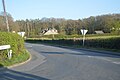
 Road junction on the B2067 - geograph.org.uk - 1722592.jpg 2,592 × 1,944; 1,021 KB
-
 Road south of Ruckinge Bridge - geograph.org.uk - 5840127.jpg 1,024 × 681; 261 KB
-
 Road to Ruckinge - geograph.org.uk - 3196874.jpg 2,256 × 1,496; 902 KB
-
 Rolling Fields near Weston's Wood - geograph.org.uk - 1722533.jpg 3,072 × 1,728; 1.34 MB
-
 Rosslie near Brisley Wood - geograph.org.uk - 2089463.jpg 3,072 × 2,304; 2.54 MB
-
 Roughstocks Wood - geograph.org.uk - 5327470.jpg 640 × 480; 239 KB
-
 Royal Military Canal - geograph.org.uk - 4329656.jpg 640 × 427; 66 KB
-
 Royal Military Canal - geograph.org.uk - 5840085.jpg 1,024 × 681; 265 KB
-
 Royal Military Canal - geograph.org.uk - 5840108.jpg 1,024 × 681; 248 KB
-
 Royal Military Canal - geograph.org.uk - 5840129.jpg 1,024 × 680; 188 KB
-
 Royal Military Canal - geograph.org.uk - 5840131.jpg 1,024 × 681; 181 KB
-
 Royal Military Canal - geograph.org.uk - 5840147.jpg 1,024 × 681; 186 KB
-
 Royal Military Canal - geograph.org.uk - 5844806.jpg 1,024 × 681; 206 KB
-
 Royal Military Canal - geograph.org.uk - 5844811.jpg 1,024 × 681; 189 KB
-
 Royal Military Canal - geograph.org.uk - 5844828.jpg 1,024 × 681; 147 KB
-
 Royal Military Canal - geograph.org.uk - 5844837.jpg 1,024 × 681; 150 KB
-
 Royal Military Canal and path - geograph.org.uk - 3629705.jpg 3,696 × 2,448; 2.33 MB
-
 Royal Military Canal and path - geograph.org.uk - 5840138.jpg 1,024 × 681; 192 KB
-
 Royal Military Canal and path - geograph.org.uk - 5840152.jpg 1,024 × 681; 214 KB
-
 Royal Military Canal and path - geograph.org.uk - 5844803.jpg 1,024 × 681; 199 KB
-
 Royal Military Canal at Ruckinge - geograph.org.uk - 5059728.jpg 4,211 × 2,800; 7.65 MB
-
 Royal Military Canal near Ruckinge - geograph.org.uk - 3692240.jpg 4,000 × 3,000; 4.16 MB
-
 Royal Military Canal near Ruckinge - geograph.org.uk - 3692246.jpg 4,000 × 3,000; 4.08 MB


_-_geograph.org.uk_-_1722747.jpg)


_-_geograph.org.uk_-_1721158.jpg)


_-_geograph.org.uk_-_1722696.jpg)


