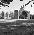
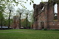
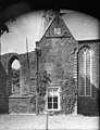
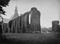
Category:Ruïnekerk, Bergen
Jump to navigation
Jump to search
| Object location | | View all coordinates using: OpenStreetMap |
|---|
church in Bergen (North Holland), Netherlands  | |||||
| Upload media | |||||
| Instance of | |||||
|---|---|---|---|---|---|
| Location | Bergen, North Holland, Netherlands | ||||
| Street address |
| ||||
| Architect |
| ||||
| Has part(s) | |||||
| Heritage designation |
| ||||
| Inception |
| ||||
| Significant event |
| ||||
| Religion or worldview | |||||
 | |||||
Kerk:
|
This is a category about rijksmonument number 9041
|
Toren:
|
This is a category about rijksmonument number 9042
|
| Address |
|
Nederlands: Restauratie in 1955-1961 door Kees Royaards
Subcategories
This category has the following 2 subcategories, out of 2 total.
I
- Interior of Ruïnekerk, Bergen (10 F)
Media in category "Ruïnekerk, Bergen"
The following 133 files are in this category, out of 133 total.
-
 16e eeuws, Bestanddeelnr 906-4706.jpg 4,237 × 3,304; 2.56 MB
-
 Battle bergen.jpg 600 × 434; 49 KB
-
 Bergen (Noord-Holland), foto 1 Jacob Olie (max res).jpg 5,045 × 6,911; 7.09 MB
-
 Bergen - Dorpsstraat - View NE towards Ruïnekerk.jpg 6,040 × 4,026; 22.16 MB
-
 Bergen - Dorpsstraat - View through Kerkstraat towards Ruïnekerk.jpg 5,902 × 3,934; 15.82 MB
-
 Bergen - Hoflaan - View NE.jpg 6,006 × 4,004; 22.17 MB
-

-
 Bergen - Oude Prinsweg - Hoflaan - View ENE on Ruïnekerk.jpg 5,856 × 3,904; 21.74 MB
-
 Bergen - Oude Prinsweg - Hoflaan - View NNE on Ruïnekerk.jpg 5,758 × 3,838; 19.73 MB
-
 Bergen - Oude Prinsweg - Raadhuisstraat - Ruïnekerk - View South.jpg 4,016 × 6,024; 23.62 MB
-
 Bergen - Oude Prinsweg - View East on Ruïnekerk.jpg 5,758 × 3,838; 19.5 MB
-
 Bergen - Oude Prinsweg - View SE on 15th Century Ruïnekerk.jpg 6,006 × 4,004; 19.75 MB
-
 Bergen - Oude Prinsweg - View SW on Ruïnekerk.jpg 5,872 × 3,914; 18.28 MB
-
 Bergen - Raadhuisstraat - Ruïnekerk - ICE Photocompilation Viewing from East to WSW.jpg 5,193 × 1,982; 10.32 MB
-

-
 Bergen - Raadhuisstraat - Ruïnekerk - View ESE.jpg 5,946 × 3,964; 18.63 MB
-
 Bergen - Raadhuisstraat - Ruïnekerk - View SE.jpg 5,800 × 3,866; 17.84 MB
-
 Bergen - Raadhuisstraat - Ruïnekerk - View South I.jpg 6,040 × 4,026; 20.76 MB
-
 Bergen - Raadhuisstraat - Ruïnekerk - View South II.jpg 3,810 × 5,716; 22.29 MB
-
 Bergen - Raadhuisstraat - Ruïnekerk - View SW.jpg 5,856 × 3,904; 17.73 MB
-
 Bergen - Raadhuisstraat - View NNE on 15th Century Ruïnekerk.jpg 5,728 × 3,818; 19.63 MB
-
 Bergen, Ruïnekerk foto3 2009-04-05 13.35.JPG 3,072 × 2,304; 2.95 MB
-
 Bergen-ruinekerk-rolandholst 1.jpg 4,256 × 2,828; 910 KB
-
 Bergen-ruinekerk-rolandholst 2.jpg 4,256 × 2,832; 1.19 MB
-
 BergenHervKerk.jpg 3,600 × 2,391; 5.41 MB
-
 BergenHervKerkdet.jpg 4,184 × 2,779; 6.48 MB
-
 BergenKerkToren.jpg 4,008 × 2,662; 8.66 MB
-
 BergenRuineKerk.jpg 3,939 × 2,616; 8.17 MB
-
 BergenRuineKerkdet.jpg 4,288 × 2,848; 6.43 MB
-
 Bouwval kerk vanuit het westen - Bergen - 20031324 - RCE.jpg 1,200 × 886; 193 KB
-
 Bouwval kerk vanuit het zuid-westen - Bergen - 20031322 - RCE.jpg 1,200 × 887; 231 KB
-
 Bouwval kerk vanuit het zuid-westen - Bergen - 20031323 - RCE.jpg 1,200 × 883; 226 KB
-
 De kerkruïne te Bergen, RP-T-1967-3.jpg 5,684 × 4,443; 3.86 MB
-
 De Ruine en Kerk (Bergen NH) 16e eeuw, Bestanddeelnr 906-4705.jpg 3,553 × 2,751; 2.15 MB
-
 De Ruine en Kerk (Bergen NH) 16e eeuw, restauratie dit jaar, Bestanddeelnr 906-4707.jpg 3,553 × 2,751; 2.04 MB
-
 De Ruine en Kerk (Bergen NH) 16e eeuw, restauratie dit jaar, Bestanddeelnr 906-4708.jpg 4,251 × 3,304; 2.78 MB
-
 De Ruine en Kerk (Bergen NH) 16e eeuw, restauratie dit jaar, Bestanddeelnr 906-4709.jpg 2,564 × 3,304; 1.51 MB
-
 De Ruine en Kerk (Bergen NH) 16e eeuw, restauratie dit jaar, Bestanddeelnr 906-4710.jpg 2,751 × 3,553; 1.93 MB
-
 De Ruïnekerk in Bergen, gezien naar het oosten - Regionaal Archief Alkmaar - FO1400001.jpg 3,595 × 5,058; 4.28 MB
-
 De Ruïnekerk in Bergen, gezien naar het oosten - Regionaal Archief Alkmaar - FO1400002.jpg 3,659 × 5,090; 3.09 MB
-
 De Ruïnekerk in Bergen, gezien naar het oosten - Regionaal Archief Alkmaar - FO1400003.jpg 3,667 × 5,002; 3.82 MB
-
 De Ruïnekerk in Bergen, gezien naar het oosten. - FO1400002 - RAA Bonda.jpg 3,659 × 5,090; 3.09 MB
-
 De Ruïnekerk in Bergen, gezien naar het oosten. - FO1400003 - RAA Bonda.jpg 3,667 × 5,002; 3.82 MB
-

-
 De Ruïnekerk in Bergen, vanuit het oosten - Regionaal Archief Alkmaar - FO1400004.jpg 3,603 × 5,066; 3.6 MB
-
 De Ruïnekerk in Bergen, vanuit het oosten. - FO1400004 - RAA Bonda.jpg 3,603 × 5,066; 3.59 MB
-
 Deel muur van ruïne - Bergen - 20323557 - RCE.jpg 1,200 × 836; 257 KB
-

-

-

-
 Exterieur GEDEELTE ZUIDGEVEL - Bergen - 20286914 - RCE.jpg 1,200 × 1,200; 405 KB
-
 Exterieur GRAFZERKEN TEGEN NOORDGEVEL - Bergen - 20286917 - RCE.jpg 1,197 × 1,200; 469 KB
-
 Exterieur GRAFZERKEN TEGEN NOORDGEVEL - Bergen - 20286918 - RCE.jpg 1,191 × 1,200; 496 KB
-
 Exterieur GRAFZERKEN TEGEN NOORDGEVEL - Bergen - 20286919 - RCE.jpg 1,193 × 1,200; 473 KB
-
 Exterieur INGANG WESTZIJDE - Bergen - 20286907 - RCE.jpg 1,200 × 1,199; 421 KB
-
 Exterieur NOORDER TRANSEPT - Bergen - 20286909 - RCE.jpg 1,193 × 1,200; 461 KB
-
 Exterieur OOSTGEVEL - Bergen - 20286910 - RCE.jpg 964 × 1,200; 335 KB
-
 Exterieur OOSTGEVEL - Bergen - 20286911 - RCE.jpg 946 × 1,200; 262 KB
-
 Exterieur OVERZICHT - Bergen - 20286906 - RCE.jpg 1,200 × 929; 246 KB
-
 Exterieur OVERZICHT ZUIDGEVEL - Bergen - 20286912 - RCE.jpg 1,200 × 953; 255 KB
-
 Exterieur POORT IN NOORDGEVEL - Bergen - 20286916 - RCE.jpg 1,172 × 1,200; 474 KB
-
 Exterieur POORT IN ZUIDGEVEL - Bergen - 20286915 - RCE.jpg 1,188 × 1,200; 475 KB
-
 Exterieur VIERINGTOREN - Bergen - 20286905 - RCE.jpg 1,200 × 1,195; 258 KB
-
 Exterieur WESTGEVEL - Bergen - 20286908 - RCE.jpg 956 × 1,200; 265 KB
-
 Exterieur ZUIDGEVEL - Bergen - 20286913 - RCE.jpg 1,200 × 953; 297 KB
-
 Gezicht op de Ruïnekerk in Bergen - Regionaal Archief Alkmaar - FO1400006.jpg 5,155 × 3,706; 3.92 MB
-
 Gezicht op de Ruïnekerk in Bergen. - FO1400006 - RAA Bonda.jpg 5,155 × 3,706; 3.92 MB
-
 Graven in de Ruïnekerk, Bergen.jpg 3,888 × 2,592; 6.73 MB
-
 Karke bargen.jpg 400 × 300; 140 KB
-
 Kerk en gedeelte van de ruïne - Bergen - 20031331 - RCE.jpg 1,200 × 827; 163 KB
-
 Kerken, ruines, Bergen, Bestanddeelnr 048-0341.jpg 3,273 × 2,160; 988 KB
-
 Kerkhofmuur, met N.H. Kerk - Bergen - 20031479 - RCE.jpg 1,200 × 1,200; 426 KB
-
 Kerkhofmuur, overzicht - Bergen - 20031480 - RCE.jpg 1,200 × 1,200; 514 KB
-
 Kerkruïne te Bergen, RP-T-1942-164-37(R).jpg 3,396 × 2,274; 1.07 MB
-
 Noord toegang tot de voormalige kerk - Bergen - 20031326 - RCE.jpg 851 × 1,200; 362 KB
-
 Noord zijde van de kerkruïne - Bergen - 20031329 - RCE.jpg 1,200 × 837; 227 KB
-
 Noord zijde van de kerkruïne - Bergen - 20031330 - RCE.jpg 1,200 × 837; 217 KB
-
 Noord-oost aanzicht - Bergen - 20031327 - RCE.jpg 860 × 1,200; 198 KB
-
 Noord-zijde van de zuid muur der voormalige kerk - Bergen - 20031332 - RCE.jpg 1,200 × 841; 248 KB
-
 Nordholland Bergen 2004 200001.jpg 1,728 × 2,304; 853 KB
-
 Overzicht - Bergen - 20031341 - RCE.jpg 1,200 × 894; 207 KB
-
 Overzicht ruïne - Bergen - 20031343 - RCE.jpg 1,190 × 1,200; 323 KB
-

-
 Overzicht Ruïnekerk, Bergen.jpg 3,888 × 2,592; 4.15 MB
-
 Portaaldoorkijk in ruïne - Bergen - 20031340 - RCE.jpg 894 × 1,200; 356 KB
-

-

-
 Ruinekerk te Bergen, Noord-Holland, Bestanddeelnr 918-6388.jpg 2,561 × 2,625; 1.6 MB
-
 Ruinekerk te Bergen, Noord-Holland, Bestanddeelnr 918-6389.jpg 2,569 × 2,637; 1.76 MB
-
 Ruinekerk te Bergen, Noord-Holland, Bestanddeelnr 918-6390.jpg 2,561 × 2,625; 2.26 MB
-
 Ruinekerk te Bergen, Noord-Holland, Bestanddeelnr 918-6391.jpg 2,561 × 2,625; 1.71 MB
-
 Ruinekerk te Bergen, Noord-Holland, Bestanddeelnr 918-6392.jpg 2,561 × 2,625; 1.68 MB
-
 Ruinekerk te Bergen, Noord-Holland, Bestanddeelnr 918-6393.jpg 2,561 × 2,625; 1.49 MB
-
 Ruinekerk te Bergen, Noord-Holland, Bestanddeelnr 918-6394.jpg 2,561 × 2,625; 2.07 MB
-
 RuinekerkBergen(gwz).JPG 4,896 × 3,264; 6.33 MB
-
 Ruïne - Bergen - 20031313 - RCE.jpg 1,200 × 836; 165 KB
-
 Ruïne - Bergen - 20031314 - RCE.jpg 905 × 1,200; 251 KB
-
 Ruïne - Bergen - 20031315 - RCE.jpg 1,200 × 804; 254 KB
-
 Ruïne - Bergen - 20031316 - RCE.jpg 809 × 1,200; 223 KB
-
 Ruïne - Bergen - 20031317 - RCE.jpg 838 × 1,200; 234 KB
-
 Ruïne - Bergen - 20031318 - RCE.jpg 835 × 1,200; 239 KB
-
 Ruïne - Bergen - 20031319 - RCE.jpg 922 × 1,200; 252 KB
-
 Ruïne - Bergen - 20031320 - RCE.jpg 929 × 1,200; 247 KB
-
 Ruïne - Bergen - 20031339 - RCE.jpg 1,200 × 894; 202 KB
-
 Ruïne - Bergen - 20323529 - RCE.jpg 1,200 × 835; 308 KB
-
 Ruïne der kerk naar het westen - Bergen - 20031321 - RCE.jpg 1,200 × 864; 211 KB
-
 Ruïnekerk (19733906522).jpg 3,603 × 5,066; 2.4 MB
-
 Ruïnekerk (19745778191).jpg 3,659 × 5,090; 2.18 MB
-
 Ruïnekerk (19745778651).jpg 3,595 × 5,058; 2.81 MB
-
 Ruïnekerk Bergen (19554497509).jpg 5,155 × 3,706; 2.55 MB
-
 Ruïnekerk Bergen (19733905602).jpg 3,627 × 5,138; 2.52 MB
-
 Ruïnekerk Bergen (19745777701).jpg 3,667 × 5,002; 2.52 MB
-
 Ruïnekerk Bergen (27488222684).jpg 2,019 × 1,627; 739 KB
-
 Ruïnekerk, Bergen 10.jpg 4,608 × 3,456; 6.66 MB
-
 Ruïnekerk, Bergen 12.jpg 2,934 × 4,489; 4.21 MB
-
 Ruïnekerk, Bergen 2.jpg 4,459 × 3,403; 6.61 MB
-
 Ruïnekerk, Bergen 3.jpg 4,319 × 3,418; 5.53 MB
-
 Ruïnekerk, Bergen 4.jpg 3,992 × 3,454; 6.74 MB
-
 Ruïnekerk, Bergen 5.jpg 2,977 × 4,248; 4.05 MB
-
 Ruïnekerk, Bergen 6.jpg 4,608 × 2,923; 5.76 MB
-
 Ruïnekerk, Bergen 7.jpg 4,608 × 3,139; 5.37 MB
-
 Ruïnekerk, Bergen 8.jpg 3,262 × 4,126; 5.42 MB
-
 Ruïnekerk, Bergen 9.jpg 3,204 × 4,367; 5.62 MB
-
 Toren Ruïnekerk, Bergen.jpg 2,592 × 3,888; 2.97 MB
-

-

-

-
 Vanuit het zuid-oosten - Bergen - 20031336 - RCE.jpg 1,200 × 874; 272 KB
-

-
 Zilveren schaal - Bergen - 20031338 - RCE.jpg 1,062 × 1,200; 411 KB
-
 Zuid-west zijde, exterieur - Bergen - 20031342 - RCE.jpg 1,200 × 809; 307 KB
-
 Zuid-zijde - Bergen - 20031328 - RCE.jpg 1,200 × 849; 194 KB
-
 Zuid-zijde van de noord muur der voormalige kerk - Bergen - 20031325 - RCE.jpg 1,200 × 865; 248 KB


,_foto_1_Jacob_Olie_(max_res).jpg)


_16e_eeuw,_Bestanddeelnr_906-4705.jpg)
_16e_eeuw,_restauratie_dit_jaar,_Bestanddeelnr_906-4707.jpg)
_16e_eeuw,_restauratie_dit_jaar,_Bestanddeelnr_906-4708.jpg)
_16e_eeuw,_restauratie_dit_jaar,_Bestanddeelnr_906-4709.jpg)
_16e_eeuw,_restauratie_dit_jaar,_Bestanddeelnr_906-4710.jpg)


,_RP-P-OB-83.960.jpg)


.jpg)


.JPG)


.jpg)
.jpg)
.jpg)
.jpg)
.jpg)
.jpg)
.jpg)


