Category:Royal Sutton Coldfield
Jump to navigation
Jump to search
town, suburb of Birmingham, England  Ajuntament | |||||
| Upload media | |||||
| Instance of | |||||
|---|---|---|---|---|---|
| Location | Birmingham, West Midlands, England | ||||
 | |||||
Royal Sutton Coldfield is a royal town and former municipal borough, which was absorbed into the City of Birmingham in 1974. Features of the town include Holy Trinity Church, Sutton Town Hall and Sutton Park.
Subcategories
This category has the following 35 subcategories, out of 35 total.
B
- Banners Gate Road Substation (3 F)
F
- Faircough Homes substation (3 F)
G
- Good Hope Hospital (3 F)
- Gracechurch Centre (3 F)
M
- Moat House, Sutton Coldfield (1 F)
N
- New Hall Manor, Sutton Coldfield (10 F)
P
- Post box B73 259D (3 F)
- Post box B73 326 (3 F)
- Post box B73 691D (3 F)
S
- St Columba's Banners Gate (12 F)
- Sutton Coldfield Town Hall (11 F)
- Sutton Coldfield War Memorial (15 F)
W
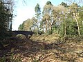
- Water Orton Bridge (10 F)
- Wylde Green railway station (6 F)
- Wyndley Lane substation (6 F)
Media in category "Royal Sutton Coldfield"
The following 200 files are in this category, out of 1,245 total.
(previous page) (next page)-
 '3 hole golf course' - geograph.org.uk - 1164079.jpg 640 × 480; 125 KB
-
 'A delight of Buttercups' - geograph.org.uk - 4506665.jpg 640 × 475; 145 KB
-
 'Natural recycling' - geograph.org.uk - 1135358.jpg 575 × 426; 97 KB
-

-
 'The most useful shop in Walmley' - geograph.org.uk - 2948267.jpg 640 × 395; 92 KB
-
 'Together by design' - geograph.org.uk - 1614725.jpg 505 × 360; 68 KB
-
 15th Sutton Coldfield Scout Group HQ - geograph.org.uk - 3159099.jpg 1,024 × 768; 441 KB
-
-
 18th and 19th holes, Pype Hayes - geograph.org.uk - 366742.jpg 640 × 480; 124 KB
-
 1955 Rail Disaster Memorial - geograph.org.uk - 5349981.jpg 4,128 × 2,322; 2.44 MB
-

-
 A ford on Ryknield Street - geograph.org.uk - 1755114.jpg 640 × 480; 81 KB
-

-
 A knoll in Sutton Park southeast - geograph.org.uk - 4638377.jpg 640 × 480; 82 KB
-
 A path across the heath in Sutton Park - geograph.org.uk - 1755126.jpg 640 × 480; 140 KB
-
 A pylon south of the track - geograph.org.uk - 6206118.jpg 2,000 × 1,330; 1.85 MB
-
 A road in Sutton Park, Sutton Coldfield - geograph.org.uk - 4264670.jpg 1,024 × 683; 240 KB
-

-

-

-
 A38 and Subway - geograph.org.uk - 2266356.jpg 1,600 × 1,200; 564 KB
-
 A38 near M6 Toll 3 - geograph.org.uk - 1863106.jpg 720 × 960; 101 KB
-
 A38 Subway - geograph.org.uk - 2266370.jpg 1,200 × 1,600; 828 KB
-

-

-
-

-

-
 A5127 Birmingham Road Wylde Green - geograph.org.uk - 5138832.jpg 640 × 484; 70 KB
-
 Access drive, Parkhall - geograph.org.uk - 2388311.jpg 3,648 × 2,048; 3.02 MB
-

-
 Across Brassington Avenue, Sutton Coldfield - geograph.org.uk - 6071087.jpg 1,024 × 614; 1,002 KB
-

-
 Across Parkhall Wood - geograph.org.uk - 2388345.jpg 2,736 × 3,648; 4.2 MB
-

-

-
 All Saints Parish Church, Four Oaks - geograph.org.uk - 4637019.jpg 640 × 480; 97 KB
-
 All-weather sports area, Sutton Park - geograph.org.uk - 1859254.jpg 640 × 480; 562 KB
-
 Allesley Close Sutton Coldfield - geograph.org.uk - 3950640.jpg 640 × 438; 74 KB
-

-
 Almost an Art Gallery - geograph.org.uk - 5350024.jpg 4,128 × 2,322; 2.93 MB
-
 Along Water Orton bridge - geograph.org.uk - 5969632.jpg 2,285 × 1,714; 1.54 MB
-

-

-
 Anderton Close Four Oaks, Another Delivery - panoramio.jpg 1,920 × 1,080; 797 KB
-
 Anglers' rods at Bracebridge Pool, Sutton Park (geograph 6844876).jpg 2,592 × 1,936; 1.67 MB
-
 Annexe, Fox Hollies - geograph.org.uk - 2266320.jpg 1,024 × 575; 237 KB
-
 Antiques showroom, Birmingham Road - geograph.org.uk - 3666921.jpg 640 × 480; 326 KB
-
 Anton Drive, Walmley - geograph.org.uk - 6109858.jpg 1,024 × 768; 136 KB
-
 Approach to footpath on Penns Lane - geograph.org.uk - 1670127.jpg 800 × 600; 162 KB
-
 Approach to Sutton Coldfield - geograph.org.uk - 6192750.jpg 2,448 × 3,264; 1.26 MB
-

-
 Arable field near Watford Gap - geograph.org.uk - 1821204.jpg 1,500 × 1,000; 264 KB
-
 Archaeological Marker - geograph.org.uk - 3414212.jpg 800 × 600; 182 KB
-
 Arden Drive, Falcon Lodge - geograph.org.uk - 6109100.jpg 1,024 × 768; 127 KB
-
 Area of dead scrub - geograph.org.uk - 6242336.jpg 6,000 × 4,000; 7.33 MB
-
 Arriva bus 2743 (LF02 PLU), 29 September 2012.jpg 4,320 × 3,240; 4.66 MB
-
 Art Deco frontages, Maney Corner - geograph.org.uk - 3666914.jpg 640 × 480; 336 KB
-
 Arthur House - geograph.org.uk - 5611276.jpg 6,000 × 4,000; 7.22 MB
-
 Arthur Terry School logo new.jpg 2,175 × 649; 258 KB
-
 Arthur Terry School, by night - geograph.org.uk - 2103475.jpg 3,648 × 2,736; 2.1 MB
-

-
 Ascending Wishaw Lane towards Over Green - geograph.org.uk - 4676361.jpg 800 × 658; 150 KB
-
 Asda hypermarket at Minworth - geograph.org.uk - 6169427.jpg 6,000 × 4,000; 7.27 MB
-
 Ashfurlong Medical Centre, Tamworth Road - geograph.org.uk - 2106813.jpg 1,600 × 1,200; 481 KB
-

-
 Astor House, Mere Green - geograph.org.uk - 5441539.jpg 1,024 × 768; 121 KB
-

-
 Autumnal Sutton Coldfield - geograph.org.uk - 2164121.jpg 2,112 × 2,816; 1.79 MB
-
 Autumnal walk along Fox Hill Road - geograph.org.uk - 2104530.jpg 1,600 × 1,200; 985 KB
-
 Backroot Bistro - geograph.org.uk - 5814616.jpg 6,000 × 4,000; 4.74 MB
-
 Badgers Bank Road, Sutton Coldfield - geograph.org.uk - 5686433.jpg 800 × 591; 108 KB
-

-
 Bakers Lane - geograph.org.uk - 3418928.jpg 640 × 480; 70 KB
-

-

-

-
 Banbury United v Sutton Coldfield Town (8114392687).jpg 2,048 × 1,536; 2.21 MB
-
 Banbury United v Sutton Coldfield Town (8114396313).jpg 2,048 × 1,536; 1.93 MB
-
 Banbury United v Sutton Coldfield Town (8114402872).jpg 2,048 × 1,536; 2.31 MB
-
 Banbury United v Sutton Coldfield Town (8114403972).jpg 1,611 × 1,229; 1.57 MB
-
 Bandstand on Harvest Fields - geograph.org.uk - 5645895.jpg 6,000 × 4,000; 6.96 MB
-

-

-
 Banners Gate Road - geograph.org.uk - 1871827.jpg 640 × 480; 84 KB
-
 Barker Road - geograph.org.uk - 5640688.jpg 6,000 × 4,000; 5.96 MB
-
 Barker Road - geograph.org.uk - 974712.jpg 640 × 480; 93 KB
-
 Barnsbury Avenue, Sutton Coldfield - geograph.org.uk - 1762994.jpg 922 × 692; 185 KB
-
 Barrier between two estates - geograph.org.uk - 5610750.jpg 6,000 × 4,000; 4.88 MB
-
-
 Becket Close - geograph.org.uk - 5943125.jpg 1,024 × 680; 231 KB
-
 Bedford Road Sutton Coldfield - geograph.org.uk - 5673817.jpg 640 × 480; 95 KB
-
 Bee My Honey Bear - geograph.org.uk - 5481701.jpg 600 × 800; 130 KB
-
 Beech Hill Grange Nursing Home - geograph.org.uk - 1634063.jpg 640 × 480; 97 KB
-

-
 Beeches Walk, Sutton Coldfield - geograph.org.uk - 2408533.jpg 3,648 × 2,736; 2.72 MB
-

-
 Beggars Bush Crossroads. - geograph.org.uk - 1139825.jpg 640 × 433; 40 KB
-
 Benchmark in Lichfield Road - geograph.org.uk - 4181459.jpg 2,560 × 1,920; 1.03 MB
-
 Berryfields Road, Walmley - geograph.org.uk - 6109840.jpg 1,024 × 768; 260 KB
-
 Beside Plants Brook - geograph.org.uk - 1738592.jpg 768 × 576; 172 KB
-
 Beside Westwood Coppice - geograph.org.uk - 1755096.jpg 640 × 480; 159 KB
-

-

-

-

-

-
 Birmingham Road - geograph.org.uk - 5481692.jpg 800 × 600; 198 KB
-
 Birmingham Road, Sutton Coldfield - geograph.org.uk - 4097119.jpg 3,488 × 2,616; 2.14 MB
-
 Birmingham Road, Wylde Green - geograph.org.uk - 4097196.jpg 3,488 × 2,616; 2.18 MB
-
 Birmingham ^ Fazeley Canal at Minworth - geograph.org.uk - 4682046.jpg 800 × 560; 137 KB
-

-
 Birmingham ^ Fazeley Canal near Minworth - geograph.org.uk - 4682036.jpg 800 × 607; 139 KB
-

-

-

-
 Birmingham ^ Fazeley Canal, Minworth - geograph.org.uk - 3137811.jpg 640 × 480; 88 KB
-

-

-

-
 Birmingham, UK - panoramio (114).jpg 1,600 × 1,200; 317 KB
-
 Birmingham, UK - panoramio (115).jpg 1,600 × 1,200; 480 KB
-
 Birmingham, UK - panoramio (116).jpg 1,600 × 1,200; 292 KB
-
 Birmingham, UK - panoramio (117).jpg 1,200 × 1,600; 501 KB
-
 Birmingham, UK - panoramio (118).jpg 1,200 × 1,600; 495 KB
-
 Birmingham, UK - panoramio (119).jpg 1,200 × 1,600; 467 KB
-
 Birmingham, UK - panoramio (120).jpg 1,600 × 1,200; 377 KB
-
 Bishops Way, Sutton Coldfield - geograph.org.uk - 5689673.jpg 800 × 574; 84 KB
-
 Blackroot Pool - geograph.org.uk - 5814611.jpg 5,713 × 3,807; 3.99 MB
-
 Blackroot Pool - geograph.org.uk - 6242353.jpg 6,000 × 4,000; 4.78 MB
-
 Blackroot Road - geograph.org.uk - 6242281.jpg 6,000 × 4,000; 4.85 MB
-
 Blackroot Road, Four Oaks - geograph.org.uk - 4097021.jpg 3,488 × 2,616; 2.16 MB
-

-
 Blakemore Drive, Sutton Coldfield - geograph.org.uk - 1877429.jpg 640 × 480; 94 KB
-
 Blocks of flats on Lichfield Road - geograph.org.uk - 5640695.jpg 6,000 × 4,000; 7.05 MB
-
 Bluebellwood Close, Walmley - geograph.org.uk - 6109643.jpg 1,024 × 768; 197 KB
-
 Boldmere Bear - geograph.org.uk - 5481644.jpg 600 × 800; 146 KB
-
 Boldmere Gate View - geograph.org.uk - 5480891.jpg 800 × 600; 102 KB
-

-
 Boswell Road, Sutton Coldfield - geograph.org.uk - 4097043.jpg 3,488 × 2,616; 2.16 MB
-
 Bovey Croft, Walmley - geograph.org.uk - 6109874.jpg 1,024 × 768; 161 KB
-
 Bowling Green, South Parade - geograph.org.uk - 3658599.jpg 640 × 480; 404 KB
-
 Bracebridge, Sutton Coldfield, England - Flickr - cattan2011.jpg 4,000 × 3,000; 4.89 MB
-
 Brassington Avenue, Sutton Coldfield - geograph.org.uk - 1599453.jpg 480 × 640; 89 KB
-
 Brassington Avenue, Sutton Coldfield - geograph.org.uk - 1599468.jpg 480 × 640; 79 KB
-
 Braunston Close, Walmley (1) - geograph.org.uk - 6109143.jpg 1,024 × 768; 168 KB
-
 Braunston Close, Walmley (2) - geograph.org.uk - 6109155.jpg 1,024 × 768; 176 KB
-
 Brentnall Drive, Mere Green - geograph.org.uk - 5441545.jpg 1,024 × 768; 161 KB
-
 Briar Cottage, Kenelm Road - geograph.org.uk - 2103463.jpg 1,600 × 1,200; 828 KB
-
 Brick Bridge on the Sutton Park Line - geograph.org.uk - 2400099.jpg 800 × 531; 172 KB
-
 Brick Bridge on the Sutton Park Line - geograph.org.uk - 2400156.jpg 800 × 531; 134 KB
-
 Brick Wall and Graffiti - geograph.org.uk - 2388503.jpg 3,648 × 2,048; 1.97 MB
-
 Bridge 121 near Castle Bromwich - geograph.org.uk - 2388484.jpg 2,736 × 3,648; 3.32 MB
-
 Bridge 39, Sutton Park freight line - geograph.org.uk - 2266164.jpg 1,200 × 1,600; 263 KB
-
-
 Bridge on the Sutton Park Line - geograph.org.uk - 2400094.jpg 800 × 531; 152 KB
-

-
 Bridge over River Tame - geograph.org.uk - 2388451.jpg 3,648 × 2,736; 3.25 MB
-
 British Home Stores 1 - Sutton Coldfield, West Midlands - geograph.org.uk - 4987898.jpg 3,072 × 2,304; 1.46 MB
-
 British Home Stores 2 - Sutton Coldfield, West Midlands - geograph.org.uk - 4987904.jpg 2,832 × 2,304; 1.51 MB
-
 British Home Stores 3 - Sutton Coldfield, West Midlands - geograph.org.uk - 4987914.jpg 3,072 × 2,304; 1.82 MB
-
 British Home Stores 4 - Sutton Coldfield, West Midlands - geograph.org.uk - 4987923.jpg 3,072 × 2,304; 1.53 MB
-
 British Home Stores 5 - Sutton Coldfield, West Midlands - geograph.org.uk - 4987928.jpg 3,072 × 2,304; 1.79 MB
-
 Brook valley and drive, Sutton Park - geograph.org.uk - 1859851.jpg 640 × 480; 521 KB
-

-

-

-
 Bungalows on Orphanage Road - geograph.org.uk - 1632801.jpg 640 × 480; 79 KB
-

-
 Bus on Weeford Road, Roughley - geograph.org.uk - 5441566.jpg 1,024 × 768; 250 KB
-
 Bus Stop on Lichfield Road - geograph.org.uk - 1821205.jpg 1,500 × 990; 154 KB
-
 Buses on South Parade, Sutton Coldfield (1) - geograph.org.uk - 4830107.jpg 1,024 × 748; 120 KB
-
 Buses on South Parade, Sutton Coldfield (2) - geograph.org.uk - 4830112.jpg 1,024 × 743; 127 KB
-
 Butlers Arms, Sutton Coldfield - geograph.org.uk - 5684153.jpg 800 × 663; 136 KB
-
 Butlers Lane - geograph.org.uk - 6064684.jpg 4,032 × 3,024; 5.28 MB
-
 Butlers Lane - geograph.org.uk - 6064697.jpg 4,032 × 3,024; 3.68 MB
-

-
 Butlers Lane Station - geograph.org.uk - 6064676.jpg 4,032 × 3,024; 6.73 MB
-
 Bypass A38 - geograph.org.uk - 2799737.jpg 3,648 × 2,048; 1.92 MB
-

-

-
 Canopies to shops, The Parade - geograph.org.uk - 3653504.jpg 640 × 480; 298 KB
-
 Car park at Mere Green - geograph.org.uk - 5611313.jpg 6,000 × 4,000; 4.87 MB
-
 Car Park, New Hall Valley - geograph.org.uk - 2490733.jpg 2,736 × 3,648; 2.84 MB
-

-
 Central garden in Sutton Coldfield - geograph.org.uk - 5629242.jpg 6,000 × 4,000; 7.22 MB
-
 Central Ground, Coles Lane - geograph.org.uk - 1247688.jpg 640 × 480; 67 KB
-
 Charles Court, Walmley - geograph.org.uk - 6109850.jpg 1,024 × 768; 149 KB
-
 Chase Farm, Weeford Road - geograph.org.uk - 2104534.jpg 1,600 × 1,200; 597 KB
-
 Chase Farm, Weeford Road, Roughley (1) - geograph.org.uk - 5441571.jpg 1,024 × 768; 162 KB
-
 Chase Farm, Weeford Road, Roughley (2) - geograph.org.uk - 5441595.jpg 1,024 × 768; 151 KB
-
 Chester Road heading north-west - geograph.org.uk - 4306843.jpg 1,500 × 999; 206 KB
-
 Chester Road heading north-west - geograph.org.uk - 4306870.jpg 1,500 × 999; 185 KB
-
 Chester Road near Oscott College - geograph.org.uk - 4306850.jpg 1,500 × 999; 179 KB
-
 Chester Road North heading to Banners Gate - geograph.org.uk - 4306876.jpg 1,500 × 999; 170 KB
-
 Chester Road North passing Westwood Coppice - geograph.org.uk - 4306881.jpg 1,500 × 999; 202 KB
-
 Chester Road North passing Westwood Coppice - geograph.org.uk - 4306884.jpg 1,500 × 999; 182 KB
-

-

-
 Cheswood Drive - geograph.org.uk - 6169438.jpg 6,000 × 4,000; 4.19 MB


_(14597656509).jpg)


.jpg)


.jpg)


,_29_September_2012.jpg)


.jpg)
.jpg)
.jpg)
.jpg)


.jpg)
.jpg)
.jpg)
.jpg)
.jpg)
.jpg)
.jpg)


_-_geograph.org.uk_-_6109143.jpg)
_-_geograph.org.uk_-_6109155.jpg)


_-_geograph.org.uk_-_4830107.jpg)
_-_geograph.org.uk_-_4830112.jpg)


_-_geograph.org.uk_-_5441571.jpg)
_-_geograph.org.uk_-_5441595.jpg)


