Category:Round House (Aberdeen Harbour)
Jump to navigation
Jump to search
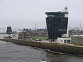
English: Round House in Aberdeen Harbour, Scotland. Other names: "Roundhouse", former Harbour Master's Station, Navigation Control Centre.
|
This is a category about listed building number 50941. |
Media in category "Round House (Aberdeen Harbour)"
The following 20 files are in this category, out of 20 total.
-
 Aberdeen Harbour - geograph.org.uk - 1272837.jpg 640 × 480; 96 KB
-
 Clock on Harbour Master's Station - geograph.org.uk - 595619.jpg 480 × 640; 70 KB
-
 Fishing Boat Leaving Aberdeen Harbour. - geograph.org.uk - 115650.jpg 634 × 432; 128 KB
-
 Footdee playpark under snow - geograph.org.uk - 133928.jpg 640 × 480; 77 KB
-
 Footdee, Aberdeen - geograph.org.uk - 1248060.jpg 640 × 426; 71 KB
-
 Former Pilot House, Footdee.jpg 1,427 × 1,544; 522 KB
-

-
 Harbour Master's Station, Footdee - geograph.org.uk - 595624.jpg 640 × 480; 63 KB
-

-

-
 New and Old Pilotage Offices - geograph.org.uk - 2008271.jpg 2,560 × 1,920; 1.7 MB
-
 Old and New at Fittie - geograph.org.uk - 487692.jpg 640 × 480; 81 KB
-
 Old Harbour Control (1425175872).jpg 1,536 × 2,048; 1.01 MB
-
 Old Harbour Control (1499309337).jpg 1,536 × 2,048; 1.43 MB
-
 Old Harbour Control (1500189234).jpg 1,536 × 2,048; 1.48 MB
-
 Old Harbour HQ (20412727581).jpg 4,998 × 3,332; 11.3 MB
-
 Old Marine Operations Centre - geograph.org.uk - 1958023.jpg 1,600 × 1,200; 602 KB
-
 Old Marine Operations Centre, Aberdeen - geograph.org.uk - 1958623.jpg 1,200 × 1,600; 665 KB
-
 Old Marine Operations Centre, Footdee - geograph.org.uk - 948434.jpg 640 × 480; 64 KB
-
 The Round House at Fittie. - geograph.org.uk - 111871.jpg 636 × 430; 90 KB


.jpg)
.jpg)
.jpg)
.jpg)


