Category:Rough Island, Comber
Jump to navigation
Jump to search
archaeological site | |||||
| Upload media | |||||
| Instance of | |||||
|---|---|---|---|---|---|
| Located in or next to body of water | |||||
 | |||||
Media in category "Rough Island, Comber"
The following 15 files are in this category, out of 15 total.
-
 Causeway to Rough Island (1) - geograph.org.uk - 775687.jpg 640 × 411; 84 KB
-
 Causeway to Rough Island (11) (geograph 2901251).jpg 640 × 373; 88 KB
-
 Causeway to Rough Island (13) - geograph.org.uk - 3056343.jpg 640 × 383; 100 KB
-
 Causeway to Rough Island (14) - geograph.org.uk - 3231363.jpg 640 × 352; 106 KB
-
 Causeway to Rough Island (2) - geograph.org.uk - 775690.jpg 640 × 403; 91 KB
-
 Causeway to Rough Island (3) - geograph.org.uk - 1042730.jpg 640 × 391; 66 KB
-
 Causeway to Rough Island (4) - geograph.org.uk - 1567267.jpg 640 × 415; 83 KB
-
 Causeway to Rough Island - geograph.org.uk - 1143010.jpg 640 × 409; 239 KB
-

-
 Causeway to Rough Island, Comber (February 2019) - geograph.org.uk - 6073845.jpg 1,014 × 503; 206 KB
-
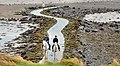
 Path and shore, Rough Island - geograph.org.uk - 775703.jpg 640 × 381; 100 KB
-
 Rough Island - geograph.org.uk - 1143005.jpg 640 × 349; 184 KB
-
 The Loughshore, Rough Island - geograph.org.uk - 775695.jpg 640 × 433; 106 KB
-
 The view from Scrabo (5) - geograph.org.uk - 1295670.jpg 640 × 375; 72 KB
-
 Warning sign near Comber - geograph.org.uk - 775680.jpg 640 × 405; 68 KB
_-_geograph.org.uk_-_775687.jpg)
_(geograph_2901251).jpg)
_-_geograph.org.uk_-_3056343.jpg)
_-_geograph.org.uk_-_3231363.jpg)
_-_geograph.org.uk_-_775690.jpg)
_-_geograph.org.uk_-_1042730.jpg)
_-_geograph.org.uk_-_1567267.jpg)

_-_geograph.org.uk_-_5076484.jpg)
_-_geograph.org.uk_-_6073845.jpg)


_-_geograph.org.uk_-_1295670.jpg)
