Category:Rothley, Northumberland
Jump to navigation
Jump to search
village and civil parish in Northumberland, UK  | |||||
| Upload media | |||||
| Instance of | |||||
|---|---|---|---|---|---|
| Location | Northumberland, North East England, England | ||||
 | |||||
Subcategories
This category has the following 4 subcategories, out of 4 total.
Media in category "Rothley, Northumberland"
The following 200 files are in this category, out of 316 total.
(previous page) (next page)-
 Airstrip on Ewesley Fell - geograph.org.uk - 4936887.jpg 1,600 × 1,200; 353 KB
-
 Arable land near Gallows Hill - geograph.org.uk - 4027827.jpg 1,024 × 769; 354 KB
-
 Arable land north of Scot's Gap - geograph.org.uk - 3657120.jpg 2,432 × 1,543; 604 KB
-
 Autumn reflections - geograph.org.uk - 2138469.jpg 640 × 480; 178 KB
-
 B6342 - geograph.org.uk - 1549519.jpg 405 × 640; 115 KB
-
 B6342 heading north - geograph.org.uk - 3186964.jpg 640 × 480; 80 KB
-
 B6342 heading north - geograph.org.uk - 3187679.jpg 640 × 480; 93 KB
-
 B6342 heading north towards Rothbury - geograph.org.uk - 3187695.jpg 640 × 480; 75 KB
-
 B6342 heading west - geograph.org.uk - 3186981.jpg 640 × 480; 66 KB
-
 B6342 heading west - geograph.org.uk - 3186992.jpg 640 × 480; 113 KB
-
 B6342 north of Cambo - geograph.org.uk - 2759168.jpg 640 × 480; 75 KB
-
 B6342 south of Gallows Hill - geograph.org.uk - 4027843.jpg 1,024 × 769; 332 KB
-
 Beech trees on old boundary near Gallows Hill - geograph.org.uk - 4027808.jpg 1,024 × 768; 378 KB
-
 Birches, Harwood Forest - geograph.org.uk - 4657197.jpg 800 × 600; 587 KB
-
 Blocked woodland track - geograph.org.uk - 3187014.jpg 640 × 480; 141 KB
-

-
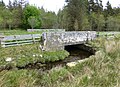
 Bridge on Rothbury Railway over Hart Burn - geograph.org.uk - 4024836.jpg 1,024 × 768; 326 KB
-
 Bridge over the Hart Burn - geograph.org.uk - 1355138.jpg 640 × 480; 70 KB
-
 Bridge over the old Rothbury line - geograph.org.uk - 2759309.jpg 640 × 480; 75 KB
-
 Bridges on the old 'Wannie Line' - geograph.org.uk - 5013709.jpg 1,600 × 1,191; 320 KB
-
 Bridleway east of Rothley - geograph.org.uk - 871165.jpg 640 × 427; 79 KB
-
 Bridleway towards Fairnley - geograph.org.uk - 3187015.jpg 640 × 480; 79 KB
-
 Broad beans, barley and poppies - geograph.org.uk - 5013767.jpg 1,600 × 1,179; 368 KB
-
 Bumble bee and marsh orchid - geograph.org.uk - 4025165.jpg 767 × 1,024; 284 KB
-
 Butterbur beside the Hart Burn - geograph.org.uk - 4661151.jpg 800 × 600; 603 KB
-
 Calves at Redpath Farm - geograph.org.uk - 1411541.jpg 640 × 480; 87 KB
-
 Cattle grazing south-west of Rothley Crags - geograph.org.uk - 4025137.jpg 1,024 × 768; 271 KB
-
 Chesters Burn - geograph.org.uk - 5013297.jpg 1,600 × 1,200; 476 KB
-
 Chesters Burn from the south - geograph.org.uk - 4027927.jpg 1,024 × 768; 284 KB
-

-
 Cottage, Hartington Hall - geograph.org.uk - 3187707.jpg 640 × 480; 72 KB
-
 Cottages at Herterton House Gardens - geograph.org.uk - 5013313.jpg 1,600 × 1,200; 454 KB
-
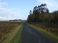
 Country road near Nunnykirk (1) - geograph.org.uk - 4671764.jpg 640 × 399; 110 KB
-
 Country road near Nunnykirk (2) - geograph.org.uk - 4671767.jpg 640 × 431; 118 KB
-
 Country road near Rothley - geograph.org.uk - 4670459.jpg 640 × 430; 151 KB
-
-

-

-

-
 Crossing of Fairnley Burn - geograph.org.uk - 4027893.jpg 1,024 × 768; 272 KB
-
 Crossing the Ford at Fairnley - geograph.org.uk - 114278.jpg 640 × 480; 139 KB
-
 Cyclist climbs hill - geograph.org.uk - 4936925.jpg 1,600 × 1,229; 422 KB
-
 Delf Burn downstream of Rothbury Railway - geograph.org.uk - 4025232.jpg 1,024 × 768; 321 KB
-
 Delf Burn in Delf Plantation - geograph.org.uk - 4025419.jpg 1,024 × 768; 466 KB
-
 Delf Burn upstream of Rothbury Railway - geograph.org.uk - 4025226.jpg 1,024 × 769; 381 KB
-
 Delf Burn west of disused Rothbury Railway - geograph.org.uk - 4025395.jpg 1,024 × 768; 301 KB
-
 Delf Plantation over Delf Burn - geograph.org.uk - 4025457.jpg 1,024 × 768; 504 KB
-

-

-
 Dismantled Rothbury Railway south of Delf Burn - geograph.org.uk - 4025202.jpg 1,024 × 767; 296 KB
-

-
 Disused limestone quarry north of Tut Hill - geograph.org.uk - 4025472.jpg 1,024 × 768; 288 KB
-
 Disused railway bridge - geograph.org.uk - 3187712.jpg 640 × 480; 97 KB
-
 Disused railway bridge near Rothley - geograph.org.uk - 2759293.jpg 640 × 480; 107 KB
-

-
 Disused railway bridge over Delf Burn - geograph.org.uk - 4025387.jpg 1,024 × 768; 441 KB
-
 Disused railway near Rothley - geograph.org.uk - 2759289.jpg 640 × 480; 70 KB
-

-
 Ditch north-east of Chesters - geograph.org.uk - 4027907.jpg 1,024 × 768; 372 KB
-
 Drain running into Hardwood Burn - geograph.org.uk - 4979475.jpg 1,600 × 1,194; 396 KB
-
 Edge of the Harwood Forest - geograph.org.uk - 3187408.jpg 640 × 480; 122 KB
-
 Ewesley ewes - geograph.org.uk - 4657288.jpg 800 × 600; 422 KB
-
 Ewesley Fell - geograph.org.uk - 4657284.jpg 800 × 600; 506 KB
-
 Faerie Glen - geograph.org.uk - 23962.jpg 480 × 640; 170 KB
-
 Fairnley - geograph.org.uk - 1549011.jpg 640 × 316; 73 KB
-
 Fairnley Burn - geograph.org.uk - 4027883.jpg 1,024 × 768; 353 KB
-
 Fairnley Farm - geograph.org.uk - 5013203.jpg 1,600 × 1,206; 256 KB
-
 Fairnley Plantation (as was) - geograph.org.uk - 1355128.jpg 640 × 480; 103 KB
-
 Fairnley Plantation - geograph.org.uk - 1549546.jpg 640 × 314; 79 KB
-
 Fairnley Plantation - geograph.org.uk - 4979037.jpg 1,600 × 1,200; 298 KB
-
 Farm access under old Rothbury Railway - geograph.org.uk - 4025103.jpg 1,024 × 768; 395 KB
-
 Farm access under old Rothbury Railway - geograph.org.uk - 4025122.jpg 1,024 × 768; 341 KB
-
 Farm building at Shildon Plantation - geograph.org.uk - 4025108.jpg 1,024 × 767; 218 KB
-
 Farm buildings near Gallows Hill - geograph.org.uk - 4027817.jpg 1,024 × 769; 416 KB
-
 Farm road to Fairnley - geograph.org.uk - 4027889.jpg 1,024 × 768; 372 KB
-
 Farmland near Hartington Hall - geograph.org.uk - 3187698.jpg 640 × 480; 51 KB
-
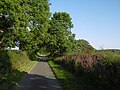
 Farmland near Rothley (1) - geograph.org.uk - 4670370.jpg 640 × 429; 164 KB
-
 Farmland near Rothley (2) - geograph.org.uk - 4670413.jpg 640 × 440; 150 KB
-
 Farmland near Rothley (3) - geograph.org.uk - 4670418.jpg 532 × 640; 235 KB
-
 Farmland near Rothley (4) - geograph.org.uk - 4670426.jpg 640 × 381; 123 KB
-
 Farmland near Rothley (5) - geograph.org.uk - 4670438.jpg 604 × 640; 212 KB
-
 Farmland near Rothley (6) - geograph.org.uk - 4671731.jpg 640 × 480; 233 KB
-
 Farmland near Rothley (7) - geograph.org.uk - 4670466.jpg 563 × 640; 241 KB
-
 Farmland near Rothley - geograph.org.uk - 3187714.jpg 640 × 480; 105 KB
-
 Farmland off the B6342 - geograph.org.uk - 3187692.jpg 640 × 480; 96 KB
-
 Farmland, Garden House Farm - geograph.org.uk - 3186934.jpg 640 × 480; 66 KB
-
 Farmland, Harwood Gate - geograph.org.uk - 3187002.jpg 640 × 480; 73 KB
-
 Feeding Time - geograph.org.uk - 2768534.jpg 1,600 × 934; 345 KB
-
 Field above Rothley Shield East - geograph.org.uk - 2263032.jpg 640 × 480; 97 KB
-
 Field boundary near Harwood Gate - geograph.org.uk - 2759157.jpg 640 × 480; 91 KB
-
 Field entrance near Kirkhill - geograph.org.uk - 3187708.jpg 640 × 480; 96 KB
-
 Field entrance, Rothley - geograph.org.uk - 3187716.jpg 640 × 480; 86 KB
-
 Finger post at junction - geograph.org.uk - 2033632.jpg 4,000 × 3,000; 4.25 MB
-
 Fontburn Reservoir, Northumberland - geograph.org.uk - 125346.jpg 640 × 480; 54 KB
-

-
 Footpath near Fontburn Reservoir - geograph.org.uk - 196981.jpg 640 × 480; 71 KB
-

-
 Ford at Low Fairnley - geograph.org.uk - 3977800.jpg 3,872 × 2,592; 4.39 MB
-
 Ford at Scot's Gap Sawmill - geograph.org.uk - 3977849.jpg 3,872 × 2,592; 4.66 MB
-
 Ford crossing the Hart Burn - geograph.org.uk - 5013267.jpg 1,600 × 1,214; 309 KB
-
 Ford near Fairnley - geograph.org.uk - 4027884.jpg 1,024 × 768; 318 KB
-
 Forest track and wood pile - geograph.org.uk - 5013693.jpg 1,600 × 1,200; 622 KB
-
 Fower rich hay meadow north of Hart Burn - geograph.org.uk - 4025119.jpg 1,024 × 768; 335 KB
-
 Gallows Hill - geograph.org.uk - 1549056.jpg 640 × 427; 155 KB
-
 Gallows Hill Wood - geograph.org.uk - 4657215.jpg 800 × 600; 522 KB
-
 Garden House Farm - geograph.org.uk - 2263039.jpg 640 × 480; 95 KB
-
 Gateway to Rothley Hall - geograph.org.uk - 4936928.jpg 1,600 × 1,122; 343 KB
-
 Grassland near Gallows Hill - geograph.org.uk - 4027851.jpg 1,024 × 768; 263 KB
-
 Grassland, Ralph Shield - geograph.org.uk - 4657209.jpg 800 × 600; 387 KB
-
 Grazing land by plantation on Ewesley Fell - geograph.org.uk - 3657129.jpg 2,771 × 1,932; 751 KB
-
 Grazing near Donkin Rigg - geograph.org.uk - 3186976.jpg 640 × 480; 59 KB
-
 Grazing near Hardwood Burn - geograph.org.uk - 3186989.jpg 640 × 480; 67 KB
-
 Hardwood Burn - geograph.org.uk - 3186985.jpg 640 × 480; 99 KB
-
 Hartington Lime Kilns - geograph.org.uk - 4027782.jpg 1,024 × 768; 315 KB
-
 Harwood - geograph.org.uk - 1549528.jpg 640 × 345; 81 KB
-
 Harwood Burn - geograph.org.uk - 2759185.jpg 640 × 480; 92 KB
-
 Harwood Burn - geograph.org.uk - 4979034.jpg 1,600 × 1,155; 531 KB
-
 Harwood bypass - geograph.org.uk - 4657193.jpg 800 × 600; 507 KB
-
 Harwood Forest - geograph.org.uk - 1549549.jpg 640 × 294; 55 KB
-
 Harwood Forest - geograph.org.uk - 4656388.jpg 800 × 600; 446 KB
-
 Harwood Forest - geograph.org.uk - 4657202.jpg 800 × 600; 584 KB
-
 Harwood from the air - geograph.org.uk - 5680090.jpg 640 × 480; 137 KB
-
 Harwood Gate - geograph.org.uk - 2759154.jpg 640 × 480; 93 KB
-
 Harwood Gate - geograph.org.uk - 3186996.jpg 640 × 480; 92 KB
-
 Harwood Gate Cottages - geograph.org.uk - 4979076.jpg 1,600 × 1,200; 346 KB
-
 Heading east towards Rothley - geograph.org.uk - 3187711.jpg 640 × 480; 145 KB
-
 Hedgerow near Chesters - geograph.org.uk - 4027909.jpg 1,024 × 768; 459 KB
-
 High Hartington Lime Kiln - geograph.org.uk - 114233.jpg 640 × 480; 120 KB
-
 Horses on the skyline - geograph.org.uk - 1355144.jpg 640 × 480; 60 KB
-
 Kind farmer opens gate at Chesters - geograph.org.uk - 5012589.jpg 1,600 × 1,274; 437 KB
-
 Kirkhill - geograph.org.uk - 1549512.jpg 640 × 335; 115 KB
-
 Kirkhill - geograph.org.uk - 2726028.jpg 3,456 × 1,354; 1.19 MB
-
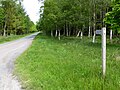
 Lane heading east - geograph.org.uk - 3187703.jpg 640 × 480; 82 KB
-
 Lane towards Rothley Shield West - geograph.org.uk - 3186970.jpg 640 × 480; 64 KB
-
 Larchwood at Liniel Law - geograph.org.uk - 2263037.jpg 640 × 480; 85 KB
-
 Liniel Law - geograph.org.uk - 2263034.jpg 640 × 480; 84 KB
-
 Long straight road beside Harwood Forest - geograph.org.uk - 4979043.jpg 1,600 × 1,200; 316 KB
-
 Long straight road, Harwood - geograph.org.uk - 4657204.jpg 800 × 600; 443 KB
-

-
 Looking across Todcrag Moss - geograph.org.uk - 4978907.jpg 1,600 × 1,200; 242 KB
-
 Looking north along the B6342 - geograph.org.uk - 1931657.jpg 2,592 × 1,944; 1.27 MB
-
 Looking south along the B6342 - geograph.org.uk - 1931660.jpg 2,592 × 1,944; 1.3 MB
-
 Low Fairnley - geograph.org.uk - 4027887.jpg 1,024 × 768; 305 KB
-
 Marshy fields above Rothley Shield East - geograph.org.uk - 4936886.jpg 1,600 × 1,208; 247 KB
-
 Meanders on Delf Burn - geograph.org.uk - 4025211.jpg 1,024 × 768; 272 KB
-
 Minor road east of Hartington Hall - geograph.org.uk - 4025131.jpg 1,024 × 768; 345 KB
-
 Minor road east of Hartington Hall - geograph.org.uk - 4025133.jpg 1,024 × 768; 230 KB
-

-
 Minor road towards Elsdon - geograph.org.uk - 3187009.jpg 640 × 480; 107 KB
-
 Minor road towards Elsdon - geograph.org.uk - 3187021.jpg 640 × 480; 70 KB
-
 Minor road towards Elsdon - geograph.org.uk - 3187407.jpg 640 × 480; 89 KB
-

-
 Minor road towards Rothley Cross Roads - geograph.org.uk - 3186948.jpg 640 × 480; 100 KB
-
 Minor road, Kirk Hill - geograph.org.uk - 4661153.jpg 800 × 600; 520 KB
-
 Moorland, Harwood - geograph.org.uk - 4656376.jpg 800 × 600; 453 KB
-
 New bridge over Chesters Burn - geograph.org.uk - 4027924.jpg 1,024 × 768; 291 KB
-
 No Exit - geograph.org.uk - 156955.jpg 640 × 480; 153 KB
-
 North Strip - geograph.org.uk - 3186944.jpg 480 × 640; 97 KB
-
 Northumberland Central Railway - geograph.org.uk - 4657227.jpg 800 × 600; 410 KB
-
 Nosey neighbours along the Rothbury Railway - geograph.org.uk - 4025168.jpg 1,024 × 768; 233 KB
-
 Old stone signpost - geograph.org.uk - 4936265.jpg 900 × 1,200; 446 KB
-
 Old wall and beech trees - geograph.org.uk - 5451684.jpg 1,024 × 767; 366 KB
-
 Once a railway to Rothbury - geograph.org.uk - 4657232.jpg 800 × 600; 492 KB
-
 Ordnance Survey Cut Mark - geograph.org.uk - 4697974.jpg 480 × 640; 127 KB
-
 Ordnance Survey Cut Mark - geograph.org.uk - 4697981.jpg 480 × 640; 136 KB
-
 Ordnance Survey Cut Mark - geograph.org.uk - 4699558.jpg 480 × 640; 115 KB
-
 Path by Delf Burn - geograph.org.uk - 4025413.jpg 1,024 × 768; 431 KB
-
 Plantation at Ewesley Fell - geograph.org.uk - 2263043.jpg 640 × 480; 78 KB
-
 Plantation at Ewesley Fell - geograph.org.uk - 2263045.jpg 640 × 480; 78 KB
-
 Plantation near Rothley - geograph.org.uk - 2759296.jpg 640 × 480; 155 KB
-
 Point of interest - geograph.org.uk - 4978915.jpg 1,600 × 1,363; 303 KB
-
 Pond at Rothley - geograph.org.uk - 5013749.jpg 1,600 × 1,155; 226 KB
-
 Pond near Ralph Shield - geograph.org.uk - 4979080.jpg 1,600 × 1,200; 338 KB
-
 Problem on a gated road^ - geograph.org.uk - 5012595.jpg 1,600 × 1,172; 485 KB
-
 Public bridleway to Harwood Forest - geograph.org.uk - 4979045.jpg 1,600 × 1,200; 553 KB
-
 Public bridleway to Whitridge - geograph.org.uk - 5013845.jpg 1,600 × 1,281; 393 KB
-
 Quarry, Liniel Law - geograph.org.uk - 4657279.jpg 800 × 600; 445 KB
-
 Railway bridge, Rothbury Branch - geograph.org.uk - 4661154.jpg 800 × 600; 537 KB
-
 Ralph Shield - geograph.org.uk - 1549010.jpg 640 × 259; 53 KB
-
 Reception committee near Rothley - geograph.org.uk - 872934.jpg 640 × 427; 94 KB
-
 Red hot pokers near Rothley - geograph.org.uk - 872926.jpg 640 × 427; 118 KB
-
 Ridge ^ Furrow at Toot Hill - geograph.org.uk - 4025462.jpg 1,024 × 768; 271 KB
-
 Ridge ^ Furrow north-west of Toot Hill - geograph.org.uk - 4025447.jpg 1,024 × 768; 327 KB
-
 River Wansbeck - geograph.org.uk - 388976.jpg 427 × 640; 101 KB
-

-

-
 Road to Harwood - geograph.org.uk - 4657196.jpg 800 × 600; 490 KB
-
 Road to Longwitton - geograph.org.uk - 3657124.jpg 2,991 × 2,017; 1.22 MB
-
 Road to Rothley - geograph.org.uk - 3657121.jpg 3,166 × 2,312; 1.01 MB
-
 Road to Rothley Cross Roads - geograph.org.uk - 4935959.jpg 1,600 × 1,200; 249 KB
-
 Roe deer make off over the field - geograph.org.uk - 4937092.jpg 1,600 × 1,404; 323 KB
-
 Rothbury Railway approaching Delf Burn - geograph.org.uk - 4031202.jpg 1,024 × 768; 275 KB
-
 Rothley Crags - geograph.org.uk - 1931635.jpg 2,592 × 1,944; 1.32 MB
-
 Rothley Crags - geograph.org.uk - 3657122.jpg 2,941 × 2,063; 1.1 MB
-
 Rothley Crags - geograph.org.uk - 4661158.jpg 800 × 600; 542 KB
-
 Rothley Crags - geograph.org.uk - 4661159.jpg 800 × 600; 535 KB
-
 Rothley Crags - geograph.org.uk - 5013791.jpg 1,600 × 1,200; 387 KB
-
 Rothley Crags near Rothley - geograph.org.uk - 4670451.jpg 640 × 441; 157 KB
-
 Rothley cross roads - geograph.org.uk - 4657245.jpg 800 × 600; 425 KB
-
 Rothley Cross Roads - geograph.org.uk - 4936274.jpg 1,600 × 1,115; 431 KB


_-_geograph.org.uk_-_4671764.jpg)
_-_geograph.org.uk_-_4671767.jpg)

_-_geograph.org.uk_-_4671719.jpg)
_-_geograph.org.uk_-_4671725.jpg)
_-_geograph.org.uk_-_4671736.jpg)
_-_geograph.org.uk_-_4671741.jpg)


_-_geograph.org.uk_-_1355128.jpg)


_-_geograph.org.uk_-_4670370.jpg)
_-_geograph.org.uk_-_4670413.jpg)
_-_geograph.org.uk_-_4670418.jpg)
_-_geograph.org.uk_-_4670426.jpg)
_-_geograph.org.uk_-_4670438.jpg)
_-_geograph.org.uk_-_4671731.jpg)
_-_geograph.org.uk_-_4670466.jpg)


