Category:Rothang Pass
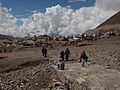
Ro-thang means "plain/field of Corpses" The narrow pass got its infamous name due to numerous people dying in bad weather trying to cross the pass. Not just the harsh weather but also the landslides are responsible for so many deaths. It is lethal: thick mud, sheer drops, landslides, truck drivers crazy through lack of sleep …
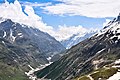
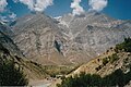
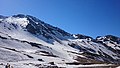
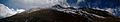
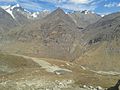
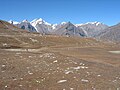
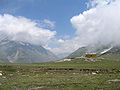
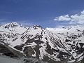
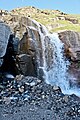
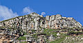
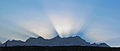
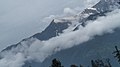
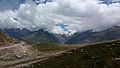
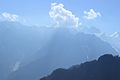
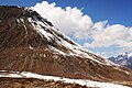
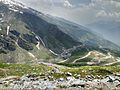
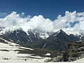
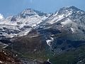
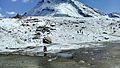
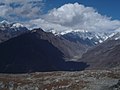
Rothang (Tibetan: Rothang La) (el. 3,978 m (13,051 ft)), is a high mountain pass on the eastern Pir Panjal Range of the Himalayas 51 km (32 mi) from Manali. It connects the Kullu Valley with the Lahaul and Spiti Valleys of Himachal Pradesh, India. The pass lies on the watershed between the Chenab and Beas Basins.
32°21′54.6″N 77°14′30.9″E / 32.365167°N 77.241917°E
mountain pass  | |||||
| Upload media | |||||
| Instance of | |||||
|---|---|---|---|---|---|
| Location | Himachal Pradesh, India | ||||
| Carries | |||||
| Mountain range | |||||
| Elevation above sea level |
| ||||
 | |||||
Subcategories
This category has the following 3 subcategories, out of 3 total.
M
- Marhi (28 F)
- Rohtang Pass monument (4 F)
R
Media in category "Rothang Pass"
The following 195 files are in this category, out of 195 total.
-
 2007 10 09 India Rohtang Pass approach from the north.JPG 1,024 × 683; 386 KB
-
 2007 10 09 India Summit of Rohtang Pass.JPG 1,024 × 683; 426 KB
-
 20170506200528 IMG 2099.jpg 1,920 × 1,280; 820 KB
-
 A Panorama at Rohtang Pass (10441173394).jpg 6,000 × 1,903; 2.63 MB
-
 A picture of Rotang pass.jpg 1,456 × 2,592; 1.41 MB
-
 A recall.jpg 2,048 × 1,152; 616 KB
-
 Aqua Ace 20160912 125829.jpg 4,864 × 2,736; 1.27 MB
-
 BEAUTIFUL SNOW MOUNTAIN.jpg 1,280 × 960; 106 KB
-
 Beautiful view, rohtang pass.jpg 4,608 × 2,592; 3.43 MB
-
 Blazing sun.jpg 4,608 × 3,456; 6.12 MB
-
 Breath Taking Mountains, Manali, India.jpg 3,264 × 1,836; 1.8 MB
-
 Chandra River from Rohtang Himachal Jul19.jpg 6,000 × 4,000; 21.9 MB
-
 Chandra Tributary Rohtang Lahaul Jul19 D72 10383.jpg 5,850 × 3,900; 18.38 MB
-
 Chandra Tributary Rohtang View Lahaul Himachal Oct20 D72 18654.jpg 6,000 × 3,375; 16.44 MB
-
 Chenab.jpg 1,782 × 1,190; 828 KB
-
 Clean blue.jpg 3,264 × 1,836; 1.81 MB
-
 Cloud Volcano.jpg 4,928 × 3,264; 2.45 MB
-
 Clouds surrounding the mountain ranges at Rohtang Pass, Manali.jpg 4,912 × 3,264; 2.84 MB
-
 Crying nature.jpg 4,000 × 3,000; 4.79 MB
-
 Dce110.jpg 2,592 × 1,944; 2.21 MB
-
 Dce111.jpg 2,592 × 1,944; 2.16 MB
-
 En route Rohtang Pass.jpg 5,184 × 3,456; 9.18 MB
-
 English Wine Shop on way to Rohtang.jpg 2,304 × 1,728; 367 KB
-
 Foothill of Rohtang Pass.jpg 2,816 × 1,760; 1.04 MB
-
 From rocks.jpg 3,264 × 1,836; 2.37 MB
-
 Garland at Rohtang Pass - Colorful nature.jpg 4,000 × 3,000; 4.81 MB
-
 Hill in Rohtank.jpg 3,264 × 1,836; 1.55 MB
-
 Hill station in rohtang pass.jpg 319 × 158; 9 KB
-
 Hill view from rohtang pass, manali.jpg 6,766 × 1,260; 1.94 MB
-
 Himalayan view from rohtang pass.jpg 2,560 × 1,920; 2.25 MB
-
 Himalayan View from Rohtang.jpg 4,608 × 3,456; 5.94 MB
-
 Himalayas from Rohtang Pass.jpg 2,592 × 1,944; 2.8 MB
-
 Horse on the mountain.jpg 4,000 × 3,000; 4.8 MB
-
 ICE MOUNTS.jpg 4,320 × 3,240; 2.8 MB
-
 IN HP Rohtangpass PanoramaNordost2 13102003.jpg 800 × 600; 414 KB
-
 Indian Navy Swarnim Vijay Abhiyan motorcycle expedition; Oct 2021 02.jpg 700 × 525; 143 KB
-
 Kullu Valley from Rohtang Pass, India.jpg 3,072 × 2,048; 4.52 MB
-
 Line of mountains.jpg 3,264 × 1,836; 2.27 MB
-
 Manali landscape.jpg 4,000 × 3,000; 5.03 MB
-
 Manali on the way.jpg 2,048 × 1,536; 215 KB
-
 Manali Rohtang Hills.jpg 2,048 × 1,536; 306 KB
-
 Manali RohtangPass.jpg 4,320 × 2,432; 3.56 MB
-
 Mid Himalayan Range (166389793).jpeg 2,048 × 1,366; 687 KB
-
 Morning of Rohtang Pass.jpg 601 × 800; 111 KB
-
 Mountain Festival.jpg 4,000 × 3,000; 4.77 MB
-
 Mountains near Rohtang Pass, Himachal Pradesh.jpg 800 × 600; 75 KB
-
 Near roh.JPG 2,816 × 2,112; 1.45 MB
-
 On Top,Rohtang La.jpg 540 × 720; 61 KB
-
 Panoramic view from rohtang pass.JPG 3,456 × 2,592; 1.67 MB
-
 Rainbow from Rohtang pass road, 5.jpg 4,128 × 3,096; 3.09 MB
-
 Refreshment stopage on the way to Rohtang (before Mahrri).JPG 4,608 × 3,456; 6.28 MB
-
 Rhotang Pass.jpg 564 × 850; 205 KB
-
 Rohatang Pass - Manali.jpg 3,648 × 2,736; 3.21 MB
-
 Rohtand So Much Snow.jpg 5,184 × 3,456; 3.5 MB
-
 Rohtang , manali.jpg 4,096 × 2,304; 1.34 MB
-
 ROHTANG 01.jpg 4,608 × 2,592; 2.98 MB
-
 ROHTANG 02.jpg 4,608 × 2,592; 2.28 MB
-
 Rohtang 1.jpg 2,048 × 1,536; 303 KB
-
 Rohtang 2.jpg 2,048 × 1,536; 294 KB
-
 Rohtang goats.JPG 1,280 × 960; 605 KB
-
 Rohtang Himachal Pradesh 01.jpg 3,456 × 2,304; 5.02 MB
-
 Rohtang Himachal Pradesh 02.jpg 3,456 × 2,304; 3.81 MB
-
 Rohtang Himachal Pradesh 03.jpg 3,456 × 2,304; 4.77 MB
-
 Rohtang Himachal Pradesh 04.jpg 4,128 × 2,322; 2.38 MB
-
 Rohtang Himachal Pradesh 05.jpg 4,128 × 2,322; 2.42 MB
-
 Rohtang Himachal Pradesh 06.jpg 4,128 × 2,322; 1.95 MB
-
 Rohtang killing scene.jpg 1,080 × 752; 59 KB
-
 Rohtang La From Distance.jpg 5,344 × 3,006; 4.46 MB
-
 Rohtang La pass.jpg 4,288 × 2,848; 3.02 MB
-
 Rohtang La-1.jpg 1,408 × 1,056; 285 KB
-
 Rohtang La-10-gje.jpg 4,353 × 2,540; 2.46 MB
-
 Rohtang La-17-Gebetsfahnen-gje.jpg 5,184 × 3,456; 4.77 MB
-
 Rohtang La-18-Gebetsfahnen-gje.jpg 5,184 × 3,456; 4.18 MB
-
 Rohtang La-20-Gebetsfahnen-gje.jpg 5,184 × 3,456; 4.09 MB
-
 Rohtang La-22-Gebetsfahnen-dicker Stein-gje.jpg 5,184 × 3,456; 4.66 MB
-
 Rohtang La-24-Panorama-gje.jpg 5,184 × 3,456; 4.3 MB
-
 Rohtang La-26-Berge-gje.jpg 5,184 × 3,456; 4.14 MB
-
 Rohtang La-28-Panorama-gje.jpg 10,172 × 3,316; 7.23 MB
-
 ROHTANG PAASS.jpg 4,032 × 3,024; 2.56 MB
-
 Rohtang Pass (2544457923).jpg 3,072 × 2,304; 3.94 MB
-
 Rohtang Pass (5176970342).jpg 3,072 × 2,304; 3.99 MB
-
 Rohtang Pass (5176976556).jpg 3,072 × 2,304; 3.18 MB
-
 Rohtang Pass (5480204499).jpg 3,072 × 2,304; 2.7 MB
-
 Rohtang Pass (5480231707).jpg 3,072 × 2,304; 3.54 MB
-
 Rohtang Pass (5480278575).jpg 3,072 × 2,304; 3.88 MB
-
 Rohtang Pass (5480298737).jpg 3,072 × 2,304; 3.86 MB
-
 Rohtang Pass (5480755438).jpg 3,072 × 2,304; 2.84 MB
-
 Rohtang Pass (9 June 2017, 10-55-04).jpg 4,160 × 3,120; 4.89 MB
-
 Rohtang Pass (9 June 2017, 15-09-24).jpg 4,160 × 3,120; 4.42 MB
-
 Rohtang Pass - Himachal Pradesh - India (5480874226).jpg 2,263 × 1,556; 2.45 MB
-
 Rohtang pass - Manali (2537768781).jpg 3,072 × 2,304; 3.76 MB
-
 Rohtang pass - Manali - 80,000+ views. (2536920618).jpg 2,549 × 2,075; 2.95 MB
-
 Rohtang Pass - Scenic point.jpg 2,263 × 1,556; 1.58 MB
-
 Rohtang Pass - Snow Fall - Video Clip (5480745310).jpg 640 × 480; 144 KB
-
 Rohtang Pass 1.jpg 1,600 × 1,200; 167 KB
-
 Rohtang Pass 15000ft.jpg 4,608 × 2,592; 4.47 MB
-
 Rohtang Pass 2.jpg 1,600 × 1,200; 212 KB
-
 Rohtang Pass 2011 IMG 1945 (6890865629).jpg 5,184 × 3,456; 7.82 MB
-
 Rohtang Pass 2011 IMG 1960 (6890881467).jpg 5,184 × 3,456; 8.08 MB
-
 Rohtang Pass 2011 IMG 1964 (6890915197).jpg 5,184 × 3,456; 7.93 MB
-
 Rohtang Pass 2011 IMG 1974 (6890920189).jpg 4,870 × 2,105; 4.29 MB
-
 Rohtang Pass 2011 IMG 2004 (6890944187).jpg 5,184 × 3,456; 12.95 MB
-
 Rohtang Pass 2011 IMG 2008 (6890951249).jpg 3,456 × 5,184; 13.21 MB
-
 Rohtang Pass 2011 IMG 2009 (6890952763).jpg 3,456 × 5,184; 13.15 MB
-
 Rohtang Pass 2011 IMG 2018 (6890976279).jpg 5,184 × 3,456; 10.4 MB
-
 Rohtang Pass 2011 IMG 2051 (6907817169).jpg 5,184 × 3,456; 11.34 MB
-
 Rohtang Pass 2011 IMG 2107 (6907947121).jpg 5,184 × 3,456; 10.38 MB
-
 Rohtang Pass 2011 IMG 2121 (6907962057).jpg 5,184 × 3,456; 13.91 MB
-
 Rohtang Pass 2011 IMG 2151 (6907994437).jpg 5,184 × 3,456; 12.2 MB
-
 Rohtang Pass 2011 IMG 2168 (6908028213).jpg 5,077 × 3,253; 11.59 MB
-
 Rohtang Pass 2011 IMG 2173 (6908051313).jpg 5,184 × 3,456; 11.58 MB
-
 Rohtang Pass 2011 IMG 2279 (6908166373).jpg 5,184 × 3,456; 12.08 MB
-
 Rohtang Pass 2011 IMG 2307 (6908220877).jpg 5,184 × 3,456; 8.73 MB
-
 Rohtang Pass 2011 IMG 9641 (6890867133).jpg 5,103 × 2,116; 4.92 MB
-
 Rohtang Pass 2011 IMG 9642 (6890868849).jpg 4,971 × 2,594; 8.34 MB
-
 Rohtang Pass 2011 IMG 9672 (6890901765).jpg 5,184 × 3,456; 11.96 MB
-
 Rohtang Pass 2011 On the road to Leh (6908255655).jpg 5,184 × 3,456; 8.4 MB
-
 Rohtang Pass 2011 The first light (6890918467).jpg 4,976 × 2,105; 5.49 MB
-
 Rohtang Pass A Gateway to Himalayas.jpg 3,072 × 1,728; 1.6 MB
-
 Rohtang Pass Aerial View.jpg 5,184 × 3,456; 5.04 MB
-
 Rohtang Pass at himachal pradesh.jpg 4,160 × 2,340; 2.19 MB
-
 Rohtang pass beauty.jpg 4,160 × 3,120; 3.92 MB
-
 Rohtang Pass by Gafoor.jpg 1,024 × 683; 360 KB
-
 Rohtang Pass hiking.jpg 5,248 × 3,936; 5.95 MB
-
 Rohtang Pass HP.jpg 4,160 × 2,340; 1.51 MB
-
 Rohtang Pass Kullu Manali.jpg 3,264 × 2,448; 522 KB
-
 Rohtang pass mountain.jpg 4,608 × 2,592; 3.43 MB
-
 Rohtang Pass panorama (10441425046).jpg 5,000 × 2,073; 1.46 MB
-
 Rohtang pass snowy valley01.jpg 2,560 × 1,920; 1.5 MB
-
 Rohtang pass sunrise.jpg 4,608 × 2,592; 2.7 MB
-
 Rohtang pass view.jpg 768 × 1,280; 140 KB
-
 Rohtang Pass View.jpg 2,448 × 3,264; 1.87 MB
-
 Rohtang Pass, Lee Manali Highway.jpg 4,096 × 2,304; 2.87 MB
-
 Rohtang Pass, Manali, Himachal Pradesh.jpg 3,456 × 2,098; 1.67 MB
-
 Rohtang pass, mountains ke paas!.jpg 4,160 × 3,120; 4.38 MB
-
 Rohtang pass, shimla.jpg 4,320 × 3,240; 4.46 MB
-
 Rohtang pass,himachal pradesh.jpg 3,328 × 1,872; 1.95 MB
-
 Rohtang Pass,Manali, Himachal Pradesh.jpg 540 × 304; 53 KB
-
 Rohtang pass- Manali.jpg 5,184 × 3,456; 8.87 MB
-
 Rohtang Pass.jpg 1,024 × 683; 512 KB
-
 Rohtang pass.jpg 1,600 × 1,200; 82 KB
-
 Rohtang pass.JPG 2,816 × 2,112; 1.62 MB
-
 Rohtang people gathering view.jpg 4,608 × 3,456; 3.49 MB
-
 Rohtang Road Sign.jpg 4,592 × 3,056; 6.04 MB
-
 Rohtang scene.jpg 752 × 1,080; 114 KB
-
 Rohtang Top.jpg 6,000 × 4,000; 11.57 MB
-
 Rohtang valley.jpg 4,160 × 3,120; 5.1 MB
-
 Rohtang way.jpg 3,024 × 4,032; 2.85 MB
-
 Rohtang white jeeps.jpg 4,412 × 2,936; 3.87 MB
-
 Rohtang's Hill 2.jpg 3,264 × 2,448; 3.46 MB
-
 Rohtang's hill.jpg 3,264 × 2,448; 2.03 MB
-
 Rohtang.JPG 4,288 × 2,848; 3.05 MB
-
 Rohtangla (28527733821).jpg 3,264 × 4,928; 14.2 MB
-
 Rohtangla (28527734721).jpg 4,021 × 2,495; 4.97 MB
-
 RohtangPass (5176957514).jpg 3,072 × 2,304; 3.61 MB
-
 Rohtangpass.jpg 2,160 × 3,600; 2.41 MB
-
 RohtngPassManali.jpg 2,816 × 2,112; 1.47 MB
-
 Rotang ( Himachal) Panorama 01.jpg 6,675 × 720; 3.53 MB
-
 Rotang ( Himachal) Panorama 02.jpg 3,146 × 1,000; 1.94 MB
-
 Rotang Pass.jpg 4,608 × 3,456; 3.65 MB
-
 Rothang pass.JPG 1,544 × 1,024; 617 KB
-
 Rothang Pass.jpg 4,608 × 2,592; 2.6 MB
-
 Rothangpass1.JPG 2,048 × 1,536; 567 KB
-
 RothangPass2 wts.JPG 2,816 × 2,112; 1.92 MB
-
 RothangPass2.JPG 2,048 × 1,536; 539 KB
-
 RothangPass3.JPG 2,048 × 1,536; 551 KB
-
 RothangPass4.JPG 2,048 × 1,536; 607 KB
-
 Sharp view of mountain ranges.jpg 4,912 × 3,264; 3.03 MB
-
 Shiny mountains.jpg 3,264 × 2,448; 2 MB
-
 Snow at rohtang pass.jpg 4,160 × 3,120; 3.2 MB
-
 Snow clad mountains at Rohtang pass.jpg 5,184 × 3,888; 6.23 MB
-
 Snow cloud.jpg 3,264 × 2,448; 3.11 MB
-
 Snow covered Rohtang Pass.jpg 4,320 × 2,562; 2.65 MB
-
 Snow mountain,rohtang pass.jpg 3,328 × 1,872; 3.1 MB
-
 SNOW MOUNTAINS.jpg 1,280 × 960; 115 KB
-
 Snow textured on the mountain.jpg 4,912 × 3,264; 3.41 MB
-
 Snowfall at the rohatang pass.jpg 4,128 × 2,322; 3.41 MB
-
 Solang Valley View.jpg 3,264 × 2,448; 1.63 MB
-
 Solang.jpg 3,264 × 2,448; 3.1 MB
-
 Summit of Rohtang pass01.jpg 1,920 × 2,560; 1.43 MB
-
 Team of rocks.jpg 3,264 × 1,836; 2.19 MB
-
 The Best Shot.jpg 4,608 × 3,456; 5.28 MB
-
 The great himalyan ranges.jpg 3,600 × 2,160; 2.16 MB
-
 Three phases of mountains.jpg 3,264 × 2,448; 2.42 MB
-
 Top of Himachal(Rohtang pass).jpg 4,128 × 2,322; 3.31 MB
-
 Trapped and enchanted.jpg 4,160 × 3,120; 4.13 MB
-
 Vallée kullu.jpg 587 × 890; 170 KB
-
 View from Rohtag.jpg 2,048 × 1,536; 417 KB
-
 View from top of rohtang.jpg 1,280 × 960; 575 KB
-
 View like haeven.jpg 4,000 × 3,000; 4.34 MB
-
 View of congested traffic(13-6-15) before Rohtang , Manali ,Himachal Pardes ,India.JPG 4,608 × 3,456; 6.09 MB
-
 View of Rothang pass.jpg 1,024 × 768; 213 KB
-
 Way to Rohtang, India P 1 ind.jpg 4,160 × 2,340; 3.64 MB
-
 Way to Rotang pass.jpg 1,456 × 2,592; 696 KB
-
 White cap mountains.jpg 4,000 × 3,000; 4.85 MB


.jpeg)


.JPG)


.jpg)
.jpg)
.jpg)
.jpg)
.jpg)
.jpg)
.jpg)
.jpg)
.jpg)
.jpg)
.jpg)
.jpg)
.jpg)

.jpg)


.jpg)
.jpg)
.jpg)
.jpg)
.jpg)
.jpg)
.jpg)
.jpg)
.jpg)
.jpg)
.jpg)
.jpg)
.jpg)
.jpg)
.jpg)
.jpg)
.jpg)
.jpg)
.jpg)
.jpg)
.jpg)


.jpg)


.jpg)
.jpg)
.jpg)


.jpg)


_before_Rohtang_,_Manali_,Himachal_Pardes_,India.JPG)


.jpg)
_Panorama_01.jpg)
_Panorama_02.jpg)