Category:Roker Lane, Pudsey
Jump to navigation
Jump to search
Subcategories
This category has the following 2 subcategories, out of 2 total.
B
- Boars Head, Pudsey (4 F)
U
- Union Bridge Mills (7 F)
Media in category "Roker Lane, Pudsey"
The following 45 files are in this category, out of 45 total.
-
 149 Roker Lane - geograph.org.uk - 421034.jpg 640 × 528; 80 KB
-
 73-79 Roker Lane - geograph.org.uk - 420930.jpg 640 × 461; 65 KB
-
 83-87 Roker Lane - geograph.org.uk - 420928.jpg 640 × 463; 63 KB
-

-
 Barn - Roker Lane - geograph.org.uk - 421025.jpg 640 × 473; 74 KB
-
 Beck - Roker Lane - geograph.org.uk - 2323830.jpg 640 × 480; 154 KB
-

-
 Benchmark on ^124 Roker Lane - geograph.org.uk - 5892087.jpg 623 × 1,024; 217 KB
-
 Cabbage field, Roker Lane - geograph.org.uk - 2264218.jpg 640 × 465; 207 KB
-
 Closed shop and very closed pub, Roker Lane, Pudsey - geograph.org.uk - 6111414.jpg 2,000 × 1,364; 542 KB
-
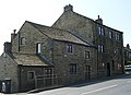
 Dene House - 124-126 Roker Lane - geograph.org.uk - 421032.jpg 640 × 493; 111 KB
-
 Derelict Building - Roker Lane - geograph.org.uk - 421029.jpg 640 × 423; 103 KB
-
 Development site, Roker Lane, Pudsey - geograph.org.uk - 6111423.jpg 2,000 × 1,500; 779 KB
-

-
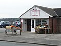
 Farm Shop - Roker Lane - geograph.org.uk - 420918.jpg 640 × 333; 47 KB
-
 Footpath - Roker Lane - geograph.org.uk - 2317179.jpg 480 × 640; 102 KB
-
 Footpath - Roker Lane - geograph.org.uk - 2323725.jpg 480 × 640; 118 KB
-
 Footpath - Roker Lane - geograph.org.uk - 2323740.jpg 480 × 640; 112 KB
-
 Footpath leading to Pudsey Beck - geograph.org.uk - 3968674.jpg 1,600 × 1,064; 801 KB
-
 Gate and alleyway behind Roker Lane - geograph.org.uk - 5162815.jpg 810 × 1,024; 183 KB
-
 House - Roker Lane - geograph.org.uk - 421039.jpg 640 × 540; 107 KB
-
 Milestone, Roker Lane, Pudsey.jpg 676 × 1,024; 210 KB
-
 Nos. 124 and 126 Roker Lane - geograph.org.uk - 5892098.jpg 1,024 × 680; 260 KB
-
 Old Milestone by Roker Lane, Pudsey (geograph 6076736).jpg 480 × 640; 350 KB
-
 Rhubarb Field - Roker Lane - geograph.org.uk - 420922.jpg 640 × 365; 81 KB
-
 Road Bridge over Pudsey Beck - Roker Lane - geograph.org.uk - 420973.jpg 480 × 640; 110 KB
-
 Roker Lane - geograph.org.uk - 2317183.jpg 640 × 480; 73 KB
-

-
 Roker Lane - Tong Road - geograph.org.uk - 2323836.jpg 640 × 480; 79 KB
-
 Roker Lane - viewed from Low Farm - geograph.org.uk - 2323716.jpg 640 × 480; 66 KB
-
 Roker Lane at Roker Lane Bottom - geograph.org.uk - 5478535.jpg 4,000 × 3,000; 2.53 MB
-
 Roker Lane at Union Bridge - geograph.org.uk - 960756.jpg 640 × 480; 88 KB
-
 Roker Lane near East House - geograph.org.uk - 6174863.jpg 1,024 × 770; 171 KB
-
 Roker Lane towards Pudsey - geograph.org.uk - 3968665.jpg 1,600 × 1,064; 542 KB
-
 Roker Lane, Pudsey - geograph.org.uk - 2264210.jpg 640 × 433; 75 KB
-
 Roker Lane, Pudsey, Leeds - geograph.org.uk - 5164142.jpg 6,000 × 4,000; 3.87 MB
-
 Roker Lane, Pudsey, Leeds - geograph.org.uk - 5164154.jpg 6,000 × 4,000; 4.28 MB
-
 Roker Lane, Southroyd Park - geograph.org.uk - 6174875.jpg 1,024 × 769; 143 KB
-
 Rose Cottage - Roker Lane - geograph.org.uk - 421036.jpg 470 × 640; 90 KB
-
 Shetland Pony in Field - Roker Lane - geograph.org.uk - 420905.jpg 640 × 417; 100 KB
-
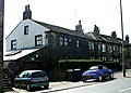
 The Weasel - Roker Lane - geograph.org.uk - 420925.jpg 640 × 401; 76 KB
-
 Tomlinson's Farm Shop, Roker Lane, Pudsey - geograph.org.uk - 6111418.jpg 2,000 × 1,500; 503 KB
-
 Union Bridge, Roker Lane - geograph.org.uk - 2264203.jpg 640 × 468; 95 KB
-
 Welcome to Leeds - geograph.org.uk - 960762.jpg 640 × 480; 92 KB
-
 ^149 Roker Lane and outbuilding - geograph.org.uk - 5892061.jpg 1,024 × 666; 105 KB


.jpg)


