Category:Rogart (civil parish)
Jump to navigation
Jump to search
Scottish parish in Highland, Scotland, UK | |||||
| Upload media | |||||
| Instance of | |||||
|---|---|---|---|---|---|
| Named after | |||||
| Location |
| ||||
| Population |
| ||||
| Area |
| ||||
 | |||||
Subcategories
This category has the following 6 subcategories, out of 6 total.
A
- Ardachu (4 F)
D
- Dalreavoch (2 F)
N
- Loch na Saobhaidhe, Rogart (2 F)
P
- Pittentrail (17 F)
R
W
- West Langwell (45 F)
Media in category "Rogart (civil parish)"
The following 200 files are in this category, out of 582 total.
(previous page) (next page)-
 A class 158 train departing from Rogart Station - geograph.org.uk - 6105273.jpg 1,024 × 768; 386 KB
-
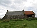
 A croft house at West Langwell - geograph.org.uk - 4144950.jpg 1,600 × 960; 509 KB
-
 A peaceful scene at Strath Fleet - geograph.org.uk - 3639807.jpg 640 × 480; 71 KB
-
 A rough road leads off towards Little Rogart - geograph.org.uk - 4144981.jpg 1,600 × 1,067; 660 KB
-
 A View of Rogart in Summer - geograph.org.uk - 4128111.jpg 4,000 × 3,000; 3.56 MB
-
 A839 at Pittentrail - geograph.org.uk - 5951313.jpg 1,600 × 1,017; 333 KB
-
 A839 in Upper Strath Fleet - geograph.org.uk - 5221235.jpg 1,800 × 1,012; 1.76 MB
-
 A839 near Rhaoine - geograph.org.uk - 5131670.jpg 640 × 431; 43 KB
-
 A839 westbound - geograph.org.uk - 4680412.jpg 640 × 440; 48 KB
-
 A839 westbound - geograph.org.uk - 4680418.jpg 640 × 480; 67 KB
-
 A839 westbound - geograph.org.uk - 4680424.jpg 640 × 450; 54 KB
-
 A839, Rogart - geograph.org.uk - 4758710.jpg 800 × 600; 165 KB
-
 A839, Strath Fleet - geograph.org.uk - 4758713.jpg 800 × 600; 169 KB
-
 Abandoned croft at Achatomlinie - geograph.org.uk - 4551890.jpg 4,896 × 3,672; 5.82 MB
-
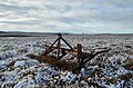 Abandoned Plough near Loch Salachaidh - geograph.org.uk - 4746219.jpg 2,957 × 1,958; 2.91 MB
-
 Above Leathad na Seamraig - geograph.org.uk - 1336654.jpg 640 × 480; 156 KB
-
 Achallach - geograph.org.uk - 4758517.jpg 800 × 600; 182 KB
-
 Achatomlinie a ruined croft in the moor - geograph.org.uk - 5128061.jpg 4,000 × 3,000; 2.48 MB
-
 Achavoan Croft, Rogart - geograph.org.uk - 963542.jpg 640 × 446; 81 KB
-
 Acheilidh to Dalmore Road - geograph.org.uk - 6237098.jpg 1,024 × 731; 349 KB
-
 Achnagarron Standing Stones - geograph.org.uk - 6236589.jpg 1,024 × 768; 214 KB
-
 Achnagarron Standing Stones - geograph.org.uk - 6236597.jpg 1,024 × 731; 210 KB
-
 Achnagarron Standing Stones - geograph.org.uk - 6236607.jpg 1,024 × 731; 202 KB
-
 Achnahuie, a croft above Rogart - geograph.org.uk - 4143106.jpg 1,600 × 1,067; 467 KB
-

-
 Achnaluachrach, the house at the end of the road - geograph.org.uk - 4144964.jpg 1,600 × 1,067; 535 KB
-
 Achvoan. - geograph.org.uk - 1219112.jpg 640 × 480; 122 KB
-
 Across Strath Brora - geograph.org.uk - 1336675.jpg 640 × 480; 143 KB
-
 Across Strath Fleet - geograph.org.uk - 4407724.jpg 640 × 420; 73 KB
-
 Allt a' Mhuilinn Duibh - geograph.org.uk - 5939200.jpg 1,152 × 864; 798 KB
-
 Allt Achadh Tom a' Leine - geograph.org.uk - 5128052.jpg 4,000 × 3,000; 2.62 MB
-
 Allt an Eisg - geograph.org.uk - 1336630.jpg 640 × 480; 166 KB
-
 Allt Bac na Lice watercourse, Sutherland - geograph.org.uk - 4950223.jpg 2,800 × 1,855; 1.89 MB
-
 Allt Clais a' Chait - geograph.org.uk - 6105707.jpg 1,024 × 768; 491 KB
-
 Allt Gobhlach - geograph.org.uk - 5045874.jpg 4,000 × 3,000; 3.1 MB
-
 Allt Gobhlach above Dalnessie - geograph.org.uk - 5000064.jpg 4,000 × 3,000; 2.46 MB
-
 Allt Gobhlach at Dail na Ceardaich, Dalnessie - geograph.org.uk - 5045869.jpg 4,000 × 3,000; 3 MB
-
 Allt Preas a' Chraicinn from the stalkers' path - geograph.org.uk - 5045935.jpg 4,000 × 3,000; 3.43 MB
-
 Alltan Dubh Ceann na Creige - geograph.org.uk - 852270.jpg 640 × 480; 79 KB
-
 An Crom-allt - geograph.org.uk - 5045884.jpg 4,000 × 3,000; 3.22 MB
-
 An Crom-allt tumbling down from the moors - geograph.org.uk - 5045890.jpg 4,000 × 3,000; 3.47 MB
-
 Approaching Pittentrail - geograph.org.uk - 4407740.jpg 640 × 425; 118 KB
-
 At Pittentrail - geograph.org.uk - 4407751.jpg 640 × 410; 82 KB
-
 ATV track over the moor in Ben Armine Forest - geograph.org.uk - 5046023.jpg 4,000 × 3,000; 3.12 MB
-

-
 Bardachan from passing place - geograph.org.uk - 1939032.jpg 960 × 720; 196 KB
-
 Bare rock on Sron Leathad Chleansaid above Dalnessie, Lairg - geograph.org.uk - 5471144.jpg 4,729 × 3,547; 5.04 MB
-
 Bay on Loch an Eoin - geograph.org.uk - 5855421.jpg 4,000 × 3,000; 2.85 MB
-
 Bee boles, Grumby, Sutherland - geograph.org.uk - 4187437.jpg 1,459 × 936; 309 KB
-

-
 Bend in the Coirefrois Burn, Sutherland - geograph.org.uk - 5000145.jpg 2,800 × 1,855; 1.5 MB
-
 Bend in the road, Strath Brora, Sutherland - geograph.org.uk - 5665673.jpg 2,400 × 1,600; 3.18 MB
-
 Birch wood, Dalreavoch - geograph.org.uk - 4758002.jpg 800 × 600; 250 KB
-
 Birches, Rogart - geograph.org.uk - 4758677.jpg 800 × 600; 320 KB
-
 Blarich - geograph.org.uk - 1864322.jpg 960 × 720; 249 KB
-

-
 Blasted Heath - geograph.org.uk - 963933.jpg 640 × 480; 75 KB
-
 Boat house and fishing hut on Glas-Loch Mhòr - geograph.org.uk - 5045993.jpg 4,000 × 3,000; 2.69 MB
-
 Bog cotton on the moor at Bad Ra'fin, Dalnessie - geograph.org.uk - 5046091.jpg 4,000 × 3,000; 2.55 MB
-
 Bog on Meall a' Chaise - geograph.org.uk - 4810921.jpg 800 × 489; 84 KB
-
 Boulder above Dalnessie, Lairg - geograph.org.uk - 5471150.jpg 4,729 × 3,547; 5.66 MB
-

-
 Bridge by A839 - geograph.org.uk - 2139500.jpg 1,000 × 750; 173 KB
-
 Bridge over River Brora - geograph.org.uk - 870149.jpg 640 × 427; 68 KB
-
 Bridge over River Brora at Dalreavoch - geograph.org.uk - 1978912.jpg 800 × 531; 252 KB
-
 Broch at Rogart - geograph.org.uk - 4386125.jpg 2,464 × 1,632; 1.93 MB
-
 Brora to Rogart road - geograph.org.uk - 4758553.jpg 800 × 600; 215 KB
-
 Brora to Rogart road - geograph.org.uk - 4758625.jpg 800 × 600; 189 KB
-
 Building beside the A839 - geograph.org.uk - 5951355.jpg 1,600 × 1,019; 318 KB
-
 By the Earl of Lettie's Grave - geograph.org.uk - 5472633.jpg 1,600 × 1,201; 502 KB
-
 Cairn above Strath Brora, Sutherland - geograph.org.uk - 4190305.jpg 734 × 936; 112 KB
-
 Cairn above Strath Brora, Sutherland - geograph.org.uk - 4190321.jpg 1,000 × 1,431; 337 KB
-
 Cairn above Strath Brora, Sutherland - geograph.org.uk - 4190370.jpg 1,459 × 1,094; 352 KB
-
 Cairnfield, Grumby Rock, Sutherland - geograph.org.uk - 4330560.jpg 1,459 × 1,094; 447 KB
-
 Cattle grid at Inchcape - geograph.org.uk - 2139487.jpg 1,000 × 750; 157 KB
-
 Cattle in the snow, near Rhemusaig - geograph.org.uk - 1055729.jpg 640 × 480; 142 KB
-
 Cemetery and school at Rogart - geograph.org.uk - 4143059.jpg 1,600 × 1,067; 536 KB
-
 Clach an Locha - geograph.org.uk - 4551914.jpg 4,896 × 3,672; 6.1 MB
-
 Clear fell, Strath Brora - geograph.org.uk - 4757989.jpg 800 × 600; 245 KB
-
 Cnoc an Alltain Rhiabhaich, Sutherland - geograph.org.uk - 5003336.jpg 2,800 × 1,855; 1.57 MB
-
 Cnoc an Dail Bhric - geograph.org.uk - 1084334.jpg 640 × 480; 94 KB
-
 Cnoc an Leath-bhaid (287m) - geograph.org.uk - 5468126.jpg 4,896 × 3,672; 5.87 MB
-
 Cnoc an Liath-bhaid (287m) - geograph.org.uk - 5468135.jpg 4,896 × 3,672; 5.8 MB
-
 Cnoc Fodha (227 m) - geograph.org.uk - 4551929.jpg 4,896 × 3,672; 6.12 MB
-
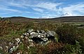
 Cnocan ruins - geograph.org.uk - 1336625.jpg 640 × 480; 142 KB
-
 Commonwealth War Grave - Private John J. MacKay - geograph.org.uk - 6165590.jpg 768 × 1,024; 738 KB
-
 Commonwealth War Grave - Private John Murray - geograph.org.uk - 6166816.jpg 768 × 1,024; 756 KB
-
 Commonwealth War Grave - Private William J. Reid - geograph.org.uk - 6169884.jpg 768 × 1,024; 734 KB
-
 Commonwealth War Grave of Corporal Philip MacDonald - geograph.org.uk - 6149015.jpg 3,672 × 4,896; 5.86 MB
-
 Confluence of Allt Gobhlach and An Crom-allt - geograph.org.uk - 5045880.jpg 4,000 × 3,000; 3.04 MB
-

-
 Cottage at Rossal - geograph.org.uk - 2139492.jpg 1,000 × 750; 123 KB
-
 Cotton grass bog east of Allt na Luibe - geograph.org.uk - 4551926.jpg 4,896 × 3,672; 5.84 MB
-
 Cotton-grass bog on Liathad an Raith - geograph.org.uk - 4551921.jpg 4,896 × 3,672; 6.08 MB
-
 Course of Allt Achadh Tom a' Leine - geograph.org.uk - 5128043.jpg 4,000 × 3,000; 3.04 MB
-
 Craggiemore - geograph.org.uk - 2837140.jpg 1,440 × 964; 290 KB
-
 Craggiemore - geograph.org.uk - 901586.jpg 640 × 480; 96 KB
-
 Craggiemore, Strath Brora - geograph.org.uk - 1978820.jpg 800 × 531; 172 KB
-
 Crags, Strath Fleet - geograph.org.uk - 4758722.jpg 800 × 600; 217 KB
-
 Creag Dhubh Dail nan Gillean - geograph.org.uk - 1083648.jpg 640 × 359; 81 KB
-
 Croft at Muie - geograph.org.uk - 4051911.jpg 1,439 × 957; 1.47 MB
-
 Croft beyond Achork - geograph.org.uk - 2837136.jpg 1,440 × 964; 374 KB
-
 Croft house at Alltamhuilt in Strath Brora - geograph.org.uk - 5855385.jpg 4,000 × 3,000; 2.66 MB
-
 Croftand at Muie. - geograph.org.uk - 1241052.jpg 640 × 480; 200 KB
-
 Croftland at Muie. - geograph.org.uk - 1241061.jpg 640 × 480; 220 KB
-
 Crossroads in Rogart - geograph.org.uk - 6105322.jpg 1,024 × 768; 344 KB
-
 Crossroads north of Garvoult - geograph.org.uk - 6105699.jpg 1,024 × 768; 450 KB
-
 Crossroads north of Rogart - geograph.org.uk - 1978588.jpg 800 × 531; 167 KB
-
 Crossroads north of Rogart - geograph.org.uk - 4143092.jpg 1,600 × 1,067; 515 KB
-
 Crossroads north of Rogart near Rhilochan - geograph.org.uk - 4143089.jpg 1,600 × 1,067; 492 KB
-
 Crow trap at Leataidh. - geograph.org.uk - 1241281.jpg 640 × 480; 302 KB
-
 Dail na Feusaig township, Sutherland - geograph.org.uk - 4213778.jpg 1,459 × 984; 301 KB
-
 Dalnessie - geograph.org.uk - 3896792.jpg 640 × 427; 71 KB
-
 Dalnessie - geograph.org.uk - 504082.jpg 640 × 480; 63 KB
-
 Dalnessie - geograph.org.uk - 868831.jpg 640 × 480; 55 KB
-
 Dalreavoch Bridge, Strath Brora, Sutherland - geograph.org.uk - 5999977.jpg 2,400 × 1,600; 3.04 MB
-
 Deer fence above Allt Leacach, Sutherland - geograph.org.uk - 4189449.jpg 1,439 × 1,068; 215 KB
-
 Deer Fence near Dalnessie, Sutherland - geograph.org.uk - 5304269.jpg 2,957 × 1,958; 2.46 MB
-
 Derelict buildings near Tressady - geograph.org.uk - 1055715.jpg 640 × 480; 188 KB
-

-
 Derelict shed at Achnaluachrach - geograph.org.uk - 1801859.jpg 3,888 × 2,592; 4.47 MB
-
 Descent into Rogart - geograph.org.uk - 4758680.jpg 800 × 600; 219 KB
-
 Disinterested horse - geograph.org.uk - 1939040.jpg 640 × 480; 86 KB
-
 Double-arch bridge over the River Brora. - geograph.org.uk - 1497741.jpg 640 × 480; 196 KB
-
 Down the hill - geograph.org.uk - 1100657.jpg 640 × 480; 90 KB
-
 Drainage channel, Strath Brora, Sutherland - geograph.org.uk - 4190718.jpg 1,094 × 1,459; 171 KB
-
 Drainage channels, Cnoc Achadh na Teanga, Sutherland - geograph.org.uk - 4188227.jpg 1,438 × 1,065; 206 KB
-
 Druimanairgeid - geograph.org.uk - 4758502.jpg 800 × 600; 124 KB
-
 Drumbuie - geograph.org.uk - 2525717.jpg 1,000 × 750; 228 KB
-
 Dubh lochs on the moor in Ben Armine Forest - geograph.org.uk - 5046070.jpg 4,000 × 3,000; 3.71 MB
-
 Early morning in Strath Fleet - geograph.org.uk - 871950.jpg 640 × 480; 65 KB
-
 East Langwell Farm - geograph.org.uk - 870144.jpg 640 × 427; 57 KB
-
 Eastern end of Loch na Gaineimh - geograph.org.uk - 5855401.jpg 4,000 × 3,000; 2.45 MB
-
 Eastern end of Loch nam Breac Beaga - geograph.org.uk - 5046083.jpg 4,000 × 3,000; 2.51 MB
-
 Eastern Island in Loch Beannach - geograph.org.uk - 1818590.jpg 720 × 540; 85 KB
-
 Edge of the forest - geograph.org.uk - 868809.jpg 640 × 480; 51 KB
-
 Electricity Pylons crossing East Sutherland - geograph.org.uk - 4385804.jpg 2,381 × 1,587; 1.51 MB
-
 Enclosure, Grumby, Sutherland - geograph.org.uk - 4191440.jpg 1,377 × 985; 241 KB
-
 End of the woods - geograph.org.uk - 1818551.jpg 720 × 540; 141 KB
-
 Entrance to Pittentrail - geograph.org.uk - 4679299.jpg 640 × 477; 97 KB
-
 Erratic by Loch na Cinneamhuin - geograph.org.uk - 5472148.jpg 1,600 × 900; 477 KB
-
 Erratic on the moor above Loch an Eoin - geograph.org.uk - 5855411.jpg 4,000 × 3,000; 3.15 MB
-
 Estate buildings at Dalnessie - geograph.org.uk - 5000054.jpg 4,000 × 3,000; 2.49 MB
-
 Evening Light at Loch Bad an t-Sean-tighe - geograph.org.uk - 4948821.jpg 2,800 × 1,854; 1.55 MB
-
 Farm at Remusaig - geograph.org.uk - 4143056.jpg 1,600 × 1,067; 529 KB
-
 Farm buildings at Preas nan Sgiathanach - geograph.org.uk - 1975366.jpg 800 × 531; 181 KB
-
 Farm track at West Langwell - geograph.org.uk - 4144952.jpg 1,600 × 1,067; 559 KB
-
 Farmland at Ardichoncherr - geograph.org.uk - 1202570.jpg 640 × 480; 151 KB
-
 Farmland at Ardichoncherr - geograph.org.uk - 1202576.jpg 640 × 480; 174 KB
-
 Farmland at Rogart - geograph.org.uk - 6105364.jpg 1,024 × 768; 557 KB
-
 Farmland near Rhemusaig - geograph.org.uk - 1055743.jpg 640 × 480; 158 KB
-
 Feith Buidhe near Strath Fleet, Sutherland - geograph.org.uk - 5214313.jpg 2,800 × 1,855; 972 KB
-

-
 Fence and Gate on the Moors near Rogart, Sutherland - geograph.org.uk - 4950929.jpg 2,400 × 1,590; 1.15 MB
-
 Fence at Knockarthur, Sutherland - geograph.org.uk - 5668311.jpg 2,400 × 1,350; 1.96 MB
-
 Fence beside the Allt na Lùibe, Sutherland - geograph.org.uk - 4187759.jpg 1,454 × 1,047; 318 KB
-
 Fence on Kinnauld Hill above Rogart - geograph.org.uk - 4386140.jpg 4,928 × 3,264; 4.96 MB
-
 Fence, Blàr nan Sùil Gorma, Sutherland - geograph.org.uk - 4188235.jpg 1,094 × 1,459; 205 KB
-
 Fence, Creag Riabhach, Sutherland - geograph.org.uk - 4190643.jpg 1,094 × 1,459; 320 KB
-
 Fence, Strath Brora, Sutherland - geograph.org.uk - 4190733.jpg 1,421 × 1,044; 184 KB
-

-
 Fences at Forest Boundary - geograph.org.uk - 5991327.jpg 1,152 × 864; 1,019 KB
-
 Flat Moorland South of Loch Farlary - geograph.org.uk - 4400499.jpg 4,928 × 3,264; 5.13 MB
-
 Flooded ground by Cnoc an Ruihean Chruaidh - geograph.org.uk - 6106175.jpg 1,024 × 768; 333 KB
-
 Foggy Afternoon near Acheilidh - geograph.org.uk - 1096863.jpg 640 × 480; 125 KB
-
 Footbridge across the Fleet - geograph.org.uk - 1096831.jpg 640 × 437; 190 KB
-
 Footings,Tosc-airigh township, Sutherland - geograph.org.uk - 4187703.jpg 1,459 × 1,094; 295 KB
-
 Footpath next to Plantation on Cnoc Fhionniaidh - geograph.org.uk - 4952846.jpg 2,800 × 1,855; 2.25 MB
-
 Ford on the stalkers path over Coirefrois Burn - geograph.org.uk - 5046060.jpg 4,000 × 3,000; 3.47 MB
-
 Ford on the track to Loch Muidhe. - geograph.org.uk - 1241130.jpg 640 × 480; 211 KB
-

-
 Forest edge at Dalnessie - geograph.org.uk - 5855757.jpg 4,000 × 3,000; 2.89 MB
-
 Forest Fence in North Dalchork Forest - geograph.org.uk - 5925803.jpg 1,152 × 864; 768 KB
-
 Forest Ride Leading Towards Loch Craggie - geograph.org.uk - 5928974.jpg 1,152 × 864; 880 KB
-
 Forestry Break near Loch Craggie, Sutherland - geograph.org.uk - 5576186.jpg 2,400 × 1,590; 2.45 MB
-
 Forestry Clearfell - geograph.org.uk - 2045559.jpg 3,072 × 2,304; 3.17 MB
-
 Forestry near Rogart, Sutherland - geograph.org.uk - 4950764.jpg 2,400 × 1,590; 1.62 MB
-
 Garbh-allt - geograph.org.uk - 6105601.jpg 1,024 × 768; 543 KB
-
 Garden art at Rovie - geograph.org.uk - 1771378.jpg 640 × 481; 176 KB
-
 Garvoult Bridge - geograph.org.uk - 6105600.jpg 1,024 × 768; 519 KB
-
 Garvout Bridge - geograph.org.uk - 4758535.jpg 800 × 600; 174 KB
-
 Gate across the road in Strath Brora - geograph.org.uk - 1978831.jpg 800 × 531; 197 KB
-
 Gate and ruins - geograph.org.uk - 1939044.jpg 960 × 720; 212 KB
-
 Gate at start of track beside the Lettie River - geograph.org.uk - 5472627.jpg 1,600 × 1,201; 961 KB
-
 Gate into the forest in Strath Brora - geograph.org.uk - 1978928.jpg 800 × 531; 246 KB
-
 Gateway on the Moors - geograph.org.uk - 4653060.jpg 3,696 × 2,448; 2.19 MB
-
 Glas- och Beag in Ben Armine Forest - geograph.org.uk - 5045944.jpg 4,000 × 3,000; 3 MB
-
 Glas-Loch Mòr - geograph.org.uk - 5045949.jpg 4,000 × 3,000; 2.58 MB
-

-
 Grazing land above Tressady - geograph.org.uk - 1199131.jpg 640 × 480; 152 KB
-

-
 Grudie, remains of the old settlement. - geograph.org.uk - 1497799.jpg 640 × 481; 145 KB
-
 Grudie, Strath Brora - geograph.org.uk - 4758001.jpg 800 × 600; 154 KB
-
 Haymaking, Rogart - geograph.org.uk - 4758557.jpg 800 × 600; 212 KB
-
 Head dyke, Achadh na Teanga township, Sutherland - geograph.org.uk - 4187740.jpg 1,094 × 1,459; 353 KB
-
 Heather in mini-coire above Dalnessie, Lairg - geograph.org.uk - 5471175.jpg 4,729 × 3,547; 5.54 MB
-
 Heather moor in full bloom at East Langwell - geograph.org.uk - 4143099.jpg 1,600 × 891; 571 KB
-
 Heather Moorland - geograph.org.uk - 1538675.jpg 640 × 425; 84 KB
-
 Heather Moorland and erratics - geograph.org.uk - 1538678.jpg 640 × 425; 87 KB
-
 Heather on the moor above Dalnessie, Lairg - geograph.org.uk - 5471126.jpg 1,600 × 1,200; 689 KB


_-_geograph.org.uk_-_5468126.jpg)
_-_geograph.org.uk_-_5468135.jpg)
_-_geograph.org.uk_-_4551929.jpg)


&filefrom=Heavy+horse%2C+Lettie+River+valley+-+geograph.org.uk+-+1202618.jpg#mw-category-media)