Category:Rock formations in Benin
Jump to navigation
Jump to search
Countries of Africa: Algeria · Angola · Benin · Botswana · Burkina Faso · Cameroon · Cape Verde · Central African Republic · Chad · Democratic Republic of the Congo · Republic of the Congo · Egypt‡ · Equatorial Guinea · Eritrea · Eswatini · Ethiopia · Gabon · Ghana · Guinea · Guinea-Bissau · Ivory Coast · Kenya · Lesotho · Libya · Madagascar · Malawi · Mali · Mauritania · Mauritius · Morocco · Mozambique · Namibia · Niger · Nigeria · Senegal · Seychelles · Somalia · South Africa · Sudan · Tanzania · Tunisia · Uganda · Zambia · Zimbabwe
Limited recognition: Somaliland – Other areas: Madeira · Mayotte · Réunion
‡: partly located in Africa
Limited recognition: Somaliland – Other areas: Madeira · Mayotte · Réunion
‡: partly located in Africa
Subcategories
This category has the following 2 subcategories, out of 2 total.
C
O
Media in category "Rock formations in Benin"
The following 29 files are in this category, out of 29 total.
-
 1656803921309 kadoukpe.jpg 720 × 539; 289 KB
-
 1656803927756 kadoukpe.jpg 720 × 539; 320 KB
-
 1656803935089 kadoukpe.jpg 607 × 1,080; 438 KB
-
 1656803952142 kadoukpe.jpg 720 × 539; 250 KB
-
 Arbres entre deux blocs granitiques dans le pâturage naturel de Samiondji (Covè).jpg 6,000 × 4,000; 2.97 MB
-
 Arbres entre roches dans le pâturage naturel de Samiondji (Covè).jpg 6,000 × 4,000; 3.63 MB
-
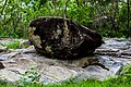
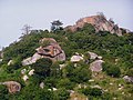 Chaos granitique Dassa.jpg 800 × 600; 254 KB
-
 Collines II.jpg 6,000 × 4,000; 3.93 MB
-
 Collines.jpg 6,000 × 4,000; 4.18 MB
-
 Escalade colline.jpg 1,170 × 1,560; 376 KB
-
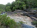
 Formation rocheuse près des chutes de la Kota.jpg 3,648 × 5,472; 6.71 MB
-
 Granites.jpg 6,000 × 4,000; 3.63 MB
-
 Grottes de Natitingou.jpg 4,000 × 3,000; 2.6 MB
-
 Grottes à Natitingou.jpg 4,000 × 3,000; 2.66 MB
-
 Herbes sur un affleurement rocheux dans le pâturage naturel de Samiondji (Covè).jpg 6,000 × 4,000; 3.13 MB
-
 Kplokedji Ewe Ketou Benin 04-05-2019.jpg 4,160 × 3,120; 7.17 MB
-
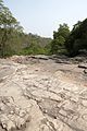
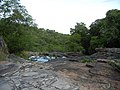
 Rivière et roches.jpg 6,000 × 4,000; 2.75 MB
-
 Roches dans le pâturage naturel de Samiondji (Covè).jpg 6,000 × 4,000; 3.14 MB
-
 Roches et végétaux.jpg 6,000 × 4,000; 3.85 MB
-
 Route dans la chaine de l'atacora à Tanguiéta.jpg 6,000 × 4,000; 5.63 MB
-
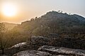 Sunset II.jpg 6,000 × 4,000; 3.76 MB
-
 Sunset III.jpg 6,000 × 4,000; 3.65 MB
-
 Sunset IV.jpg 6,000 × 4,000; 4.48 MB
-
 Tanougou-Formation rocheuse (2).jpg 3,648 × 5,472; 8.36 MB
-
 Tanougou-Formation rocheuse.jpg 5,472 × 3,648; 7.04 MB
-
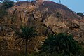
 Végétation saxicole verdoyant à Tanguiéta.jpg 5,551 × 3,701; 3.13 MB
-
 Végétation saxicole à l'entré de Tanguiéta.jpg 6,000 × 4,000; 4.91 MB
-
 Végétation saxicole à Tanguiéta.jpg 6,000 × 4,000; 5.18 MB
-
 Végétation saxicole.jpg 6,000 × 4,000; 2.89 MB


.jpg)
.jpg)


.jpg)


.jpg)


.jpg)


