Category:Robbesscheier
Jump to navigation
Jump to search
| Object location | | View all coordinates using: OpenStreetMap |
|---|
| Upload media | |||||
| Instance of | |||||
|---|---|---|---|---|---|
| Location | Munshausen, Clervaux, Canton of Clervaux, Luxembourg | ||||
| official website | |||||
 | |||||
Media in category "Robbesscheier"
The following 5 files are in this category, out of 5 total.
-
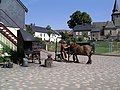 ArdennerPferd.JPG 2,592 × 1,944; 1.17 MB
-
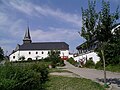
 Robbesscheier Munshausen 01.jpg 2,657 × 1,770; 3.34 MB
-
 Robbesscheier Munshausen 02.jpg 1,745 × 2,712; 3.05 MB
-
 Robbesscheier Munshausen 03.jpg 2,677 × 1,760; 3.5 MB
-
 Robbesscheier.JPG 2,592 × 1,944; 1.25 MB


