Category:Robbers Roost, California
Jump to navigation
Jump to search
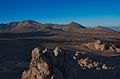
English: Robbers Roost (unincorporated Kern County, California, also known as Robber's Roost and Bandit Rock) is a rock formation in the foothills of the Scodie Mountains portion of the Southern Sierra Nevada Mountain Range in the North Mojave Desert. The formation overlooks the southern portion of the Indian Wells Valley. The nearest municipality is Ridgecrest. The Los Angeles Aqueduct is within several hundred yards of the formation. The area is managed by the Bureau of Land Management. Robbers Roost lies west of Freeman Junction, which is approximately at the intersection of California highways 178 and 14.
|
This is a category about a place or building that is listed on the National Register of Historic Places in the United States of America. Its reference number is 75000431. |
 | |||||
| Upload media | |||||
| Instance of | |||||
|---|---|---|---|---|---|
| Location | California, Pacific States Region | ||||
| Heritage designation |
| ||||
 | |||||
Media in category "Robbers Roost, California"
The following 7 files are in this category, out of 7 total.
-
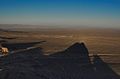 Freeman junction, California.jpg 640 × 422; 81 KB
-
 Robbers Roost.JPG 1,936 × 1,936; 1.31 MB
-
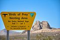 RobbersRoost - BirdsofPreyNestingArea.jpg 640 × 425; 65 KB
-
 Robbersroost1.jpg 640 × 422; 82 KB
-
 Robbersroost2.jpg 640 × 422; 103 KB
-
 Robbersroost3.jpg 640 × 422; 157 KB
-
 RobbersRoostKern.jpg 640 × 425; 82 KB


