Category:Roads in Extremadura
Jump to navigation
Jump to search
Autonomous communities of Spain: Andalusia · Aragon · Asturias · Balearic Islands · Basque Autonomous Community · Canary Islands · Cantabria · Castile and León · Castile-La Mancha · Catalonia · Extremadura · Galicia · Community of Madrid · Region of Murcia · Navarre · La Rioja · Valencian Community · Autonomous cities:
Wikimedia category | |||||
| Upload media | |||||
| Instance of | |||||
|---|---|---|---|---|---|
| Category combines topics |
| ||||
| Category contains | |||||
| Extremadura | |||||
autonomous community of Spain  .svg)   | |||||
| Instance of |
| ||||
| Patron saint | |||||
| Location | Spain | ||||
| Capital | |||||
| Legislative body | |||||
| Anthem |
| ||||
| Head of government |
| ||||
| Inception |
| ||||
| Highest point |
| ||||
| Population |
| ||||
| Area |
| ||||
| official website | |||||
 | |||||
Subcategories
This category has the following 23 subcategories, out of 23 total.
A
- Autovía EX-A1 (6 F)
- Autovía EX-A2 (7 F)
D
- Dirt roads in Extremadura (16 F)
E
H
M
- Milestones in Extremadura (1 F)
N
P
- Paths in Extremadura (4 F)
R
- Ronda Norte, Cáceres (2 F)
T
Media in category "Roads in Extremadura"
The following 20 files are in this category, out of 20 total.
-
 Carretera CC-1.2.JPG 3,648 × 2,736; 4.46 MB
-
 Construcción línea Ave Madrid-Portugal 07.jpg 4,608 × 3,456; 3.39 MB
-
 Construcción línea Ave Madrid-Portugal 08.jpg 4,608 × 3,456; 3.41 MB
-
 Empty road at night.jpg 3,264 × 2,448; 1.6 MB
-
 ESP A-58.svg 512 × 192; 15 KB
-
 ESP A-66.svg 1,000 × 400; 4 KB
-
 ESP EX-A3.svg 1,300 × 400; 4 KB
-
 ESP EX-A4.svg 1,300 × 400; 4 KB
-
 ESP EX-A5.svg 1,300 × 400; 5 KB
-
 ESP EX-A6.svg 1,300 × 400; 6 KB
-
 EX-359. Circunvalación oeste de Almendralejo. Tramo 1. Panorámica -1600x1200-.JPG 1,600 × 1,200; 1.13 MB
-
 EX-359. Circunvalación oeste de Almendralejo. Tramo 2. Panoramica.jpg 3,525 × 1,185; 1.32 MB
-
 EX-390. Desvío para evitar Cáceres el Viejo (campamento romano).jpg 1,688 × 1,185; 426 KB
-
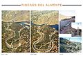 EX-390. Mejora de trazado en los Riberos del Almonte.jpg 5,906 × 4,134; 2.35 MB
-
 Extremadura 2010 (4484647248).jpg 1,332 × 894; 762 KB
-
 Trazado EX-A1.svg 937 × 443; 116 KB
-
 View on Sierra de Gata (7563954240).jpg 1,014 × 556; 311 KB
-
 Vía de la Plata. Hito nuevo en obra Puerto de los Castaños. Anverso.JPG 1,224 × 1,632; 534 KB
-
 Vía de la Plata. Hito nuevo en obra Puerto de los Castaños. Reverso.JPG 1,224 × 1,632; 498 KB
-
 Vía de la Plata. Representación calzada en Puerto de los Castaños.JPG 1,632 × 1,224; 406 KB


.jpg)

.jpg)

.jpg)


