Category:Road markings in London
Jump to navigation
Jump to search
Subcategories
This category has only the following subcategory.
L
Media in category "Road markings in London"
The following 46 files are in this category, out of 46 total.
-
 Traffic bollards at Sainsbury's Low Hall, Chingford, London 1.jpg 5,148 × 3,861; 16.78 MB
-
 Road marking between North London and Highgate cricket clubs, Crouch End, London, England.jpg 4,415 × 2,484; 18.02 MB
-
 Abbey Road London.jpg 600 × 407; 79 KB
-
 Anas platyrhynchos -London, England -male-8.jpg 1,684 × 1,174; 577 KB
-
 Blackout Precautions For Drivers, London, England, 1941 D2730.jpg 528 × 800; 42 KB
-
 Blackout Precautions For Drivers, London, England, 1941 D2733.jpg 529 × 800; 50 KB
-
 Brent Cross Bus Station 2.jpg 3,648 × 2,736; 3.73 MB
-
 Christ Church, Lambeth in 2010.jpg 2,736 × 3,648; 3.28 MB
-
 Confusing direction sign.jpg 700 × 664; 83 KB
-
 Definitely no parking here - geograph.org.uk - 1024362.jpg 480 × 640; 91 KB
-
 Direction sign error?.jpg 4,032 × 3,024; 6.64 MB
-
 DoubleRed-&-DoubleYellow-LinesMeet-London.jpg 3,072 × 2,304; 1.73 MB
-
 Finsbury Pavement junction with Finsbury Square (north side) view south 01.jpg 3,648 × 2,736; 3.77 MB
-
 Games Lane of the London 2012 Olympic route network.JPG 1,872 × 909; 507 KB
-

-
 Great Smith Street, SW1 - geograph.org.uk - 1006828.jpg 640 × 480; 87 KB
-
 Line Painting, City Road, London (24551577052).jpg 1,752 × 1,140; 1.26 MB
-
 London 2012 games lane.jpg 3,264 × 2,448; 3.1 MB
-
 London cycle lanes 24.JPG 2,736 × 3,648; 3.76 MB
-
 London Look Right.jpg 4,048 × 3,040; 3.35 MB
-
 London MMB »0K1 Marsh Wall.jpg 4,128 × 2,933; 4.96 MB
-
 London Street Look Left.JPG 1,936 × 1,936; 1.41 MB
-
 London, Islington, line painting (101).jpg 3,970 × 1,834; 2.26 MB
-
 London, Islington, line painting (102).jpg 3,897 × 1,801; 2.06 MB
-
 London, Islington, line painting (103).jpg 3,883 × 1,794; 2.76 MB
-
 London, Islington, line painting (104).jpg 3,955 × 1,827; 2.81 MB
-
 London, Islington, line painting (105).jpg 3,970 × 1,834; 2.83 MB
-
 Look Right.jpg 2,592 × 1,944; 1.54 MB
-
 Look Right1.jpg 1,923 × 1,443; 1.12 MB
-
 'Model Traffic Area' at Lordship Recreation Ground Haringey London England 01.jpg 3,500 × 2,333; 8.28 MB
-
 'Model Traffic Area' at Lordship Recreation Ground Haringey London England 03.jpg 3,500 × 2,333; 8.55 MB
-
 'Model Traffic Area' at Lordship Recreation Ground Haringey London England 04.jpg 3,500 × 2,333; 7.84 MB
-
 'Model Traffic Area' at Lordship Recreation Ground Haringey London England 05.jpg 3,500 × 2,333; 8.21 MB
-
 Red Route Westminster Bridge.jpg 6,000 × 4,000; 8.49 MB
-
 RoadSurfaceMarking.jpg 1,698 × 2,094; 2.96 MB
-
 Entrance to St John's Church Centre - geograph.org.uk - 1523743.jpg 640 × 480; 69 KB
-
 Stoke Newington Church Street - geograph.org.uk - 1469336.jpg 480 × 640; 74 KB
-
 Stoke Newington Church Street duplicate cycle markings.JPG 3,712 × 2,088; 3.4 MB
-
 Thornfield Road, W12 - geograph.org.uk - 697007.jpg 640 × 512; 99 KB
-
 Tottenham Court Road (32743243904).jpg 720 × 1,080; 1.13 MB
-
 Upper Street, Islington.JPG 4,000 × 3,000; 4.11 MB
-
 Utilities and telecoms road markings.jpg 2,048 × 1,536; 732 KB
-
 Utility company road markings.jpg 750 × 500; 393 KB
-
 Wavy lines before pedestrian crossing.jpg 2,816 × 2,112; 2.96 MB
-
 White Lining - geograph.org.uk - 263812.jpg 640 × 480; 98 KB
-
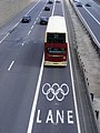 YX09 GWJ East Yorkshire 763 in the Olympic Lane A12 London E3 July 15 2012.jpg 979 × 1,306; 231 KB


_view_south_01.jpg)


.jpg)


.jpg)
.jpg)
.jpg)
.jpg)
.jpg)


.jpg)


.jpg)