Category:Riverfront Trail
Jump to navigation
Jump to search
part of the bike trail network in Windsor, Ontario, Canada | |||||
| Upload media | |||||
| Location | Ontario, Canada | ||||
|---|---|---|---|---|---|
| Terminus | |||||
 | |||||
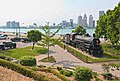
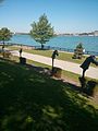
Windsor, Ontario features riverside parks along a long continuous stretch. It's not always clear where one ends and the next begins. These riverfront public parks have one thing in common - the Riverfront Trail for walking and bicycles.
The Riverfront Trail parks from south/west to north/east...
Windsor Sculpture Park[edit]
- formerly Assumption Park which is now just south of Riverside Drive West only
- starts at the Ambassador Bridge
Centennial Park[edit]
Caron Ave Pumping Station Park[edit]
- by Caron Ave
Steamboat Wharf[edit]
Korean War Memorial[edit]
Dieppe Gardens[edit]
The Great Canadian Flag[edit]
- at the base of Ouelette Ave
Spirit of Windsor Canadian National # 5588[edit]
- at the base of Goyeau St
Civic Terrace[edit]
Festival Plaza[edit]
- between McDougall St / Glengarry Ave
Great Western Park[edit]
Bert Weeks Memorial Gardens[edit]
- between Parent Ave / Langlois Ave
Joan and Cliff Hatch Wildflower Garden[edit]
- between Hall Ave / Moy Ave
- ...and the Riverfront Trail ends across the train tracks between Lincoln Rd / Devonshire Rd
Subcategories
This category has the following 6 subcategories, out of 6 total.
Media in category "Riverfront Trail"
The following 33 files are in this category, out of 33 total.
-
 Assumption Park - Real geese among the sculpture.jpg 1,024 × 768; 667 KB
-
 Bell Measure.jpeg 2,448 × 3,264; 3.28 MB
-
 Bridge Bites (2825579078).jpg 2,272 × 1,704; 506 KB
-
-

-
 Craft 9.jpeg 3,264 × 2,448; 2.62 MB
-
 Flags at half mast for Jack Layton in Windsor Ontario.jpg 577 × 473; 127 KB
-
 Odette Sculpture Park Tembo.jpg 3,197 × 2,558; 5.03 MB
-
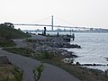
 Picture of Detroit river.jpg 4,896 × 3,672; 5.04 MB
-
 Portofino Choo-Choo (2824751827).jpg 1,704 × 2,272; 1.41 MB
-
 Racing Horses.jpeg 2,448 × 3,264; 2.63 MB
-
 Remains of the old CP Rail station (2825572054).jpg 2,272 × 1,704; 1.51 MB
-
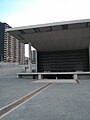 RiverfrontFestivalPlaza.jpg 768 × 1,024; 241 KB
-
 Riverfrontwalk windsor.jpg 800 × 600; 477 KB
-
 Riverside Windsor.jpg 1,920 × 2,560; 2.16 MB
-
 Riverside, Windsor Canada.jpg 2,560 × 1,920; 2.04 MB
-
 Sculpture park (2825575658).jpg 2,272 × 1,704; 1.22 MB
-
 Silver Cross Monument - Croix d'Argent monument - panoramio.jpg 2,337 × 2,338; 1.2 MB
-
 Spirit of Windsor.jpg 640 × 480; 154 KB
-
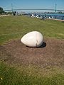 The Chicken and Egg.jpeg 2,448 × 3,264; 3.78 MB
-
 The Columns.jpeg 2,448 × 3,264; 3.03 MB
-
 The not so Big Apple (2825579670).jpg 2,272 × 1,704; 967 KB
-
 The Sisters Sculpture.jpeg 2,448 × 3,264; 2.52 MB
-
 The Sisters.jpeg 2,448 × 3,264; 3.38 MB
-
 Tribute to the brain.jpeg 2,448 × 3,264; 1.63 MB
-
 Twin Cities Water Fountain.jpeg 2,448 × 3,264; 3.02 MB
-
 Unknown sculpture.jpeg 2,448 × 3,264; 3.33 MB
-
 West of Caron (2824736531).jpg 2,272 × 1,704; 824 KB
-
 Windsor Sculpture Park.jpeg 2,448 × 3,264; 3.92 MB
-
 Windsor, Ontario (21151692493).jpg 4,000 × 3,000; 2.95 MB
-
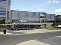
 WindsorAmbassadorPlaza.jpg 1,909 × 1,273; 494 KB
-
 WindsorDieppeGardens snack bar.jpg 2,551 × 1,901; 718 KB
-
 WindsorSculptrewalkandbiketrail.jpg 2,576 × 1,920; 1.11 MB


.jpg)


.jpg)

.jpg)


.jpg)


.jpg)


.jpg)

.jpg)


