Category:River Lynher
Jump to navigation
Jump to search
river in Cornwall, England  | |||||
| Upload media | |||||
| Instance of | |||||
|---|---|---|---|---|---|
| Location |
| ||||
| Length |
| ||||
| Origin of the watercourse | |||||
| Mouth of the watercourse | |||||
| Tributary | |||||
 | |||||
Subcategories
This category has the following 3 subcategories, out of 3 total.
S
- St Germans viaduct (25 F)
T
- Trevague Ford (3 F)
Media in category "River Lynher"
The following 60 files are in this category, out of 60 total.
-
 A Glimpse of the River - geograph.org.uk - 408018.jpg 640 × 427; 160 KB
-
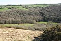
 A waterside field - geograph.org.uk - 72427.jpg 640 × 444; 79 KB
-
 Admiralty Chart No 3418 St. Germans or Lynher River, Published 1904.jpg 10,587 × 8,159; 35.55 MB
-
 Another view across estuary - geograph.org.uk - 345431.jpg 480 × 640; 141 KB
-
 Anthony Lynher River scene 1729645 2d56b596.jpg 640 × 467; 143 KB
-
 Antony Passage quay - geograph.org.uk - 66296.jpg 640 × 386; 110 KB
-
 Antony Passage, Cornwall.jpg 5,152 × 3,864; 12.98 MB
-
 At Wearde Quay - geograph.org.uk - 1190659.jpg 640 × 480; 97 KB
-
 Boats in the Lynher - geograph.org.uk - 1190828.jpg 640 × 480; 63 KB
-
 By the Lynher, Bathpool - geograph.org.uk - 530661.jpg 640 × 480; 191 KB
-
 Churchtown Farm Community Nature Reserve - geograph.org.uk - 1191804.jpg 640 × 480; 107 KB
-
 Clapper bridge over the Lynher - geograph.org.uk - 1954829.jpg 2,816 × 2,112; 2.81 MB
-
 Cumble Tor View - geograph.org.uk - 150246.jpg 640 × 480; 129 KB
-
 Daffodils by the River Lynher - geograph.org.uk - 1205451.jpg 480 × 640; 125 KB
-
 Devonport from Saltash.jpg 3,279 × 2,702; 3.79 MB
-
 Devonport River - panoramio (1).jpg 3,648 × 2,736; 1.38 MB
-
 Devonport River - panoramio.jpg 3,648 × 2,736; 1.54 MB
-
 Evening on the River Lynher - geograph.org.uk - 133532.jpg 640 × 395; 43 KB
-

-
 Forder Viaduct.jpg 5,152 × 3,864; 10.8 MB
-

-
 High Water Mark - geograph.org.uk - 344887.jpg 640 × 455; 111 KB
-
 HMS Brecon in the Lynher.jpg 3,156 × 2,355; 2.11 MB
-
 HMS Brecon on the Lynher.jpg 5,556 × 2,730; 6.55 MB
-
 Linkinhorne, the Lynher at Rilla Mill - geograph.org.uk - 49058.jpg 640 × 435; 186 KB
-
 Lynher Estuary at Antony Passage.jpg 6,928 × 2,756; 6.4 MB
-
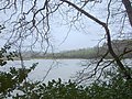
 Lynher River - geograph.org.uk - 359754.jpg 640 × 480; 81 KB
-
 Lynher River near Erth Barton - geograph.org.uk - 150232.jpg 640 × 231; 26 KB
-
 Lynher Viaduct and river - geograph.org.uk - 738798.jpg 640 × 447; 80 KB
-
 North Hill, river Lynher - geograph.org.uk - 1221966.jpg 640 × 427; 519 KB
-
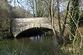 NotterBridgeCornwallUK.jpg 640 × 427; 329 KB
-
 Passage Point and the River Lynher - geograph.org.uk - 1191937.jpg 640 × 462; 81 KB
-
 Pillaton mill weir on the river Lynher - geograph.org.uk - 915383.jpg 640 × 606; 142 KB
-
 River Lynher (25915720165).jpg 3,264 × 1,836; 4.12 MB
-
 River Lynher - geograph.org.uk - 195940.jpg 640 × 480; 139 KB
-
 River Lynher - geograph.org.uk - 5018795.jpg 640 × 435; 45 KB
-
 River Lynher at Pillatonmill - geograph.org.uk - 179844.jpg 640 × 427; 351 KB
-
 River Lynher from Wearde Road - geograph.org.uk - 1191296.jpg 640 × 480; 74 KB
-
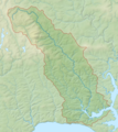 River Lynher map.png 1,343 × 1,508; 831 KB
-
 River Lynher towards Saltash - geograph.org.uk - 356419.jpg 640 × 480; 128 KB
-
 St Ive, Lynher valley - geograph.org.uk - 715479.jpg 640 × 427; 172 KB
-
 St Ive, River Lynher near Newbridge - geograph.org.uk - 715466.jpg 640 × 427; 247 KB
-
 St Mellion, Pillaton Mill Weir - geograph.org.uk - 37195.jpg 640 × 428; 120 KB
-
 The Lynher River - geograph.org.uk - 411619.jpg 640 × 427; 141 KB
-
 The Lynher River - geograph.org.uk - 492823.jpg 640 × 480; 94 KB
-
 The Lynher viaduct from Trevollard - geograph.org.uk - 1712336.jpg 640 × 427; 74 KB
-
 The River Lynher above Newbridge - geograph.org.uk - 1205461.jpg 480 × 640; 112 KB
-
 The River Lynher at Bicton Mill - geograph.org.uk - 465227.jpg 640 × 427; 104 KB
-
 The River Lynher at low tide - geograph.org.uk - 1049579.jpg 640 × 426; 114 KB
-
 The River Lynher below Cadson Bury Fort - geograph.org.uk - 407984.jpg 427 × 640; 154 KB
-
 The River Lynher below Newbridge - geograph.org.uk - 1205454.jpg 480 × 640; 107 KB
-
 The River Lynher by Plushabridge - geograph.org.uk - 410666.jpg 640 × 426; 168 KB
-

-
 The River Lynher, Bathpool - geograph.org.uk - 534097.jpg 605 × 640; 198 KB
-
 Tidal Marshes, Sconner Turf , St Germans - geograph.org.uk - 163886.jpg 640 × 421; 105 KB
-
 View across Estuary - geograph.org.uk - 345428.jpg 640 × 480; 137 KB
-
 View From the Lynher Viaduct - geograph.org.uk - 133319.jpg 640 × 427; 68 KB
-
 Warehouse, Wearde Quay - geograph.org.uk - 1190855.jpg 640 × 480; 74 KB
-
 Watery meadow by the Lynher - geograph.org.uk - 637427.jpg 480 × 640; 132 KB
-
 Bathpool, Slipway into the Lynher - geograph.org.uk - 534085.jpg 640 × 480; 201 KB


.jpg)


.jpg)


