Category:River Dane
Jump to navigation
Jump to search
river in Cheshire, United Kingdom  | |||||
| Upload media | |||||
| Instance of | |||||
|---|---|---|---|---|---|
| Location |
| ||||
| Heritage designation | |||||
| Mouth of the watercourse | |||||
| Tributary |
| ||||
 | |||||
Subcategories
This category has the following 11 subcategories, out of 11 total.
C
- Congleton Park (10 F)
D
- Dane Aqueduct (7 F)
- Dane Bridge, Danebridge (10 F)
- Danebower (45 F)
N
- North Rode Viaduct (5 F)
S
- Shipbrook Bridge, Davenham (4 F)
T
- Twemlow Viaduct (16 F)
U
- Upper Washford Mill (11 F)
Media in category "River Dane"
The following 82 files are in this category, out of 82 total.
-

-
 Beeches by the River Dane - geograph.org.uk - 317983.jpg 480 × 640; 165 KB
-
 Blackbrook meets the Dane - geograph.org.uk - 4402788.jpg 5,004 × 3,336; 2.96 MB
-
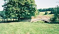
 Bridge over the River Dane - geograph.org.uk - 1289702.jpg 640 × 426; 62 KB
-
 Byley Bridge - geograph.org.uk - 27692.jpg 640 × 480; 147 KB
-
 Colleymill Bridge 01.jpg 4,000 × 3,000; 4.81 MB
-
 Colleymill Bridge 02.jpg 4,000 × 3,000; 4.75 MB
-
 Colleymill Bridge 03.jpg 4,000 × 3,000; 4.84 MB
-
 Congleton Bridge Mill 2431.JPG 3,264 × 2,448; 2.04 MB
-
 Congleton Dane Havannah St 2603.JPG 3,264 × 2,448; 2.05 MB
-
 Congleton Dane Mill 2585.JPG 3,264 × 2,448; 2.07 MB
-
 Congleton Dane Rope Walk 2573.JPG 3,264 × 2,448; 1.99 MB
-
 Congleton Dane Royle Street 2574.JPG 3,264 × 2,448; 2.02 MB
-
 Congleton Mallard with Ducklings 2592.JPG 3,264 × 2,448; 1.96 MB
-
 Congleton Old Mill Weir 2441.JPG 3,264 × 2,448; 2.04 MB
-
 Congleton Old Mill Weir 2442.JPG 3,264 × 2,448; 2.05 MB
-
 Congleton Park 2445.JPG 3,264 × 2,448; 2.08 MB
-
 Congleton Park 2446.JPG 3,264 × 2,448; 2 MB
-
 Congleton Park River Dane 2447.JPG 3,264 × 2,448; 2 MB
-
 Congleton Upper Washford Mill 2502.JPG 3,264 × 2,448; 1.98 MB
-
 Congleton Upper Washford Mill 2504.JPG 3,264 × 1,840; 1.53 MB
-
 Congleton Upper Washford Mill 2604.JPG 3,264 × 2,448; 2.03 MB
-
 Congleton Upper Washford Mill 2605.JPG 3,264 × 2,448; 1.97 MB
-
 Congleton Upper Washford Mill 2607.JPG 3,264 × 2,448; 2.01 MB
-
 Congleton Upper Washford Mill 2608.JPG 3,264 × 2,448; 2.01 MB
-
 Congleton Upper Washford Mill 2610.JPG 3,264 × 2,448; 1.99 MB
-
 Dane valley above Three Shire Heads - geograph.org.uk - 175801.jpg 640 × 480; 120 KB
-
 Dane Valley Way in Forest Wood - geograph.org.uk - 1298890.jpg 640 × 480; 200 KB
-
 Dane Valley Way near Danebridge - geograph.org.uk - 1298841.jpg 640 × 480; 197 KB
-
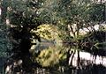
 Fishing still waters - geograph.org.uk - 1567334.jpg 640 × 480; 70 KB
-
 Gradbach Mill as it is - geograph.org.uk - 4234642.jpg 5,184 × 3,456; 2.61 MB
-
 Gradbach Mill as it was - geograph.org.uk - 4234632.jpg 1,514 × 960; 305 KB
-
 Havannah Bridge.jpg 4,000 × 3,000; 4.84 MB
-
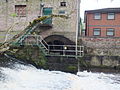
 Havannah Weir.jpg 4,052 × 3,070; 2.1 MB
-
 Hermitage Bridge at Holmes Chapel.jpg 1,072 × 616; 294 KB
-
 Hermitage Bridge, Holmes Chapel.jpg 3,456 × 2,304; 4.2 MB
-
 Hug Bridge.jpg 3,456 × 2,304; 444 KB
-
 Looking downriver at Gradbach - geograph.org.uk - 3160795.jpg 1,024 × 683; 114 KB
-
 Lymford Bridge.jpg 4,000 × 3,000; 5.32 MB
-
 Old Mill (1753-1830) in 1902.png 460 × 278; 123 KB
-
 Open gateway above the Dane Valley - geograph.org.uk - 3211055.jpg 3,872 × 2,592; 5.59 MB
-
 Railway bridge over the River Dane - geograph.org.uk - 1950795.jpg 640 × 480; 122 KB
-
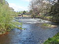
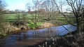
 River Dane - geograph.org.uk - 1289553.jpg 640 × 426; 51 KB
-
 River Dane - geograph.org.uk - 1289559.jpg 640 × 426; 54 KB
-
 River Dane - geograph.org.uk - 1289663.jpg 640 × 426; 52 KB
-
 River Dane - geograph.org.uk - 1289666.jpg 640 × 426; 54 KB
-
 River Dane - geograph.org.uk - 1414194.jpg 640 × 480; 145 KB
-
 River Dane - geograph.org.uk - 25347.jpg 640 × 480; 143 KB
-
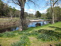
 River Dane - geograph.org.uk - 2925474.jpg 427 × 640; 290 KB
-
 River Dane - geograph.org.uk - 3989177.jpg 3,522 × 2,602; 3.62 MB
-
 River Dane - geograph.org.uk - 433942.jpg 640 × 480; 104 KB
-
 River Dane - geograph.org.uk - 444644.jpg 640 × 480; 408 KB
-
 River Dane - geograph.org.uk - 447274.jpg 640 × 480; 175 KB
-
 River Dane - geograph.org.uk - 46363.jpg 640 × 450; 132 KB
-
 River Dane - geograph.org.uk - 508508.jpg 640 × 480; 177 KB
-
 River Dane - geograph.org.uk - 508514.jpg 640 × 480; 192 KB
-
 River Dane - geograph.org.uk - 55492.jpg 640 × 480; 127 KB
-
 River Dane - geograph.org.uk - 56518.jpg 640 × 480; 131 KB
-
 River Dane above Three Shire Heads - geograph.org.uk - 175799.jpg 640 × 480; 124 KB
-
 River Dane and Black Brook confluence - geograph.org.uk - 2404312.jpg 3,883 × 2,912; 6.5 MB
-
 River Dane at Northwich (1).JPG 4,608 × 3,456; 3.4 MB
-
 River Dane footbridge - geograph.org.uk - 898112.jpg 640 × 474; 173 KB
-
 River Dane in Forest Wood - geograph.org.uk - 317915.jpg 483 × 640; 176 KB
-
 River Dane near Bosley - geograph.org.uk - 751033.jpg 480 × 640; 67 KB
-
 River Dane near Middlewich - geograph.org.uk - 3847675.jpg 1,024 × 576; 249 KB
-
 River Dane near the old quarry - geograph.org.uk - 1023036.jpg 640 × 480; 91 KB
-
 River Dane under the Railway - geograph.org.uk - 3847676.jpg 1,024 × 627; 257 KB
-
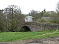
 River Dane, Danebridge - geograph.org.uk - 680788.jpg 640 × 480; 190 KB
-
 River Dane. - geograph.org.uk - 871728.jpg 640 × 480; 336 KB
-
 Road across the Dane - geograph.org.uk - 3211045.jpg 3,872 × 2,592; 5.96 MB
-
 The Dane Valley at Gradbach - geograph.org.uk - 1768771.jpg 1,583 × 2,279; 667 KB
-
 The Dane Valley near Gradbach - geograph.org.uk - 3211108.jpg 3,872 × 2,592; 5.63 MB
-
 The Dane Valley near Knar - geograph.org.uk - 3210989.jpg 3,872 × 2,592; 4.22 MB
-
 The end of a wall above the Dane Valley - geograph.org.uk - 3211025.jpg 3,872 × 2,592; 4.99 MB
-
 The River Dane East of Leftwich - geograph.org.uk - 2689692.jpg 3,072 × 2,304; 4.86 MB
-
 Victoria Bridge, Chester Way - geograph.org.uk - 1297724.jpg 640 × 480; 76 KB
-
 Weir on River Dane - geograph.org.uk - 117987.jpg 640 × 433; 130 KB
-
 Wincle - River Dane - geograph.org.uk - 280555.jpg 640 × 480; 211 KB
-
 Bridge over the River Dane - geograph.org.uk - 107244.jpg 640 × 480; 111 KB
-
 Footbridge Over River Dane - geograph.org.uk - 409977.jpg 640 × 480; 107 KB
-
 River Dane north east of Gradbach - geograph.org.uk - 317223.jpg 640 × 497; 181 KB
-
 The River Dane, near Bosley, Cheshire - geograph.org.uk - 550102.jpg 465 × 640; 161 KB


_in_1902.png)


.JPG)


