Category:Risley, Derbyshire
Jump to navigation
Jump to search
English: Risley is a small village and parish in Erewash in the English county of Derbyshire. It is just over four miles south of Ilkeston. Sandiacre is next door to the east.
village and civil parish in Erewash District, Derbyshire, England  | |||||
| Upload media | |||||
| Instance of | |||||
|---|---|---|---|---|---|
| Location | Erewash, Derbyshire, East Midlands, England | ||||
 | |||||
Subcategories
This category has the following 6 subcategories, out of 6 total.
Media in category "Risley, Derbyshire"
The following 110 files are in this category, out of 110 total.
-
 A52 Footbridge, near junction 25 of M1 - geograph.org.uk - 3470037.jpg 2,256 × 1,504; 1.31 MB
-
 A52 half mile to the M1 - geograph.org.uk - 3884574.jpg 3,088 × 2,056; 2.09 MB
-
 All Saints church, Risley - geograph.org.uk - 3954784.jpg 1,280 × 960; 357 KB
-
 All Saints' church - geograph.org.uk - 2536440.jpg 640 × 427; 103 KB
-
 Ascent Into Light - geograph.org.uk - 923683.jpg 427 × 640; 252 KB
-
 Autumn Scene, Risley - geograph.org.uk - 990030.jpg 640 × 480; 151 KB
-
 Awaiting The Pants - geograph.org.uk - 1361927.jpg 640 × 427; 71 KB
-
 B5010 near Mount Pleasant - geograph.org.uk - 3133066.jpg 1,024 × 768; 146 KB
-
 B5010 towards Derby - geograph.org.uk - 6196778.jpg 800 × 600; 179 KB
-
 Backlit Grass - geograph.org.uk - 908088.jpg 640 × 427; 165 KB
-
 Bench mark, All Saints, Risley - geograph.org.uk - 3954772.jpg 1,280 × 960; 540 KB
-
 Between Golden Valley and Pastures Farms - geograph.org.uk - 6056823.jpg 2,000 × 1,333; 2.78 MB
-
 Breaston Lane, Risley - geograph.org.uk - 990039.jpg 640 × 480; 77 KB
-
 Brian Clough Way near Risley - geograph.org.uk - 3753070.jpg 2,659 × 1,549; 805 KB
-
 Brook House, Risley - geograph.org.uk - 3954797.jpg 1,280 × 960; 468 KB
-
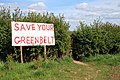 Campaign Sign on the Midshires Way - geograph.org.uk - 1360684.jpg 640 × 427; 124 KB
-
 Chest tombs, Risley churchyard - geograph.org.uk - 3954758.jpg 1,280 × 960; 472 KB
-
 Church Cottage - geograph.org.uk - 2536454.jpg 640 × 427; 97 KB
-
 Church Cottage, Risley - geograph.org.uk - 3954769.jpg 1,280 × 960; 301 KB
-

-
 Daffodils in Risley - geograph.org.uk - 6056825.jpg 2,000 × 1,333; 3.25 MB
-
 Derby Road (B5010) towards Risley - geograph.org.uk - 6196784.jpg 800 × 600; 105 KB
-
 Derby Road, Risley - geograph.org.uk - 3133052.jpg 1,024 × 768; 178 KB
-
 Derby Road, Risley - geograph.org.uk - 4822238.jpg 1,280 × 851; 344 KB
-
 Derby Road, Risley - geograph.org.uk - 6196767.jpg 800 × 633; 102 KB
-
 Derby Road, Risley - geograph.org.uk - 6199893.jpg 5,184 × 3,888; 6.08 MB
-
 Derbyshire UK parish map highlighting Risley.svg 888 × 1,308; 2.34 MB
-
 Doorway detail. Latin House, Risley - geograph.org.uk - 3954792.jpg 1,280 × 960; 269 KB
-
 Elizabeth II postbox on Derby Road, Risley - geograph.org.uk - 6199892.jpg 2,521 × 4,382; 3.2 MB
-
 Evening View from The Midshires Way - geograph.org.uk - 860325.jpg 640 × 427; 176 KB
-
 Farm Building Conversion - geograph.org.uk - 862652.jpg 640 × 427; 247 KB
-
 Farm track near Peatmeadow Farm - geograph.org.uk - 5490202.jpg 1,280 × 869; 269 KB
-
 Farmland south of No Man's Lane - geograph.org.uk - 4994055.jpg 1,280 × 851; 397 KB
-
 Field Near Risley - geograph.org.uk - 908158.jpg 427 × 640; 248 KB
-
 Field north of the B5010 near Risley - geograph.org.uk - 3133070.jpg 1,024 × 768; 133 KB
-
 Field of Wheat near Risley - geograph.org.uk - 3603108.jpg 4,000 × 3,000; 3.17 MB
-
 Footbridge, Risley Park - geograph.org.uk - 2818740.jpg 1,600 × 1,200; 775 KB
-
 Footpath towards Risley Lodge Farm - geograph.org.uk - 5490162.jpg 1,280 × 881; 236 KB
-
 Four Ways - geograph.org.uk - 889295.jpg 427 × 640; 254 KB
-
 Golden Valley Farm - geograph.org.uk - 3948035.jpg 1,280 × 818; 208 KB
-
 Golf course warning - geograph.org.uk - 1970132.jpg 683 × 1,024; 186 KB
-
 Grazing near Pastures Farm - geograph.org.uk - 6196782.jpg 800 × 600; 133 KB
-
 Grotesque heads, Latin House, Risley (1) - geograph.org.uk - 3979305.jpg 1,280 × 960; 288 KB
-
 Grotesque heads, Latin House, Risley (2) - geograph.org.uk - 3979311.jpg 1,280 × 960; 281 KB
-
 Grotesque heads, Latin House, Risley (3) - geograph.org.uk - 3979316.jpg 1,280 × 996; 185 KB
-
 Haloed Poppy - geograph.org.uk - 878716.jpg 399 × 640; 237 KB
-
 Houses on Derby Road, Risley - geograph.org.uk - 6196766.jpg 800 × 435; 84 KB
-
 Ivy Covered Pole - geograph.org.uk - 908075.jpg 427 × 640; 179 KB
-
 Latin College and Latin Cottage, Risley - geograph.org.uk - 3954799.jpg 1,280 × 960; 525 KB
-
 Latin House - geograph.org.uk - 2536314.jpg 640 × 427; 125 KB
-
 Latin House, Risley - geograph.org.uk - 3979272.jpg 1,280 × 1,082; 374 KB
-
 Midshires Way crossing the Golden Brook - geograph.org.uk - 5491139.jpg 1,280 × 902; 630 KB
-
 Midshires Way near Hopwell Hall - geograph.org.uk - 5491135.jpg 1,280 × 939; 358 KB
-
 Near Risley Lodge Farm - geograph.org.uk - 5490191.jpg 1,280 × 883; 241 KB
-
 No Man's Lane - geograph.org.uk - 4993934.jpg 1,280 × 851; 267 KB
-
 No Man's Lane towards Sandiacre - geograph.org.uk - 6196749.jpg 800 × 600; 121 KB
-
 Nottingham Road (B5010) towards Risley - geograph.org.uk - 6196793.jpg 800 × 600; 133 KB
-
 Nottingham Road, Risley - geograph.org.uk - 3133057.jpg 1,024 × 768; 182 KB
-
 Old Milepost by the B5010 in Risley (geograph 5623807).jpg 640 × 640; 536 KB
-
 Old Milepost by the B5010, west of Risley (geograph 5623806).jpg 868 × 1,522; 215 KB
-
 Petrol Station and garage - geograph.org.uk - 1777462.jpg 1,024 × 683; 166 KB
-
 Public Footpath near Risley - geograph.org.uk - 3603060.jpg 4,000 × 3,000; 2.63 MB
-
 Recycling day on Rushy Lane - geograph.org.uk - 6296859.jpg 2,000 × 1,330; 1.91 MB
-
 Risley , Bostocks Lane - geograph.org.uk - 5979040.jpg 6,000 × 4,000; 7.38 MB
-
 Risley Church - geograph.org.uk - 4822165.jpg 1,280 × 863; 352 KB
-
 Risley Church - geograph.org.uk - 4823623.jpg 851 × 1,280; 333 KB
-
 Risley Churchyard - geograph.org.uk - 4823186.jpg 1,280 × 851; 477 KB
-
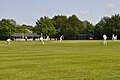 Risley Cricket Club.jpg 3,216 × 2,136; 3.52 MB
-
 Risley Information Point - geograph.org.uk - 4822242.jpg 851 × 1,280; 298 KB
-
 Risley Lodge Farm - geograph.org.uk - 2324454.jpg 640 × 443; 109 KB
-
 Risley Lodge Farm - geograph.org.uk - 5490179.jpg 1,280 × 960; 386 KB
-
 Risley Lodge Farm - geograph.org.uk - 5490182.jpg 1,280 × 842; 301 KB
-
 Risley Lodge Farm - geograph.org.uk - 878722.jpg 427 × 640; 251 KB
-
 Risley Lodge Farm, Risley, Derbys. - geograph.org.uk - 3338448.jpg 3,516 × 1,563; 1.15 MB
-
 Risley Lodge Farm, Risley, Derbys. - geograph.org.uk - 3338508.jpg 2,531 × 2,568; 1.14 MB
-
 Risley Lower Grammar School - geograph.org.uk - 6196771.jpg 800 × 478; 102 KB
-
 Risley Park - geograph.org.uk - 5491137.jpg 1,280 × 960; 421 KB
-
 Risley postbox ref DE72 442 - geograph.org.uk - 3979268.jpg 960 × 1,280; 335 KB
-
 Risley War Memorial - geograph.org.uk - 3133055.jpg 1,024 × 768; 192 KB
-
 Rushy Lane, Risley - geograph.org.uk - 3133048.jpg 1,024 × 768; 120 KB
-
 Second Avenue, Sandiacre - geograph.org.uk - 990020.jpg 640 × 480; 99 KB
-
 Shell porch, The Old School House - geograph.org.uk - 3979328.jpg 863 × 1,280; 338 KB
-

-
 Small Rainbow - geograph.org.uk - 889299.jpg 424 × 640; 151 KB
-
 Sun and shadows under the A52 - geograph.org.uk - 5647483.jpg 1,280 × 902; 272 KB
-
 The Crescent - geograph.org.uk - 1030276.jpg 640 × 426; 169 KB
-
 The entrance to Risley Hall - geograph.org.uk - 3979290.jpg 1,280 × 960; 485 KB
-
 The Grammar School, Risley.jpg 1,280 × 974; 380 KB
-
 The Old Post Office, Risley - geograph.org.uk - 990031.jpg 640 × 480; 146 KB
-
 The Old School House, Risley.jpg 1,280 × 960; 454 KB
-
 The Risley Park - geograph.org.uk - 3603098.jpg 3,998 × 2,998; 2.11 MB
-
 The Risley Park - geograph.org.uk - 921518.jpg 640 × 395; 83 KB
-
 The Risley Park Bar ^ Restaurant - geograph.org.uk - 6196773.jpg 800 × 542; 89 KB
-
 The track to Peatmeadow Farm - geograph.org.uk - 6368105.jpg 3,008 × 2,000; 4.28 MB
-
 The track to Trentham Farm - geograph.org.uk - 6368100.jpg 3,008 × 2,000; 2.47 MB
-
 Through a Thick Hedge - geograph.org.uk - 908267.jpg 640 × 427; 241 KB
-
 Toward Wisteria Farm - geograph.org.uk - 897169.jpg 640 × 427; 166 KB
-
 Track to Hopwell Hall Farm - geograph.org.uk - 1361942.jpg 640 × 427; 123 KB
-
 Track to Wisteria Farm - geograph.org.uk - 4994052.jpg 1,280 × 851; 448 KB
-
 Tree and Field - geograph.org.uk - 1361934.jpg 427 × 640; 113 KB
-
 Waymark variety - geograph.org.uk - 5490190.jpg 1,280 × 960; 334 KB
-
 Wheat field at dawn - geograph.org.uk - 4059209.jpg 1,600 × 1,200; 1.48 MB
-
 Where the wild oats are sown - geograph.org.uk - 5490160.jpg 1,280 × 899; 633 KB
-
 Wood Hall and The Story of the Risley Lanx - geograph.org.uk - 5491134.jpg 1,280 × 947; 425 KB
-
 Horse and its shelter - geograph.org.uk - 642610.jpg 640 × 427; 133 KB
-
 Longmoor Road - Long Eaton - geograph.org.uk - 642598.jpg 640 × 427; 145 KB
-
 Maywood Golf Club - geograph.org.uk - 71110.jpg 640 × 480; 58 KB
-
 Maywood Golf Course - geograph.org.uk - 73245.jpg 640 × 480; 76 KB
-
 Risley Lodge Farm - geograph.org.uk - 71289.jpg 640 × 480; 75 KB
-
 Strawberry picking near Risley - geograph.org.uk - 569482.jpg 640 × 480; 124 KB


_towards_Risley_-_geograph.org.uk_-_6196784.jpg)


_-_geograph.org.uk_-_3979305.jpg)
_-_geograph.org.uk_-_3979311.jpg)
_-_geograph.org.uk_-_3979316.jpg)


_towards_Risley_-_geograph.org.uk_-_6196793.jpg)

.jpg)
.jpg)


