Category:Rhyd Ddu
Jump to navigation
Jump to search
village in Gwynedd, Wales  | |||||
| Upload media | |||||
| Pronunciation audio | |||||
|---|---|---|---|---|---|
| Instance of | |||||
| Location | Gwynedd, Wales | ||||
 | |||||

Català: Rhyd-Ddu és un petit poble de la zona d' Eryry (Snowdonia en anglès), del comtat gal·lès de Gwynedd. Està situat en un extrem de la vall del Nantlle. El seu nom està format per les paraules gal·leses Rhyd (= gual) + Du (=Negre) [1].
Cymraeg: Pentref yng Ngwynedd yw Rhyd-Ddu, ar lôn yr A4085 rhwng Caernarfon a Beddgelert. Mae wedi ei leoli ar ben uchaf Dyffryn Nantlle, ym Mharc Cenhedlaethol Eryri.
Subcategories
This category has the following 4 subcategories, out of 4 total.
F
- Fridd quarry, Beddgelert (1 F)
G
- Glanrafon quarry (2 F)
R
- Rhyd Ddu path (4 F)
- Rhyd Ddu railway station (53 F)
Media in category "Rhyd Ddu"
The following 34 files are in this category, out of 34 total.
-
 NG87 Caernarfon bound.jpg 3,008 × 2,000; 2.8 MB
-
 WHR NG87 blue near Rhyd-Ddu.jpg 3,888 × 2,592; 5.01 MB
-
 Bodysgallen south of Rhyd Ddu.jpg 1,980 × 1,283; 581 KB
-
 WHR NG138 approaching Rhydd Ddu.jpg 800 × 533; 131 KB
-
 Snowdon from WHR train.jpg 2,400 × 1,600; 2.64 MB
-

-
 Climbing towards Rhyd Dhu with a Beyer Garret - 4721454337.jpg 2,533 × 2,151; 3.21 MB
-
 Copa Garn Rhyd Ddu, Eryri.jpg 1,600 × 1,200; 507 KB
-
 Forest Road Junction at Moelfryn - geograph.org.uk - 257739.jpg 640 × 473; 93 KB
-
 Forestry Road Junction at Moelfryn - geograph.org.uk - 233954.jpg 640 × 480; 112 KB
-
 G16 No 87 near Rhyd-Ddu.jpg 4,183 × 2,749; 1.85 MB
-
 Llyn y Gadair - panoramio.jpg 5,252 × 2,354; 4.79 MB
-
 Looking South Along Afon Cwm-du - geograph.org.uk - 257822.jpg 640 × 533; 113 KB
-
 Looking towards Beudy'r Weirglodd - geograph.org.uk - 257505.jpg 640 × 480; 59 KB
-
 Pitt's Head.jpg 1,536 × 2,048; 479 KB
-
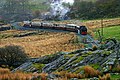
 Rhyd Ddu and the reverse curves.jpg 3,888 × 2,592; 5.31 MB
-
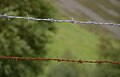 Rhyd Ddu barbed wire.jpg 2,400 × 1,538; 1.01 MB
-
 Rhyd Ddu sheep pen.jpg 2,400 × 1,600; 2.6 MB
-
 Snowdon & Llyn Y Dywarchen.jpg 1,063 × 1,595; 197 KB
-
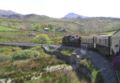
 The Rhyd-Ddu Train - geograph.org.uk - 225400.jpg 640 × 485; 134 KB
-

-
 Track into "town" from Oread MC Hut - geograph.org.uk - 1348255.jpg 640 × 426; 67 KB
-
 View westwards from Bwlch Maesgwm - geograph.org.uk - 1509073.jpg 640 × 480; 47 KB
-
 Welsh Highland Railway (22407889776).jpg 5,145 × 3,430; 14.84 MB
-
 Welsh Highland Railway (48328821902).jpg 4,109 × 2,739; 8.5 MB
-

-
 Welsh Highland Railway near Rhyd-Ddu - geograph.org.uk - 551978.jpg 477 × 640; 94 KB
-
 Welsh Highland Railway near Rhyd-Ddu - geograph.org.uk - 551983.jpg 640 × 477; 92 KB
-
 Welsh Highland Railway near Rhyd-Ddu - geograph.org.uk - 551989.jpg 640 × 477; 90 KB
-
 Welsh Highland Railway train and Snowdon - geograph.org.uk - 39692.jpg 640 × 480; 262 KB
-
 WHR heading into Rhyd-Ddu.jpg 3,008 × 2,000; 2.47 MB
-
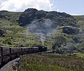
 WHR in landscape near Rhyd Ddu.jpg 3,888 × 2,592; 4.8 MB
-
 WHR-P5141523X.JPG 1,024 × 711; 551 KB
-
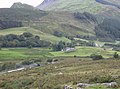
 Rhyd Ddu - geograph.org.uk - 39553.jpg 640 × 480; 236 KB


.jpg)


.jpg)
.jpg)


