Category:Republic of Ireland photographs taken on 2008-05-05
Jump to navigation
Jump to search
Countries of Europe: Austria · Belarus · Belgium · Bulgaria · Czech Republic · Denmark · Finland · France‡ · Germany · Hungary · Republic of Ireland · Italy · Latvia · Malta · Netherlands‡ · Norway · Poland · Portugal‡ · Russia‡ · Spain‡ · Sweden · Switzerland · Turkey‡ · Ukraine · United Kingdom
Specific status: Jersey
‡: partly located in Europe
Specific status: Jersey
‡: partly located in Europe
| ← | 5 May 2008 | → | ||
| ← | May 2008 | → | ||

Republic of Ireland photographs taken on 5 May 2008.
Image files should be categorized here automatically using {{taken on}} template. Direct categorisation is also possible, if automatic is impossible.
Media in category "Republic of Ireland photographs taken on 2008-05-05"
The following 62 files are in this category, out of 62 total.
-
 Abandoned quarry at Letter - geograph.org.uk - 797923.jpg 640 × 480; 77 KB
-
 Advance warning^ - geograph.org.uk - 1607466.jpg 640 × 480; 78 KB
-
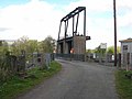 Bellantra Bridge - geograph.org.uk - 798107.jpg 640 × 480; 54 KB
-
 Brinlack - Derelict house - geograph.org.uk - 1180433.jpg 639 × 426; 238 KB
-

-

-
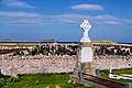 Bunbeg - Magheragallon Cemetery - geograph.org.uk - 1177902.jpg 640 × 426; 311 KB
-

-
 Bunbeg Harbour Road - New house - geograph.org.uk - 1176571.jpg 639 × 426; 275 KB
-

-
 Bunbeg Harbour Road - Road Scene - geograph.org.uk - 1176568.jpg 639 × 426; 267 KB
-
 Bunbeg Harbour Road - Road Scene - geograph.org.uk - 1176570.jpg 639 × 426; 403 KB
-
 Car park for the Scardan Waterfall - geograph.org.uk - 1607450.jpg 640 × 480; 113 KB
-
 Church Ruin - geograph.org.uk - 789918.jpg 640 × 426; 77 KB
-
 Crolly - Tree near Leo's Tavern - geograph.org.uk - 1174635.jpg 640 × 426; 301 KB
-
 Cross Roads - geograph.org.uk - 789801.jpg 640 × 426; 74 KB
-
 Disused quarry at Ardlougher - geograph.org.uk - 1607447.jpg 640 × 480; 112 KB
-
 Donegal Carrickfin Airport - Sign - geograph.org.uk - 1174776.jpg 640 × 411; 188 KB
-

-
-
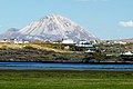
 Dunlewy - Hillside and Lough - geograph.org.uk - 1190435.jpg 640 × 426; 283 KB
-
 Entrance Gate - geograph.org.uk - 789780.jpg 640 × 426; 82 KB
-
 Fallen tree, Arigna valley - geograph.org.uk - 1587973.jpg 640 × 480; 129 KB
-
 Field and Stream - geograph.org.uk - 789816.jpg 640 × 426; 88 KB
-
 Forest road at Liscuillew - geograph.org.uk - 1587975.jpg 640 × 480; 87 KB
-

-

-

-

-
-

-

-
 Glenveagh National Park - Lough Beagh - geograph.org.uk - 1188714.jpg 640 × 426; 239 KB
-

-
 Greaghnaslieve - geograph.org.uk - 798024.jpg 640 × 480; 98 KB
-
 Hillside above Timpaun - geograph.org.uk - 798083.jpg 640 × 480; 68 KB
-
 Hillside at Timpaun - geograph.org.uk - 1607454.jpg 480 × 640; 118 KB
-
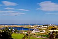
 Ireland - panoramio - Raimundas Budzeika.jpg 1,600 × 1,200; 748 KB
-
 Jacob's sheep at Timpaun - geograph.org.uk - 1607456.jpg 640 × 480; 103 KB
-
 Lane in Ballyderowen, Burnfoot - geograph.org.uk - 1129463.jpg 640 × 480; 111 KB
-
 Main Street, Drumkeeran - geograph.org.uk - 797938.jpg 640 × 480; 54 KB
-
 Meenaclady - East of Bloody Foreland - geograph.org.uk - 1180586.jpg 639 × 426; 341 KB
-
 Millennium Wood - geograph.org.uk - 789859.jpg 640 × 412; 74 KB
-
 Moderragh near Drumkeeran - geograph.org.uk - 798030.jpg 640 × 480; 69 KB
-
-
 Moorland near Ardlougher - geograph.org.uk - 1607443.jpg 640 × 480; 88 KB
-

-
 Quarry at Liscuillew Upper - geograph.org.uk - 797933.jpg 640 × 480; 61 KB
-

-

-
 River Shannon at Bellantra Bridge - geograph.org.uk - 798108.jpg 640 × 480; 48 KB
-
 Rural transport yard at Srananooan - geograph.org.uk - 798081.jpg 640 × 480; 79 KB
-
 Scarden Falls - geograph.org.uk - 798051.jpg 480 × 640; 114 KB
-
 School at Srabragan - geograph.org.uk - 798089.jpg 640 × 480; 70 KB
-
 Tawnyard Lough, lower end - geograph.org.uk - 791929.jpg 600 × 450; 175 KB
-
 The old Mountallen Bridge - geograph.org.uk - 798088.jpg 640 × 480; 95 KB
-
 The road down from Corry Mountain - geograph.org.uk - 798047.jpg 640 × 480; 72 KB
-
 Tractor and barn in the Arigna valley - geograph.org.uk - 797932.jpg 640 × 480; 75 KB
-
 Valley above Drumkeeran - geograph.org.uk - 797928.jpg 640 × 480; 101 KB
-
 Valley at Bargowla - geograph.org.uk - 797919.jpg 640 × 480; 78 KB
-
 Walkway down to the Scarden Falls - geograph.org.uk - 798050.jpg 480 × 640; 78 KB
-
 Wooded valley above Drumkeeran - geograph.org.uk - 797936.jpg 640 × 480; 110 KB


